In April, the Lincoln Institute of Land Policy and the Ministry of Housing and Urban Planning of Chile hosted a scenario planning workshop to help guide reconstruction efforts and policy changes in wake of the country’s January 2024 wildfires. Join the Lincoln Institute and scenario planning experts from Latin America as they guide rebuilding by discussing best practices and lessons learned from working with the Ministry of Housing. The webinar will coincide with the release of a toolkit designed to give attendees the resources they need, including facilitation guides, agendas, and proposed budgets, to replicate the process in their own communities.
Simultaneous English-Spanish translation will be available via Zoom. If you would like to use the translation service, please join the webinar five minutes early.
In this thoughtful, inquisitive volume, Walker investigates technologies that have emerged over the past few years and their implications for planners, policymakers, residents, and the virtual and literal landscapes of the cities we call home. Featuring a foreword by tech journalist Kara Swisher and an afterword by urbanist and futurist Greg Lindsay, the book explores the role of technology in our rapidly urbanizing world.
Experts predict that up to 80 percent of the population will live in cities by 2050. To accommodate that growth while ensuring quality of life for all residents, cities are increasingly turning to technology, from apps that make it easier for citizens to pitch in on civic improvement projects to designs for smarter streets and neighborhoods.
“We’re on a complicated journey; our decisions can set us off in surprising directions, and opinions may differ on how to navigate the challenges ahead,” writes Walker, a Fast Company columnist and New York Times contributor, in the book’s introduction. “But based on the examples in this collection, it seems clear that collaboration, creativity, and an openness to new ideas are the keys to getting where we need to go.”
City Tech is a chronicle of the recent rise of urban technologies, featuring firsthand reflections from the founders, innovators, and researchers closest to the work and from the planners and other officials who are putting these tools into practice on the ground. It’s also a source of essential questions: What are the ethical implications of smart cities? How can cities keep up with the rapid evolution of driverless vehicles? Is building skyscrapers out of wood a viable climate solution?
“If the last decade of urban tech has been a dress rehearsal, then the curtain is now rising on the most momentous decade of change most cities have ever had to face,” writes Lindsay in the book’s afterword. “It is our turn to formulate what we demand from our technologies, versus the other way around.”
City Tech, a curated collection of newly updated columns originally published in Land Lines, the magazine of the Lincoln Institute, follows last year’s release of Mayor’s Desk by Anthony Flint, a compilation of interviews with mayors from five continents who shared their strategies for tackling global challenges at a local level. Together, the books provide tangible examples of how cities across the world have mobilized to implement innovative land-based solutions for some of society’s most critical challenges.
Rob Walker is a journalist and columnist covering technology, design, business, and other subjects. A longtime contributor to the New York Times, Walker writes a column on branding for Fast Company, and has contributed to Bloomberg Businessweek, The Atlantic, Fortune, Marketplace, and many other outlets. He writes the City Tech column for Land Lines, the magazine of the Lincoln Institute of Land Policy. He is the coeditor of Lost Objects: 50 Stories About the Things We Miss and Why They Matter and the author of The Art of Noticing. His Art of Noticing newsletter is at robwalker.substack.com. He also serves on the faculty of the School of Visual Arts in New York City.
About the Lincoln Institute of Land Policy
The Lincoln Institute of Land Policy seeks to improve quality of life through the effective use, taxation, and stewardship of land. A nonprofit private operating foundation whose origins date to 1946, the Lincoln Institute researches and recommends creative approaches to land as a solution to economic, social, and environmental challenges. Through education, training, publications, and events, we integrate theory and practice to inform public policy decisions worldwide. We organize our work around three impact areas: land and water, land and fiscal systems, and land and communities. We work globally, with locations in Cambridge, Massachusetts; Washington, DC; Phoenix, Arizona; and Beijing, China.
Lead image: Quantum network servers managed in a partnership between Chattanooga utility EPB and Qubitekk. Credit: Courtesy of EPB.
Events
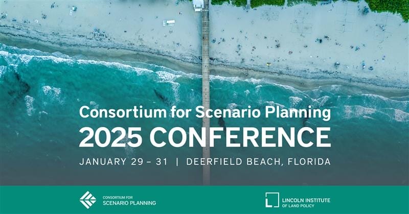
Consortium for Scenario Planning 2025 Conference
January 29, 2025 - January 31, 2025
Deerfield Beach, FL United States
Offered in English
SHARE
The Consortium for Scenario Planning invites you to its eighth annual conference at the Embassy Suites by Hilton Deerfield Beach Resort & Spa in Deerfield Beach, Florida, January 29–31, 2025.
In an era marked by extreme weather events, economic instability, and the challenges of post-pandemic living, scenario planning is an essential tool for cities and regions preparing for an uncertain future. The in-person conference is an opportunity to explore cutting-edge advances in the use of scenarios to address local and global trends that shape our communities’ future with leading practitioners, consultants, and academics in the field. Attendees will dive into topics ranging from climate adaptation and urban resilience to economic disparities and housing challenges.
Jennifer Jurado, Broward County’s chief resilience officer and deputy department director, will deliver the keynote presentation on how scenario planning is transforming the region’s approach to compound flooding and other climate risks. Lightning talks and participant-driven unconference sessions will allow attendees to share their projects, collaborate, and hear new perspectives.
Registration closes on January 22, 2025, and is free for students. Conference sessions will be eligible for AICP Certification Maintenance credits.
The event will be held at the Embassy Suites by Hilton Deerfield Beach Resort & Spa. The closest airport is Fort Lauderdale–Hollywood International. Book your stay at the conference venue.
Please share this opportunity with your colleagues and contact Madeline Hiller, program assistant, planning practice and scenario planning, at the Lincoln Institute, with questions.
Climate Mitigation, Disaster Recovery, GIS, Housing, Land Use Planning, Mapping, Planning, Scenario Planning, Water
City Tech
Aplicaciones de riego de árboles para el follaje urbano
Por Rob Walker, October 31, 2023
SHARE
A medida que la ciudad crece y los efectos del cambio climático se tornan más evidentes, también crece la importancia de los árboles urbanos. Los árboles brindan la sombra que tanto necesitamos, eliminan la contaminación del aire, absorben el carbono e incluso aumentan los valores de los bienes inmuebles. Pero suele pasarse por alto un elemento: una cosa es plantar muchos árboles, pero otra es preservarlos.
Durante años, la tecnología ha desempeñado un papel importante en los esfuerzos de rastrear, mapear y cuantificar los impactos globales de los paisajes arbóreos, desde lo ambiental hasta lo económico, tema que se trató en esta columna en 2018. Pero, desde entonces, surgieron y evolucionaron nuevas tecnologías, y algunas de las más interesantes se centran no solo en los impactos políticos de alto alcance, sino también en el tema crucial del mantenimiento a largo plazo. Si se espera que la población de árboles urbanos perdure, el riego adecuado y oportuno, sobre todo para los árboles más jóvenes, debe ser parte de la planificación. Y, cada vez más, las ciudades están aprovechando herramientas de datos sofisticadas para fomentar y permitir la participación de la ciudadanía en la preservación de los árboles urbanos.
Por ejemplo, CityLAB Berlin, una organización sin fines de lucro de innovación tecnológica de Alemania que aplica datos a los problemas urbanos tiene varios proyectos en curso. En los últimos años, Berlín, una de las ciudades con más árboles de Europa, perdió el 20 por ciento de sus ejemplares a causa de las altas temperaturas y la escasez de lluvias. Esto se debe, en parte, a que supervisar y preservar árboles individuales puede ser una carga ardua y complicada para los gobiernos municipales. Así que, en 2020, CityLAB lanzó Gieß den Kiez (Regar el barrio), una plataforma digital que puso a disposición del público en general datos del gobierno sobre árboles. Esto permitió que la ciudadanía pudiera informarse sobre las necesidades de riego de los árboles locales y comprometerse a ayudar. “La aplicación se desarrolló con base en las necesidades de nuestra comunidad”, expresó por correo electrónico Yannick Müller, directora de asociaciones estratégicas de la organización.
La cantidad de datos disponibles fue una revelación: los proyectos de los gobiernos habían detallado y mapeado con anterioridad cientos de miles de árboles. CityLAB, un proyecto de Technologiestiftung Berlin, fundación financiada por la Cancillería del Senado de Berlín, combinó esto con otros datos, como cifras de lluvias, para crear un mapa que asocia la actividad de riego con las necesidades específicas para cada especie para los árboles de la ciudad. Los comentarios de la ciudadanía comprometida con los árboles ayudaron a darle forma al desarrollo de la plataforma. Algunas personas ya habían adoptado y empezado a preservar árboles de forma particular. “Sienten que son sus propios árboles”, dijo la gerenta de CityLAB Berlin, Julia Zimmermann. La ciudadanía también tuvo ideas sobre cómo utilizar el sistema de bombas de agua existente en la ciudad y mejorar su asequibilidad.
“Los usuarios, grupos e iniciativas pueden interactuar entre sí a través de una herramienta de chat, que también nos permitió comunicar y recopilar opiniones”, explicó Müller. Aparte de resolver errores pequeños, esto inspiró nuevas funciones, como una que muestra la ubicación y el estado de las bombas de agua. A su vez, permitió designar “cuidadores” para árboles específicos, que se comprometen a supervisar y regar con regularidad. “La adición de esta función pequeña permite a los ciudadanos hacer uso de sus recursos de forma más dirigida”, expresó.
Residentes de Berlín usan el sistema de bombas de agua de la ciudad para ayudar a preservar el follaje urbano. Crédito: Florian Reimann.
Según Müller, en 2021, la ciudad de Leipzig adoptó la herramienta, y algunas otras municipalidades alemanas siguieron sus pasos. Los números de los usuarios no paran de crecer, y más de 3.500 ciudadanos se registraron como cuidadores de más de 7.500 árboles adoptados.
Más allá de esto, los esfuerzos de Gieß den Kiez siguen siendo un complemento de la política pública. “Sin embargo, la plataforma logra generar cada vez más conciencia sobre las adaptaciones climáticas, anticipándose a las futuras olas de calor”, sostiene Müller. En Berlín, por ejemplo, “suscitó un debate entre las diferentes autoridades de distritos locales sobre hasta qué punto la ciudadanía debería participar en el cuidado de los árboles de la ciudad y si ese uso del agua es adecuado” (Según Müller, lo es, si se consideran los costos de plantar árboles nuevos y los numerosos beneficios comprobados para la salud y el medioambiente que ofrece un follaje urbano robusto).
Una de las inspiraciones que CityLAB Berlin ha citado es el mapa de árboles de la ciudad de Nueva York (NYC Tree Map), una herramienta digital que se remonta al 2016, y que ya tiene registrados alrededor de un millón de árboles. En un comunicado de prensa de 2022, el Departamento de Parques y Recreación (NYC Parks) declaró que “NYC Tree Map es el mapa más integral y actualizado de árboles vivos en el mundo”. “El mapa, que está integrado directamente con la base de datos forestales de los parques, le brinda a la ciudadanía el mismo acceso en tiempo real al bosque urbano que los silvicultores de parques tienen en el terreno”. Esto permite que las personas de Nueva York “interactúen de forma digital” con la población forestal de la ciudad en los cinco distritos; por ejemplo, pueden supervisar la inspección más reciente de un árbol, con la fecha y la identificación de la inspección.
“Nuestro NYC Tree Map permite que los amantes casuales de árboles identifiquen ejemplares fácilmente, comuniquen sus inquietudes e informen sobre su cuidado”, explicó por correo electrónico Nichole Henderson, directora de la Administración de NYC Parks. “Grupos y personas registran en el mapa sus actividades de cuidado de árboles, como el riego, la eliminación de basura, el cultivo de la tierra y la cobertura con mantillo”.
Varios grupos usan el mapa para coordinar esfuerzos de mantenimiento y administración más ambiciosos. A modo de ejemplo, Hernderson menciona el Jackson Heights Beautification Group, una organización ambiental y artística de Queens; Trees New York, una organización profesional de larga trayectoria que capacita a “podadores de la ciudad”, entre muchas otras actividades, y la organización Gowanus Canal Conservancy, cuyos proyectos incluyen esfuerzos de “ciencia comunitaria” como experimentos sobre la captura y el uso del agua de lluvia. Y el mapa de árboles es clave para la campaña de mayor alcance de NYC Parks, Let’s Green NYC (Llenemos de verde a NYC), que publica “actividades de cuidado de árboles en las calles de toda la ciudad con socios comunitarios y permite que los voluntarios vean el impacto visible, cómo están contribuyendo directamente con el cuidado de la floresta urbana”, dijo Herderson.
En otras ciudades importantes se están llevando a cabo iniciativas similares. El Departamento de Transporte del Distrito (DDOT) de Washington, DC, mantiene un mapa de árboles digital que promueve la participación ciudadana (por ejemplo, para que informen el oscurecimiento de las hojas o el daño de insectos, así como los árboles que necesitan agua). El mapa de árboles se lanzó con un foco especial en preservar 8.200 árboles plantados en 2017. Otro ejemplo es la aplicación Adopt-A-Tree en Atenas, que permite a los ciudadanos asumir la responsabilidad del riego de árboles individuales de la ciudad durante los meses secos del verano. Y las entidades como CityLAB Berlin siguen innovando: su nuevo proyecto Árboles Cuantificados (QTrees) aspira a desarrollar un sistema de predicción respaldado por inteligencia artificial, haciendo uso de bases de datos y sensores para identificar los árboles urbanos en riesgo de secarse. Ya se está probando un prototipo, y el plan es lanzarlo este año.
Washington, DC, los residentes pueden usar la herramienta Tree Tool de la ciudad para localizar árboles según el barrio, clasificarlos por especies, edad y el cuidado que necesitan, e informar problemas. Crédito: Departamento de Transporte del Distrito (DDOT, por su sigla en inglés).
Zimmermann, de CityLAB Berlin, reconoce que fue difícil demostrar con precisión el impacto de estos esfuerzos. “Esto se debe a la naturaleza de la naturaleza”, dijo. Los árboles se adaptan con lentitud, así que estimar los efectos de los programas de riego podría requerir años de supervisión del crecimiento y la salud. Pero el tablero de datos del proyecto ilumina los patrones de riego, y mostró que las cantidades de riego aumentaron desde que el programa comenzó, y, casi con certeza, contrarrestaron los efectos de la sequía. “Así que el proyecto genera, por lo menos, un mejor entendimiento y cuidado de los espacios verdes urbanos”, añadió. En algunos casos, ha inspirado a gobiernos locales a apoyar a voluntarios, al brindarles material y lineamientos para prácticas de riego óptimas.
En una encuesta reciente sobre la valoración sorprendentemente duradera de las personas por lo arbóreo, la historiadora y autora, Jill Lepore, observó que “los árboles son los nuevos osos polares, la imagen que es tendencia en el movimiento medioambiental”. Ahora tenemos la ciencia y la tecnología para entender y cuantificar el valor de los árboles más allá de lo estético. “Si a nuestros ancestros les pareció inteligente y necesario talar los bosques rápidos, es incluso más necesario que sus descendientes planten árboles”, escribió la paisajista Andrew Jackson Downing en 1847. “Permitamos que todas las personas, cuyas almas no sean un desierto, planten árboles”. De acuerdo. Pero, también tenemos la obligación, y la tecnología, para preservarlos.
Rob Walker es periodista; escribe sobre diseño, tecnología y otros temas. Es el autor de The Art of Noticing. Publica un boletín en robwalker.substack.com.
Imagen principal: Árboles en la calle y una ciclovía emergente en Berlín, donde una organización sin fines de lucro del sector tecnológico lanzó una plataforma digital que ayuda a los residentes a informarse sobre las necesidades de riego de los árboles locales. Crédito: IGphotography vía iStock/Getty Images Plus.
Con una población de casi 33 millones y en crecimiento, Delhi es la segunda área metropolitana más grande del mundo después de Tokio, y va en camino a ser la número uno. Shelly Oberoi, de 39 años, fue elegida como alcaldesa de la Corporación Municipal de Delhi (MCD, por su sigla en inglés), un órgano gubernamental que representa a unos 20 millones de esas personas, a principios de 2023. Oberoi, que nació en la ciudad capital, recibió el cargo de vicepresidenta del ala de las mujeres del Partido anticorrupción Aam Aadmi antes de convertirse en concejala del distrito electoral en 2022. Oberoi, quien tuvo que candidatearse para el cargo de alcaldesa varias veces debido a desafíos electorales parlamentarios, prometió que “Delhi se limpiará y transformará” durante su mandato. Fue profesora adjunta en la Universidad de Delhi y el Instituto Narsee Monjee de Estudios de Gestión, y es la autora de muchos trabajos de investigación sobre responsabilidad social corporativa, finanzas globales y otros temas.
Anthony Flint: En la última década, usted es la primera alcaldesa que debe supervisar toda la ciudad central de Delhi, después de la reunificación de la corporación municipal. ¿Qué tipo de desafíos y oportunidades trae aparejados esta situación para el gobierno?
Shelly Oberoi: Gobernar la Corporación Municipal de Delhi (MDC) después de su unificación trajo consigo una cantidad de grande desafíos y oportunidades. Por un lado, la centralización de los poderes permite una optimización en la toma de decisiones, una mayor rendición de cuentas y una mejor colaboración entre todos los departamentos. Si bien la centralización permite mejorar la eficiencia, también requiere una planificación minuciosa para asegurar una distribución equitativa de los recursos destinados a satisfacer las necesidades diversas de diferentes áreas dentro de Delhi. Equilibrar estas necesidades y optimizar la asignación de recursos es un desafío considerable que estamos analizando en este momento. Por el otro lado, la unificación también nos ofreció una oportunidad para el alineamiento de políticas. Ahora, con una corporación municipal unificada, podemos alinear políticas y regulaciones en todas las áreas de Delhi. El alineamiento de políticas nos permite afrontar problemas como la educación, el impuesto a la propiedad y las nuevas iniciativas de una forma coordinada, lo que conduce a una planificación y un desarrollo civil más efectivos en toda la ciudad. Esto permite una implementación consistente de reglas y regulaciones, lo que nivela el campo de juego, y garantiza justicia y transparencia en la gobernanza.
Alcaldesa Shelly Oberoi. Crédito: Corporación Municipal de Delhi.
AF: Cuando la nombraron, dijo que trabajaría “para que Delhi sea la ciudad que debería haber sido”, ¿cómo es esa visión, y cuáles son los mayores obstáculos para alcanzarla?
SO: Mi visión para Delhi se basa en las 10 garantías del Partido Aam Aadmi, como anunció el primer ministro y coordinador nacional, Arvind Kejriwal. Estas garantías reflejan las aspiraciones de las personas que priorizan el bienestar general de la ciudad. Visualizamos una Delhi bella y limpia, libre de la plaga de vertederos, en la que los sistemas de gestión de residuos se optimicen y que promueva la limpieza en toda la ciudad. Estamos estableciendo una cultura de transparencia y rendición de cuentas, lo que asegura una Corporación Municipal de Delhi libre de corrupción. Además, nuestra visión prevé una solución permanente al problema de estacionamiento a través de sistemas de gestión eficientes y un abordaje para el problema de los animales vagabundos con medidas sostenibles y compasivas. Además, aspiramos a tener calles bien mantenidas que prioricen la seguridad y un flujo de tráfico tranquilo, lo que mejorará la experiencia general para los residentes que se trasladan a diario para trabajar.
El trabajo del gobierno estatal del Partido Aam Aadmi en Delhi ya está teniendo repercusiones en términos globales, en especial en las áreas de educación y salud. El primer ministro, Kejriwal, ha dirigido revoluciones en el escenario de la educación pública y los sectores de salud pública de India. Las personas han empezado a creer que se puede confiar en los servicios del gobierno, que pueden ofrecerles el mismo estándar de servicios sin costo que los servicios privados ofrecen a precios exorbitantes.
Aprovechando este impulso, estamos trabajando con un foco especial en transformar escuelas y hospitales en centros de excelencia. Además, estamos mejorando los parques en toda la ciudad, creando espacios verdes para que la ciudadanía disfrute. En la búsqueda de un cambio favorable, estamos asegurando salarios uniformes para los trabajadores y ofreciéndoles un mejor ambiente dentro de la MCD para promover la seguridad laboral y construir una fuerza de trabajo motivada. También pretendemos simplificar el proceso de obtención de licencias para comerciantes, crear un ambiente de negocios acogedor y establecer áreas de ventas designadas para los vendedores ambulantes.
Sin embargo, reconocemos los desafíos que presentan la urbanización rápida, las restricciones presupuestarias, el compromiso de las partes interesadas y la coordinación entre diferentes agencias. Al reconocer estos desafíos y analizarlos proactivamente, podemos trabajar para lograr que Delhi sea la ciudad que siempre debería haber sido: una metrópolis sostenible, inclusiva y próspera de la que sus residentes se enorgullezcan como su hogar, y, sobre todo, la capital número uno del mundo.
AF: Respecto de la calidad del aire, asunto sobre el que documentales como Todo lo que respira llamaron la atención a nivel internacional, ¿qué soluciones hay a corto plazo? ¿Podría comentar también sobre su mirada con relación a la basura y los vertederos? Los dos temas se relacionan, en el sentido de que la nueva planta que transforma los residuos en energía, aparentemente, ayudará a solucionar un problema a la vez que contribuirá aún más contra la contaminación del aire.
SO: La calidad del aire es, realmente, una preocupación apremiante para Delhi, y enfrentarla requiere un abordaje multifacético que incorpora soluciones tanto a corto, como a largo plazo. No obstante, el aire no pertenece a ninguna frontera geográfica; muchos de los factores que surgen en nuestros estados vecinos tienen un efecto negativo sobre Delhi. Por tanto, el desafío requiere un abordaje coordinado y conjunto de todas las partes interesadas, incluido el gobierno central y los gobiernos estatales vecinos.
El gobierno de Delhi está coordinando un esfuerzo de gran escala para reducir la contaminación del aire a través de sus Planes de Acción de Verano y Primavera. Por consiguiente, escoge soluciones a corto y largo plazo como parte de estos planes de acción, ya sea detener la contaminación por el polvo y la contaminación industrial, lo que mejora la gestión de residuos sólidos, o realizar estudios de distribución de fuentes en tiempo real. Con estos planes de acción, a la MCD se le delegó la responsabilidad de mantener un control de los factores bajo su dominio y de custodiar rutas pequeñas bajo su dominio. El gobierno estatal celebra reuniones periódicas de revisión, y la MCD extendió su apoyo incondicional para ayudar con estos esfuerzos. También es importante destacar que, debido a estos esfuerzos, ya se observó un cambio favorable en la contaminación del aire en Delhi.
Con respecto a la basura y los vertederos, estamos trabajando de forma activa en la mejora del sistema de gestión de residuos sólidos de la ciudad por medio del fomento de la segregación de residuos, instalando estaciones de transferencia de compactadores fijos y cerrando basurales barriales. Además, establecimos un plan para eliminar los tres vertederos de basura de la ciudad. Respecto a esto, estamos en camino a limpiar por completo el vertedero Okhla para fines de este año, y Bhalswa para la primera mitad del año próximo. El estado estableció estos objetivos como parte de un abordaje enfocado en limpiar la ciudad, y el primer ministro Kejriwal ha estado supervisando el progreso diario para fortalecer aún más el propósito de la MCD en pos de esta misión.
AF: ¿Existe alguna política en los trabajos para abordar la congestión de tráfico notoria en la ciudad? ¿Cómo se adapta esto a su plan integral de mejorar la infraestructura y hacer que la ciudad sea más resiliente?
SO: El tráfico está, en su mayoría, fuera del alcance de la MCD. En Delhi, el órgano municipal solo protege las rutas menos importantes y los caminos vecinales, de cuyo mantenimiento nos estamos ocupando con el mayor compromiso desde que tomamos el mando. Junto con la ayuda de nuestros consejeros y ciudadanos locales, estamos identificando todas las rutas y caminos que necesitan algún tipo de reparación y asegurándonos de que la tarea se realice. A un nivel más amplio, el Departamento de Obras Públicas y el Departamento de Transporte del gobierno de Delhi están haciendo un gran trabajo en la reducción de la congestión del tráfico en la ciudad por medio de la mejora de la infraestructura existente, la construcción de pasos sobre nivel y bajo nivel, y la incorporación de autobuses eléctricos.
AF: El área metropolitana de Delhi, con una población de casi 33 millones y con un crecimiento de casi el 3 por ciento anual, parece merecer una forma más centralizada de gobierno. ¿Existe alguna oportunidad de reforma que permita a los alcaldes de India gestionar sus ciudades como lo hacen los dirigentes en las principales ciudades de otras partes del mundo?
SO: En principio, reconozco la necesidad de reformas que empoderen a los dirigentes de la ciudad para que puedan gestionar con eficacia sus ciudades, de forma similar a los modelos de gobiernos observados en las principales ciudades del mundo. Sin embargo, la estructura de gobierno actual en India tiene sus limitaciones, que respetamos, y preferimos reflexionar dentro de nuestro propio paisaje. En teoría, siempre existe una oportunidad de reforma y exploración de modelos alternativos. Podemos explorar potenciando la capacidad de la alcaldía y las autoridades a través de programas de capacitación, el intercambio de conocimientos y la colaboración con las instituciones internacionales de gestión de ciudades que pueden equiparlas con las habilidades y la experiencia necesarias para dirigir y gestionar sus ciudades con eficacia. Además, podemos promover modelos de gobierno colaborativo que impliquen la participación activa de la ciudadanía, las organizaciones de la sociedad civil, y otras partes interesadas, para facilitar una mejor toma de decisiones y asegurarnos de que se representen de forma adecuada las preocupaciones e intereses de los residentes de la ciudad.
Anthony Flint es miembro sénior del Instituto Lincoln de Políticas de Suelo, editor colaborador de Land Lines y conductor del pódcast Land Matters.
Imagen principal: Con Delhi en camino a convertirse el área metropolitana más grande del mundo, los dirigentes de la ciudad están fomentando una participación ciudadana más activa. Crédito: PRABHASROY via iStock Editorial/Getty Images Plus.
What Happens When Climate Solutions Cause Problems?
In the small beachside settlement of Praia do Xavier, along Brazil’s northeastern coast, villagers have long practiced traditional raft fishing, farmed the dunes, or harvested shellfish as a way of life. They did so for generations without any infrastructure to speak of—no roads, schools, electricity, or running water—on what was common land, freely accessible to the public.
That is, until the Brazilian government allowed much of that land to be privatized so a European company could install a 50-turbine wind farm along the shoreline to capture the coastal breezes. The construction of the 2,570-acre wind farm in the state of Ceará added up to 104 megawatts of clean energy to Brazil’s electric grid when it opened in 2009, but it also drained the lagoons that villagers relied upon for winter fishing and impeded their access to other traditional fishing grounds.
Ramping up renewable energy production is a crucial climate goal, and one that Brazil has excelled at to date. But the rush to produce more solar and wind power has also led to new forms of land speculation and “green grabbing.” A study by University College London researchers found that over a third of wind parks installed in Brazil from 2000 to 2021 were built on legally dubious grounds, either on common lands or without legal titles, and most are owned by international investors.
A pair of researchers in Brazil is now studying how such land use decisions are being made, with a particular focus on the state of Ceará, and how to ensure renewable energy expansion doesn’t result in further climate injustices. Their project is one of seven finalists selected for support through a request for proposals issued by the Lincoln Institute of Land Policy in March.
“Society can’t afford to delay the energy transition or the work needed to adapt to our changing climate,” says Amy Cotter, director of urban sustainability at the Lincoln Institute. “But we need to do so in a way that avoids undermining people’s ability to provide for themselves and their families at a time when that ability is already challenged by climate change itself.” It’s a tension unfolding around the world, as governments, utilities, and nonprofits try to achieve a quick but just transition to clean energy, balancing the critical need for rapid renewable energy development with other demands on the land.
“With this suite of research, we hope to help accelerate climate action that anticipates and avoids or offsets any negative consequences,” Cotter says.
Through case studies and interviews, Flavia Collaço, visiting professor at Universidade Federal do Ceará, and Joachim Stassart, a PhD candidate at the University of British Columbia, will analyze the expert and government knowledge, technological tools, and underlying politics that inform how land is allocated for renewable energy projects, why that process often ignores traditional and communal land uses, and how it could be improved to reduce land dispossession and climate injustices as more wind and solar projects go forward.
The first stage of Brazil’s wind projects was almost all installed along the coast, Collaço says. “So it’s mainly affected small artisanal fishermen, and Indigenous people and traditional communities that live in this coastal region,” she says. “But the second stage of wind projects is coming to the countryside, and that means new challenges and new types of communities and ecosystems that are going to be impacted.”
“Brazil is a country with a lot of land conflicts and a lot of speculation related to land, but it’s usually and historically been related to agriculture,” Stassart notes. “With this renewable energy boom, there’s this new form of speculation, and it’s in areas that weren’t the target of land conflict in the past.”
Parts of rural Ceará have yet to go through a formal land regularization process, which creates potential for land conflict and speculation as renewable projects move inland. “In Brazil, it’s very common, especially in the most remote areas, that there are a lot of overlapping land claims and a lot of informality in the land sector,” Stassart says. “So people can be using the land for generations without holding a title to it . . . there are still a lot of Indigenous and local communities who don’t have access to a formal land title that recognizes their rights.”
Less than a fifth of Ceará has yet to be regularized, but much of that land is in areas now targeted for new wind and solar installations, which has set the formalization process in motion, Collaço says. “So our research is going to capture precisely the beginning of this process.”
The Lincoln Institute selected six other projects to support through this RFP, many of which focus on curtailing “green grabbing” practices:
Researchers from the SD Dombo University of Business and Integrated Development Studies in Ghana will perform a literature analysis and empirical case study on the rise and fall of land-based biofuel investments in Sub-Saharan Africa, to understand why most of these projects have failed, collapsed, or been abandoned.
National strategies for reducing biodiversity loss and land-based emissions are often isolated as separate policy goals, despite their obvious connections. A team from the University of British Columbia, University of Melbourne, and the Land Gap research collective will examine the feasibility of including national strategies as part of a just transition, identifying both the role and the limitations of domestic policy in addressing the drivers of deforestation.
An international and interdisciplinary team led by the German Institute for Global and Area Studies will assess the impacts of land-intensive carbon-offset projects on the livelihoods of local communities in Madagascar and Indonesia, and the effectiveness of sustainability standards in addressing these impacts.
An environmental consultant affiliated with the University of Lausanne in Switzerland will look at how the establishment of protected areas for conservation purposes over the past century has often led to conflict or even outright tragedy for Indigenous peoples and local communities, with the goal of drawing lessons for how large-scale ecosystem and forest restoration projects can avoid having the same negative impacts.
In Central Appalachia, corporate landowners have long extracted resources and value while leaving locals impoverished. As the region’s forests draw interest for their carbon sequestration potential, a University of Colorado at Colorado Springs researcher will use power mapping, interviews, and data analysis to evaluate the initial outcomes of the Family Forest Carbon Program. The new endeavor, by the American Forest Foundation and The Nature Conservancy, aims to enroll small landowners in Kentucky and West Virginia as beneficiaries of the expanding carbon market.
A team from the University of Technology Sydney will look at emerging community partnership models in Australian cities that have allowed community-driven conservation efforts to reach scale and expand their impact by overcoming common barriers to such initiatives, including a lack of secure land and stringent land use planning standards.
To learn more about all Lincoln Institute RFPs, fellowships, and research opportunities, visit the research and fellowship opportunities section of our website.
Jon Gorey is a staff writer at the Lincoln Institute of Land Policy.
Lead image: Wind turbines at Canoa Quebrada Beach in Ceara, Brazil. Credit: Cristian Lourenço via iStock/Getty Images Plus.