A few years ago, the city of San Antonio conducted research into the anticipated impacts of climate change on local temperatures. The study projected that, by midcentury, the city might experience 61 days a year with temperatures over 100 degrees. In reality, the city notched 75 days over 100 degrees—in 2023.
Like many cities, San Antonio has been strategizing responses to climate change for years, but recent record-shattering temperatures have given such efforts a new sense of urgency, says Douglas Melnick, San Antonio’s chief sustainability officer. One major component that’s been getting a serious rethink: city surfaces, from roads to roofs. These human-made surfaces are often dark and impermeable, amplifying hot weather, worsening flood risks, and contributing to the heat island effect. But soaring global temperatures are sparking a wave of experiments with new materials and engineering innovations designed to reimagine surface problems as deep opportunities.
Pavement is a particular focus for San Antonio and many other cities, because it’s hot and there’s a lot of it: researchers estimate that it accounts for 30 to 40 percent of urban land cover. After an initial “very small” pilot in 2021 experimenting with a reflective pavement coating, San Antonio embarked on a $1 million project that will test five such materials in various parts of town, Melnick says. The streets were selected based on data related to equity and heat, and the work is being integrated into already-scheduled maintenance and repaving projects; the city will work with the University of Texas San Antonio to evaluate the results.
A similar effort is underway in Phoenix, a city “on the front lines of extreme heat,” as David Sailor, professor and director of the school of geographical sciences and urban planning at Arizona State University, puts it. The city was an early proponent of rethinking surfaces, launching a major Cool Pavement Pilot Program three years ago. But even in this notoriously hot place, efforts have accelerated lately: ASU has been involved as a research and advisory partner in a city-led project that has treated more than 100 miles of local roads with reflective coatings. “This is something that would not have happened five years ago,” Sailor says, “and it’s increasingly happening across different cities.”
Los Angeles has introduced a number of pilot programs, including one in the Pacoima neighborhood testing a reflective coating on streets, a school playground, and a recreation center parking lot. Researchers at Purdue University, meanwhile, have developed and are preparing for market the “world’s whitest paint,” which reflects 98 percent of solar heat and could be used on buildings, trains and buses, and other surfaces. A number of US cities are offering tax incentives for reflective roofs. Others have installed green roofs, topping waterproofing material with plants and other greenery that can be both cooling and absorb rainfall. And smaller projects are popping up all over the world, like parking lot solar canopies that provide shade and generate energy; corrugated self-cooling walls that stay as much as 18 degrees cooler than flat walls and can help reduce the need for air conditioning; and innovative, affordable cool-roofing materials for informal and self-built structures in India, Africa, and elsewhere.
The idea that governmental will to address extreme heat is expanding—and municipal funding is growing along with it—is spurring more material innovation in the market, says Sailor of ASU. He notes the creation of new, acrylic-based asphalt treatments. Because lighter colors can show tire markings, demand has also led to the development of a coatings that are dark in the visible spectrum but engineered to have high reflectance outside that spectrum, and reflect 30 to 40 percent of the sun’s energy, compared to 4 percent on a standard road. Other materials getting their moment in the sun include new kinds of coating for extruded metal roofing; reflective, porous concrete; and passive radiative cooling film engineered to actively radiate heat away from surfaces (instead of simply reflecting it, as coatings do). ASU is testing such products from giants like 3M as well as smaller startups.
But the real breakthrough isn’t any single material or innovation, says Greg Kats, founder and CEO of the Smart Surfaces Coalition (SSC)—it’s the sheer variety of projects afoot, and a new willingness to “think broadly and citywide” about surfaces. Launched in 2019, SSC is now working with some 40 organizations and 10 cities and metropolitan areas across the country, providing data and tools to help implement smart surfaces effectively. “The city has gotten hotter and darker and more impermeable, with higher energy bills, more environmental injustice,” Kats says. “A lot of cities have really reached a point where they’re looking for systemic solutions.” Kats notes that there are fiscal motivations, too: major credit rating agencies have begun to factor climate change into their calculations, which could affect municipal credit ratings.
Kats and other smart surface advocates emphasize that tech-based materials must be complemented by trees and other natural solutions. Brendan Shane, climate director for the Trust for Public Land, which focuses on creating and enhancing parks and green spaces in cities and communities (and works with SSC), argues that smart surfaces and green infrastructure go naturally together. “Our tree canopies are at historic low levels,” he points out. But they are part of a city’s surface area, and “the surface of the city is one of those things that really does change. You’re going to repave roads. And you’re going to replant trees.”
The coalition hopes to help cities devise multi-pronged but locally tailored approaches, Kats says, through improved data synthesis and analysis. SSC is already working with a dozen US cities, and two in India, to compile data from hundreds of sources, producing detailed heat maps from satellite data and other information, and running cost/benefit scenarios on different implementations and timelines. The goal is to be both comprehensive and flexible, given that a dry city like Stockton, California, will have different needs and solutions than a wetter city like Baltimore. Whatever a given city’s objective, Kats asserts that with a full suite of responses—smart reflective surfaces, trees, and green infrastructure projects like rain gardens—the vast majority of cities can cool average temperatures by five degrees, or even more in previously neglected heat island neighborhoods.
Back in San Antonio, plans are taking shape to use heat-mapping technology to identify the neighborhoods that would most benefit from municipal investments in cool pavement, street trees, and shade structures. The wake-up call of recent extreme weather, Melnick says, has created a real opportunity for coordinated, citywide plans. “Cities tend to be very siloed. The parks department’s doing trees over here, and then the public works department is doing roads over there,” he says. “Everyone’s got a role in mitigating heat, but how do we get everybody talking together?”
As technologies evolve and the world’s cities continue to grow, investing in solutions to create cooler, more livable cities—and working together to implement them—is essential, Kats says: “Waiting is now a higher-risk strategy than taking action.”
Rob Walker is a journalist covering design, technology, and other subjects. He is the author of The Art of Noticing. His newsletter is at robwalker.substack.com.
Lead image: Researchers measure the reflectivity of cool pavement coatings at Berkeley Lab. Credit: Roy Kaltschmidt/Berkeley Lab, ©The Regents of the University of California, Lawrence Berkeley National Laboratory.


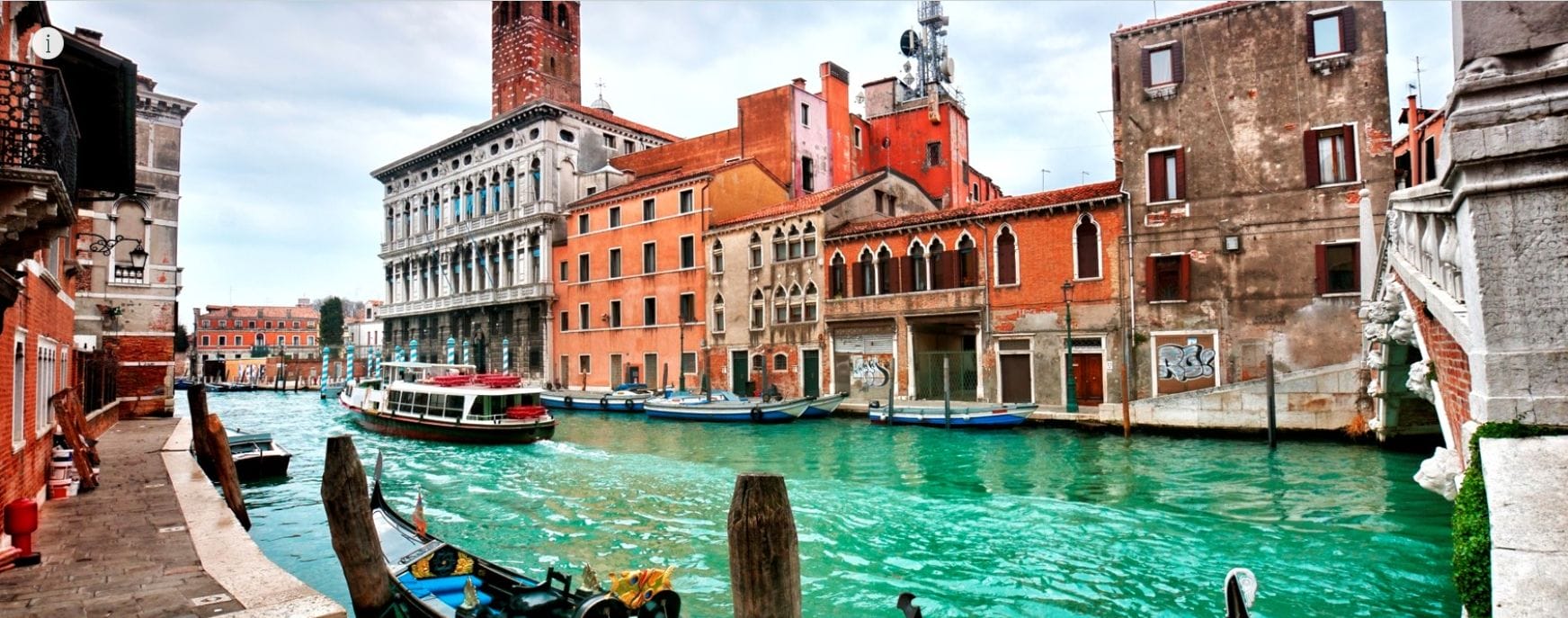 This StoryMap features a growing library of case studies that illustrate the role of land use and policy in mitigating and adapting to climate change. Featured case studies range from the Life Vimine Project in Venice, Italy, to the Watts Rising Transformative Climate Communities Project in Los Angeles.
