Topic: Water

Map of Mississippi River watershed and Gulf of Mexico

Feed the Farm, Not the Algae

By Jon Gorey, November 1, 2023


Natural ecosystems offer some powerful solutions to our climate crisis. And nature holds answers to other environmental challenges as well—like figuring out how to feed a growing human population without contributing to climate change, pollution, and toxic algal blooms.  

The invention of synthetic fertilizer allowed farmers to double their yields per acre in the past century, supporting some four billion additional humans. But its use and production can have serious ecological impacts. Along with methane from livestock and the carbon released by soil disturbance, fertilizer is a primary reason why agriculture accounts for about 10 percent of greenhouse gas emissions in the US. But new funding models in the Midwest are providing an incentive to farmers to swap status quo techniques for more sustainable practices.    

The high-temperature production of synthetic nitrogen fertilizer is by itself responsible for 1.4 percent of global carbon emissions. After that fertilizer is applied to crops, it can release nitrous oxide, a greenhouse gas 245 times more potent than carbon dioxide. And excess nitrogen also finds its way into waterways, polluting drinking supplies and wildlife habitat and, in the American Midwest and Plains, flowing down the Mississippi River to create a vast, headline-making “dead zone” in the Gulf of Mexico, where it feeds toxic algal blooms that suck the oxygen out of the water. 

“That is the principal cause of these dead zones and toxic algal blooms in the Gulf of Mexico,” says Jim Levitt, director of the International Land Conservation Network at the Lincoln Institute of Land Policy. “The Mississippi River collects fertilizer runoff from Montana all the way to Pittsburgh, and sends it down in one big spout that flows into the Gulf of Mexico, and it becomes this concentrated soup of nitrogen and phosphorus.”  

However, some fairly simple practices can reduce how much fertilizer farmers need, and how much ends up polluting watersheds. First and foremost, says Matthew Helmers, director of the Iowa Nutrient Research Center at Iowa State University, is resisting the tendency to over-fertilize. About a third of farmers apply more nitrogen than necessary, sometimes in an effort to maximize yields or hedge against risk.  

“If we can reduce the rate, and not reduce yields for the crop,” he says, that cuts nitrogen loss as well as costs for the farmer. Iowa State and other universities developed a calculator to help Midwestern farmers determine the best amount of nitrogen to use depending on their goals. And simply fertilizing in the spring instead of in the fall can also reduce nitrogen runoff by an average of 6 percent.  

Beyond better fertilizer management, regenerative farming—a more holistic and sustainable approach to agriculture that can help restore degraded soil, enhance biodiversity, and protect water and other resources—can also help reduce nitrogen runoff. 

One of the most basic regenerative farming practices is planting cover crops in between growing seasons. “That’s where we try to have something green out there during the period when we’re not growing our cash crop,” Helmers says, “covering the soil surface and taking up nutrients that might otherwise be susceptible to loss.”  

A perennial cover crop such as rye or oat stabilizes the soil, but also converts excess water-soluble nitrate into plant matter, “so there’s less nitrate that could be leached away in the next rainfall event,” Helmers explains. Rarely employed just 30 years ago, the use of cover crops nearly doubled in Iowa between 2017 to 2021, to an estimated 2.8 million acres.  

Other in-field practices include a diverse crop rotation—alternating corn or soybean seasons with forage crops, for example—or growing an energy crop such as switchgrass, which can be used to produce renewable natural gas. (That may sound like gas-powered greenwashing, but it’s a real technology.) Low- or no-till farming, meanwhile, which reduces soil disturbance and leaves most of the plant residue on the surface after harvest, can cut nitrous oxide emissions and help soil retain more carbon and nutrients. No-till farming is now employed on 41 percent of Iowa farmland, or 9.5 million acres.


Corn field
No-till farming minimizes soil disturbance, helping soil retain more carbon and nutrtients. Credit: Jason Johnson, USDA Resources Conservation Service.


The edge of a farm offers one more chance to halt nitrogen loss as water drains off the cropland and into nearby waterways. “We have a whole suite of practices to treat that water before we deliver it to a stream, and they’re kind of utilizing Mother Nature to promote denitrification,” Helmers says, referring to the natural process that converts nitrate into dinitrogen, the inert, stable gas that makes up most of Earth’s atmosphere.  

In one configuration, underground drainage systems can be diverted so they release water perpendicular to a stream instead of directly into it, forcing it to flow slowly across a 30-foot vegetated buffer. If the soil in that buffer zone doesn’t contain enough organic matter to promote denitrification, then installing a bioreactor—which sounds high-tech, but is simply a trench full of wood chips—can help do the job. These simple methods can reduce nitrate loss by 42 percent or more

“We could also route that drainage water to a wetland—that might be a riverine wetland next to the stream, or an oxbow wetland, or one that we restore,” Helmers says. In addition to providing ecological benefits to the landscape, “those can be very effective for promoting denitrification.”   

Despite the impact of nitrates on both local drinking water and the Gulf’s marine environment, these practices remain voluntary in Iowa and in most other states. But there are federal and local cost-share programs designed to encourage their adoption, some more robust than others.  

Iowa’s Polk County, for example, offers both financial and logistical assistance for installing edge-of-field buffers, making it easier and more economical for farmers who might otherwise be put off by the hassle or cost. And since water treatment plants are finding that it’s more efficient to pay farmers to reduce fertilizer runoff at the source than to build additional treatment facilities, new funding models have emerged that encourage more farmers to introduce conservation measures to their land.  

The multistate Soil and Water Outcomes Fund, for example, pays farmers to create vegetative buffers, plant cover crops, or employ other regenerative agriculture techniques chosen by the farmer. Later in the year, an independent scientific team measures and verifies the reduction in nitrogen or increase in stored soil carbon. The fund then sells a mix of environmental credits to various public and private entities seeking to meet required or voluntary sustainability goals. Water quality credits, for example, allow water treatment facilities subject to strict nutrient reduction standards to fund pollution mitigation at the source instead of paying for expensive new equipment. Carbon offsets, meanwhile, are tied to the amount of additional carbon stored in the soil.  

Importantly, given the growing and valid criticism aimed at carbon offset schemes, those credits are tied to actual outcomes, “after they have been produced and verified,” says Eric Letsinger, CEO of Quantified Ventures, whose AgOutcomes subsidiary jointly manages the fund with the Iowa Soybean Association. The outcomes-based model is “a demonstrably more cost-effective means of achieving environmental improvements than existing ‘pay for practices’ approaches,” he adds, in a paper prepared for the Environmental Defense Fund.  

“Basically the sewage treatment plant pays into a fund, and the fund will contract with soybean farmers to manage their land in a different way, so as to reduce the amount of phosphorus and nitrogen that reaches the streams,” Levitt explains. “That’s a natural climate solution that is applicable to the entire Mississippi River Valley, and will clean up the water more efficiently than building engineered filters into the streams of Guttenberg, Iowa, or Des Moines.”  

In 2021 and 2022, the Soil and Water Outcomes Fund expanded from Iowa into eight more states, and paid farmers an average of $31 per acre to implement new conservation measures on over 241,000 acres of cropland. Those practices prevented 3.4 million pounds of nitrogen and 206,000 pounds of phosphorus from reaching waterways, and sequestered over 465 million pounds of carbon.  

Still, there’s a lot more ground to cover—literally—including millions of acres in Iowa alone. Cultural barriers remain, with some longtime farmers wary of deviating from a proven formula.  

“We need to get over that hump of changing what’s the norm,” Helmers says, perhaps hinting at the most powerful untapped nature-based solution of all: human nature. “We still need to create a sense of urgency—that we have a problem, and we need to do something about it.” 


Jon Gorey is a staff writer at the Lincoln Institute of Land Policy.

Lead image: This map illustrates how runoff from farms (green areas) and cities (red areas) drains into the Mississippi River, delivering nutrients into the Gulf of Mexico and fueling the annual hypoxic zone. Credit: NOAA.


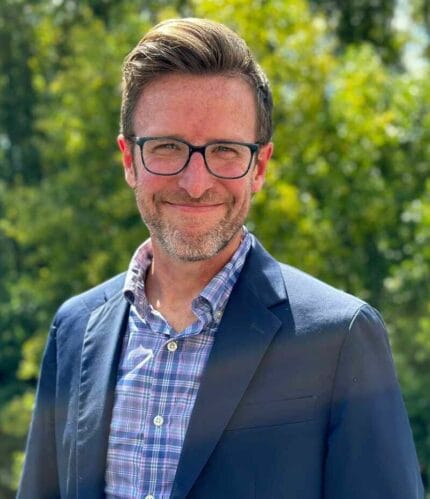
Jim Holway speaks in front of an audience

Land Matters Podcast: Water in the West

Jim Holway Reflects on Decades of Problem-Solving
By Anthony Flint, October 31, 2023


Water in the West—one of the most enduring and confounding stories of human settlement anywhere around the world.  

Jim Holway, who retired as director of the Babbitt Center for Land and Water Policy this summer, has spent more than 40 years helping to solve the puzzle of ensuring sustainable water resources in this increasingly arid region. In the latest Land Matters podcast, he describes the challenges ahead, and the kind of leadership—and serious, good-faith negotiation—it will take to establish a more secure water future. 

With some places having their water restricted, and big reservoirs like Lake Mead drawing down to historically low levels, it has become increasingly clear that water from the Colorado River—distributed to nine states in the US and Mexico through a series of agreements and amendments hammered out since the 1920s—is no longer enough to meet the demands of a fast-growing population. 

How did the region get to this point? “I’d say it was a combination of optimism, beginning with allocating more water [than would be available], and then it was just ignoring science for political reasons,” said Holway. “If I want to get my water project approved, it’s going to be a lot easier if I can convince people there’s enough water left for their project too. Even once we should have known better, we acted like we didn’t know better.” 

The water allocations now have a structural deficit, Holway said, that is clear throughout the year-to-year ups and downs of drought and sufficient snowpack. Climate change is intensifying everything. 

“We designed a hydrologic system for a physical reality that is changing on us, and the change in the level of heat is driving the system. More evaporation and more demand for agriculture, more demand in urban use—that heat is actually a more significant factor than precipitation. Whereas there is a lot of uncertainty about what the future precipitation changes will be in the Southwest, it’s very clear that it’s going to be hotter.” 

While politicians debate climate science, Holway says, water and land managers know they have no choice but to prepare for the uncertain future that climate change will bring: “Droughts that cause inadequate supplies for historic uses, floods that exceed the infrastructure we’ve built to handle flooding, wildfires of much greater intensity and size, urban areas that are getting increasingly hot and leading to crisis situations in the middle of the summer—this is the reality of our future, and we need to adapt to deal with it.” 

Building the capacity of local communities to integrate land use planning and the management of water resources has been the calling card of the Babbitt Center under Holway’s tenure, including using scenario planning techniques to map out future supply and demand conditions. Importantly, agriculture—which uses approximately three-quarters of Colorado River water—has increasingly been at the table, Holway said. 

When asked to look to the future, Holway said, “It’s important for anyone doing this kind of work to find some way to sustain themselves. I suspect the thing that makes me most optimistic is when I look at the 20- and 30-year-olds getting involved . . . it seems that they really have an understanding of the challenges they’re inheriting.” 

One of those challenges is developing the capacity to work together as a civilization to address water shortages in a more serious and straightforward manner, he said. 

“When societies fail, it may look like it’s because of a flood, a drought, disease, or warfare. However, societies have survived those challenges before. Why do they not survive the next one? Typically, what we find is they have lost the ability to govern themselves. 

“To me, that is where my main pessimism comes from. It isn’t our water challenge. It’s, will we come together? Will we make the necessary decisions we need to govern ourselves? That is our biggest challenge, and it’s what we’re doing particularly badly at the moment.” 

Water, Holway said, “perhaps will help us rediscover our ability to come together and make collaborative decisions. There are very few things that humans see as critical to their survival [more than] a good water supply. That’s pretty clear and pretty compelling. Let’s hope it’s part of our path forward.” 

Jim Holway served as director of the Babbitt Center for Land and Water Policy from its founding in 2017 until late 2023. He was elected to the board of the Central Arizona Water Conservation District, directed the Western Lands and Communities program with the Sonoran Institute, and served as a professor of practice in sustainability at Arizona State University and assistant director at the Arizona Department of Water Resources. He has degrees from Cornell University and the University of North Carolina, and was inducted into the College of Fellows of the American Institute of Certified Planners. 

You can listen to the show and subscribe to Land Matters on Apple PodcastsGoogle PodcastsSpotifyStitcher, or wherever you listen to podcasts.

Learn more about the Babbitt Center as part of the Lincoln Institute’s work to mitigate and adapt to climate change at http://babbittcenter.org


Further Reading

Colorado River growers say they’re ready to save water, but need to build trust with states and feds (NPR)

John Farner Named Executive Director of the Babbitt Center for Land and Water Policy (Land Lines magazine)

Fellows in Focus: Neha Gupta (Land Lines magazine) 

The Babbitt Center: Who We Are (Lincoln Institute of Land Policy)

Babbitt Center Video Library (Lincoln Institute of Land Policy)  

The Hardest-working River in the West (Lincoln Institute of Land Policy) 

Sowing Seeds (Lincoln Institute of Land Policy) 

Get your own Colorado River Basin Map (Lincoln Institute of Land Policy) 


Anthony Flint is a senior fellow at the Lincoln Institute of Land Policy, host of the Land Matters podcast, and a contributing editor of Land Lines.

Lead image: Jim Holway, founding director of the Babbitt Center for Land and Water Policy. Credit: Courtesy image.

John Farner Named Executive Director of the Babbitt Center for Land and Water Policy

By Lincoln Institute of Land Policy, October 4, 2023

John Farner, a leading expert on water, land use, and agriculture, has been named executive director of the Babbitt Center for Land and Water Policy. Farner will lead the Babbitt Center’s work to promote the integration of land and water management in the United States and around the world.

Farner, who joined the Babbitt Center in September, was previously global chief sustainability officer of the precision agriculture technology company Netafim. He succeeds founding director Jim Holway, who is retiring after leading the Babbitt Center since its launch by the Lincoln Institute of Land Policy in 2017.

“The Babbitt Center has established itself as a thought leader at the nexus of land use planning and water management in the Colorado River Basin under Jim Holway’s leadership, with a focus on connecting and supporting the communities that steward this essential resource,” said George W. McCarthy, president of the Lincoln Institute. “John Farner brings experience and perspectives to this role that will help us deepen our roots in the region, even as we expand our knowledge base and global influence.”

Farner has spent more than 20 years promoting solutions to global environmental challenges, and has addressed the United States Congress, the United Nations, and various other national and global organizations. Before joining Netafim, he served as head of sustainability, public affairs, and strategic initiatives for the US-based Irrigation Association, where he was the chief advocate and spokesperson for the industry before national and international policymakers, as well as NGOs. At Netafim, Farner oversaw initiatives related to agriculture, water replenishment, and corporate social responsibility.

“Water is the lifeblood of the West, and the decisions we make today will have lasting impacts well into our future,” Farner said. “I’m thrilled to be joining such a talented team as we embrace the challenge of making a positive impact on our land, water, and livelihoods. The spotlight on the Colorado River Basin is growing, and the Babbitt Center has proven to be the best resource for tools and solutions that help communities secure their water future. I’m excited to build upon our efforts and expand our reach, sharing what we’ve learned with others facing similar challenges in the United States and around the world.”

Since its founding, the Babbitt Center has developed tools and best practices to support community-led management of land and water resources in the Colorado River Basin, which is dependent on one of the most heavily used and overallocated rivers in the world. It works throughout the seven Colorado River Basin states, binationally across the Basin into Mexico, and with Native American Tribes, helping communities become more resilient and building an exchange of transformative ideas with other arid and semiarid regions.

“Effective land and water management is critically important, especially as the climate changes,” McCarthy noted. “The Babbitt Center is testing innovative new methodologies and approaches for both urban and rural communities, and we’re ready to share these ideas broadly as we help build capacity and resilience in the Basin and beyond.”

Learn more about the Babbitt Center for Land and Water Policy.

University of Arizona Assistant Research Professor and former Babbitt Fellow Neha Gupta.

Fellows in Focus: Rethinking Stormwater Management in the West

By Jon Gorey, September 13, 2023


The Lincoln Institute provides a variety of early- and mid-career fellowship opportunities for researchers. In this series, we follow up with our fellows to learn more about their work.

While pursuing her doctorate at the University of Arizona, Neha Gupta participated in the Babbitt Center’s Dissertation Fellowship Program, which assists PhD students whose research focuses on integrating land and water policy to advance water sustainability and resilience. Gupta is now a joint assistant research professor of hydrology and atmospheric sciences at the University of Arizona. We caught up with her to talk about climate change, urban stormwater innovations, and her favorite cli-fi novels; this interview has been edited for length and clarity.

JON GOREY: What is the focus of your work, and how did your fellowship help advance that research?

NEHA GUPTA: A lot of my work is focused on urban hydrology, the use of stormwater as a resource, especially in arid regions, and collaborative approaches to water resource planning. I received the fellowship at the beginning of 2020—as we know, a very chaotic time in global history—so not only did it help me get across the finish line with my dissertation, but it gave me some stability in that time as well. Since then, I’ve engaged with people at the Babbitt Center and am working a little more closely with them; I got involved with being a small-group facilitator for some of the exploratory scenario planning work that they’re doing with workshops in Cochise County, and I point to the center as a place the students I’m working with and mentoring might want to partner with or eventually work for.

JG: What are you working on now, and what are you interested in working on next?

NG: I’m especially focused on green stormwater infrastructure. I’m involved in a lot of collaborative projects with the City of Tucson, the Pima County Flood Control District, and other water managers across the state. I’m also working on a statewide water reliability planning effort with the Department of Water Resources. So I’m helping manage that project at a high level, and also specifically looking at opportunities to use stormwater to recharge groundwater and support water resource needs in Arizona as things start to look a bit tighter across the Colorado River Basin.

In Tucson, we have a program called Storm to Shade that’s focused on maximizing green infrastructure, with a community outreach component and a maintenance and monitoring component. That program involves a couple of different agencies, and I work a lot with them. So it’s not just myself working in urban hydrology, but we have other people in the university thinking about it from a social, community-based perspective with an equity lens, we have landscape architects, and we all try to knit our work together . . . because stormwater really sits at the intersection of landscape architecture, urban planning, hydrology, soil health, equity, and more socially based components and perspectives.

JG: A tropical storm just dropped months’ worth of rain on Southern California in a few hours. Is that the kind of situation where some of that extreme rainfall could be collected, or is that more of a disaster than an opportunity?

NG: We’re trying to make it both. That’s exactly the kind of work that we’re trying to focus on. When we do get these bigger storms, a lot of that water is considered a threat to property. But that’s excess water that can be harnessed and used to support plants, which can then help address the urban heat island effect, and can create microclimate benefits in different areas of the state. They call it urban enhanced runoff, and that can be used for groundwater recharge projects. It’s really about treating water in a more holistic sense. And thinking about equity across an urban region, the wealthier areas tend to have more canopy and lower temperatures. So capturing urban stormwater is a resources benefit, but it can address a whole other slew of issues.

JG: When it comes to your work, what keeps you up at night? And what gives you hope?

NG: There isn’t a lot that keeps me up at night. We know that we live in a water-stressed region. It’s been this way for a long time, and it’s really about having creative ways to move water around to meet various water demands. We know that we live in an area that’s getting hotter. We know that we live in an area that’s going to be experiencing more unpredictable precipitation, whether it’s record-breaking dry years or record-breaking wet years. So I think to stay in this space in the long run, you can’t let those things keep you up at night. Otherwise you won’t get any sleep to show up the next day.

I think the hardest part, or maybe the thing that does keep me up at night, is the heat and the temperatures. Those probably cause the most immediate threat to life. But that’s why we’re focusing on ways to increase and support the urban canopy.

I’m very much a solutions-focused person, and we know these problems are not new. They’re just getting bigger and more pressing and unpredictable. But there are a lot of things we can do to address them. It really requires us working collaboratively.

JG: What’s the best book you’ve read lately?

NG: I am a pretty big fan of the “cli-fi” or climate fiction genre. On the more hopeful end, The Ministry for the Future by Kim Stanley Robinson is a great exercise in thinking about not only some of the terrible things that might happen as a result of climate change—and while this book came out a few years ago, we see some of these things showing up in the news now; the first chapter starts out with a heat wave in India that’s above the wet bulb temperature that humans can survive in—but also a lot of different environmental strategies. A book I recently finished that is on the more concerning end, but that I really enjoyed—it read like a movie—was called The Displacements by Bruce Holsinger. In that book, a Category 6 hurricane hits Miami, and essentially wipes it off the map. He really links together a lot of our existing societal struggles, but in the context of natural disasters that are amplified by climate change. So they’re kind of two sides of the genre—one’s a little more hopeful, the other a little more concerning—but I think they help seed the imagination and help us look a few steps out and wrap our heads around an overall slow-moving crisis that shows its face most visibly in natural disasters. I really appreciate a good story—but a story that can also help me with my own work and wrapping my head around the bigger picture.


Related Articles

Fellows in Focus: Designing a New Approach to Property Tax Appraisals

Fellows in Focus: Building Affordable Homeownership Opportunities in New Orleans

Fellows in Focus: Mapping Our Most Resilient Landscapes


Jon Gorey is a staff writer at the Lincoln Institute of Land Policy.

Image: University of Arizona Assistant Research Professor and former Babbitt Fellow Neha Gupta. Credit: Courtesy photo.

Fellowships

China Program International Fellowship 2024-25

Submission Deadline: November 30, 2023 at 11:59 PM

The Lincoln Institute’s China program invites applications for the annual International Fellowship Program. The program seeks applications from academic researchers working on the following topics in China:  

  • Impacts of the COVID-19 pandemic on the future of cities; 
  • Climate change and cities; 
  • Urban development trends and patterns; 
  • Urban regeneration; 
  • Municipal finance and land value capture; 
  • Land policies; 
  • Housing policies; 
  • Urban environment and health; and 
  • Land and water conservation. 

The fellowship aims to promote international scholarly dialogue on China’s urban development and land policy, and to further the Lincoln Institute’s objective to advance land policy solutions to economic, social, and environmental challenges. The fellowship is provided to scholars who are based outside mainland China. Visit the website of the Peking University–Lincoln Institute Center for Urban Development and Land Policy (Beijing) to learn about a separate fellowship for scholars based in mainland China.  

Application period: September 29 to November 30, 2023, 11:59 p.m. EST. 


Details

Submission Deadline
November 30, 2023 at 11:59 PM


Downloads

Fellowships

Premio Lincoln al periodismo sobre políticas urbanas, desarrollo sostenible y cambio climático

Submission Deadline: September 17, 2023 at 11:59 PM

El Lincoln Institute of Land Policy convoca a periodistas de toda América Latina a participar del concurso “Premio Lincoln al periodismo sobre políticas urbanas, desarrollo sostenible y cambio climático”, dirigido a estimular trabajos periodísticos de investigación y divulgación que cubran temas relacionados con políticas de suelo y desarrollo urbano sostenible. El premio está dedicado a la memoria de Tim Lopes, periodista brasileño asesinado mientras hacía investigación para un reportaje sobre las favelas de Rio de Janeiro. 

Convocamos a periodistas de toda América Latina a participar de este concurso, dirigido a estimular trabajos periodísticos de investigación y divulgación que cubran temas relacionados con políticas de suelo y desarrollo urbano sostenible. Recibimos postulaciones para el premio hasta el 17 de septiembre de 2023. Para ver detalles sobre la convocatoria vea el botón "Guía/Guide" o el archivo a continuación titulado "Guía/Guide".


Details

Submission Deadline
September 17, 2023 at 11:59 PM


Downloads


Keywords

Adaptation, BRT, Bus Rapid Transit, Climate Mitigation, Community Development, Community Land Trusts, Conservation, Development, Dispute Resolution, Eminent Domain, Environment, Favela, Growth Management, Housing, Inequality, Informal Land Markets, Infrastructure, Land Reform, Land Speculation, Land Use, Land Use Planning, Land Value, Land Value Taxation, Local Government, Municipal Fiscal Health, Natural Resources, Planning, Poverty, Public Finance, Public Policy, Resilience, Security of Tenure, Segregation, Slum, Stakeholders, Sustainable Development, Transport Oriented Development, Transportation, Urban Development, Urban Revitalization, Urban Sprawl, Urban Upgrading and Regularization, Urbanism, Value Capture, Water, Water Planning, Zoning

Ilustración muestra cómo el rediseño de calles con elementos como jardines pluviales y pavimento permeable puede ayudar a frenar y almacenar el agua pluvial.

Futuros Inciertos

Cómo integrar la planificación del agua y el suelo en una era de volatilidad climática
Por Heather Hansman, April 1, 2023


“Cambio climático es cambio hídrico”. Este adagio se ha popularizado en ciertos círculos, ya que nuestros sistemas globales cambiantes afectan a cada parte del ciclo del agua. En los Estados Unidos, se materializó en una sequía y aridificación récord en el oeste, inundaciones masivas en el centro oeste y supertormentas en el este. Tales cambios climáticos, además, tuvieron impactos secundarios, como la subsidencia del suelo, temporadas de incendios forestales más prolongadas y suministros de agua contaminada. Y todos estos efectos se ven agravados por factores que van desde el crecimiento demográfico hasta infraestructuras viejas.

Mientras estos efectos azotan a todos los rincones del país, los planificadores y gestores del agua buscan nuevas formas de enfrentarlos, trabajando de forma colaborativa para generar resiliencia frente a un clima cada vez más volátil.

La planificación para un futuro que podría incluir una combinación impredecible de sequías, inundaciones, contaminación y otros problemas relacionados con el agua exige un cambio significativo, explica Bill Cesanek de la Red de Agua y Planificación de la Asociación Estadounidense de Planificación. “Históricamente, las comunidades de los Estados Unidos han lidiado con la planificación del uso del suelo y la gestión del agua por separado”, comenta Cesanek. “Pero ahora sabemos que tenemos que gestionarlos usando un enfoque integrado”.

Tradicionalmente, explica, los planificadores y departamentos hídricos, a menudo, han trabajado dentro de diferentes límites geopolíticos, estructuras de gestión y líneas de tiempo, incluso cuando su trabajo se superponía en el terreno. Pero las comunidades crecen rápido, sobre todo en el sur, y el cambio climático exacerba los riesgos relacionados con el agua, por lo que la planificación se complejiza y la necesidad de colaboración se vuelve más urgente.

“Necesitamos un enfoque multidisciplinario e integrado”, admite Brenda Bateman, directora del Departamento de Conservación y Desarrollo del Suelo de Oregón. Bateman es directora de la Conferencia Especializada sobre el Agua y el Suelo de la Asociación Estadounidense de Recursos Hídricos, un evento que se centra en conectar el suelo y el agua para lograr comunidades saludables. “Estos problemas son tan complicados que si intentamos resolverlos uno por uno, o por cuenta propia, terminamos obteniendo soluciones o resultados que no son eficaces. Están unidos, sin importar cómo funcionen nuestros presupuestos y burocracias”.

El objetivo de mejorar la planificación y los procesos de gestión de recursos para que se integren más y sean más resilientes, flexibles y creativos es complicado debido a las diferencias regionales: “Lo que funciona en California, no funcionará necesariamente en Nueva Jersey”, explica Cesanek. Y, como la naturaleza de la volatilidad climática implica que lo que funciona en California hoy en día no necesariamente funcionará en el futuro, los planificadores y gestores del agua deben prepararse para diferentes escenarios posibles. “En el mundo de la planificación, se solía pensar, ‘imaginemos el futuro más deseado y construyamos con eso en mente’”, dice Jim Holway, director del Centro Babbitt para Políticas de Suelo y Agua del Instituto Lincoln. “Ahora tenemos que implementar políticas que se mantengan firmes en los diferentes futuros, no solo los deseables, e incorporar programas que sean más adaptables. Este es un cambio de enfoque”.

Anticiparse a potenciales futuros y cambiar prácticas para tener en cuenta la incertidumbre es complejo, pero no imposible. A pesar de la naturaleza local de la planificación y la gestión de recursos, las prácticas y estrategias compartidas pueden funcionar en todo el país. Aquí podemos ver cómo tres comunidades que enfrentan diferentes desafíos están adaptando sus enfoques y prácticas para prepararse para un futuro cambiante.

Nueva Orleans: convivir con el agua

Pocas ciudades han dedicado tanto tiempo y energía a luchar contra el agua como Nueva Orleans. La ciudad se construyó sobre un dique natural a lo largo del Río Mississippi, una ubicación valorada que ofrece beneficios económicos y medioambientales. Pero siglos de esfuerzos para diseñar el río y drenar los pantanos circundantes condujeron a una subsidencia del suelo tan grave que algunos barrios se encuentran tres metros por debajo del nivel del mar, lo que los hace propensos a inundaciones frecuentes. Además, Nueva Orleans es uno de los lugares más lluviosos del país, con 1,5 metros de precipitaciones anuales, y es vulnerable a huracanes cada vez más potentes que frecuentan la costa del golfo.


Siglos de esfuerzos para combatir el agua están abriendo camino a una nueva filosofía en Nueva Orleans. Crédito: pawel.gaul vía E+/Getty images.

Cuando el huracán Katrina azotó en 2005, e inundó el 80 por ciento de la ciudad, reveló de forma explícita una verdad que poco a poco venía saliendo a la luz: Nueva Orleans no pudo usar sus enfoques históricos para combatir las tormentas más fuertes y las crecidas de agua que genera el cambio climático. Tuvo que pensar diferente.

“Katrina fue el punto de inflexión”, explica Ed Blakely, un experto en políticas urbanas globales que dirigió los esfuerzos de recuperación de la ciudad. Blakely dice que el enfoque anterior que la ciudad adoptó para los asuntos relativos al agua (con la intención de dominarla en lugar de planificar en torno a los patrones de inundaciones y el flujo de las corrientes naturales) reflejó un patrón urbano común en los Estados Unidos. “No hemos usado la historia para planificar los asentamientos”.

A medida que el trabajo urgente de recuperación fue avanzando, también empezó a surgir un nuevo enfoque de planificación a largo plazo. Con el apoyo de un fondo para la resiliencia comunitaria del estado impulsado por el presupuesto federal para la recuperación de desastres, la organización para el desarrollo económico de la región, Greater New Orleans, Inc. (GNO) encomendó un proyecto que ayudaría a la ciudad a reimaginar su relación con el agua.

Inspirado por el enfoque holandés para la gestión del agua, que se basa en la colaboración entre todas las disciplinas y en la visión del agua como un bien, el Plan Hídrico Urbano de Greater New Orleans hizo uso de la experiencia internacional, nacional y local, y previó sistemas y estrategias inspirados en la naturaleza que pudieran ayudar a gestionar el agua pluvial con mayor eficiencia y contribuir a la salud de los residentes, los ecosistemas y la economía. Las propuestas de infraestructura verde en el plan variaban desde acondicionamientos de escala pequeña como jardines de biofiltración y pavimento permeable, hasta el uso más integral y estratégico de parques, canales y vía fluviales para frenar y almacenar el agua (Waggonner & Ball 2013).

El plan ambicioso se centra intencionalmente en el espacio físico, no en las políticas o la política, explica Andy Sternad, arquitecto y experto en resiliencia, y uno de los autores principales del plan para la empresa radicada en Nueva Orleans, Waggonner & Ball. Obtuvo el reconocimiento de organizaciones como C40 Cities y la Asociación Estadounidense de Planificación (APA, por su sigla en inglés), y como consecuencia, recibió el Premio Nacional a la Excelencia en Planificación en 2015, en parte, debido a su naturaleza colaborativa. En la descripción de su premio, APA destacó que “los planificadores tuvieron una participación decisiva en la comunicación con los diseñadores y los ingenieros sobre los impactos culturales, políticos, socioeconómicos y espaciales”. “Además, integraron con éxito el Plan Hídrico Urbano con el Plan de Ordenamiento Territorial Costero de Luisiana y otros procesos de planificación locales”.

“El plan hídrico nos facilitó una nueva forma de abordar el agua, local y regionalmente”, explica Robin Barnes, una asesora sobre resiliencia y recuperación económica radicada en Nueva Orleans que es la ex vicepresidenta ejecutiva y directora general de GNO, Inc. “Nos brinda información, esquemas e instrucciones sobre todo, desde materiales hasta proyectos de demostración específicos, e ilustra cómo funciona Living with Water”.

Barnes es directora de la Junta de Agua y Sistemas Cloacales de Nueva Orleans (SWBNO, por su sigla en inglés) desde 2014, y dice que ha visto cómo la filosofía orientadora del plan se filtra en las operaciones tanto en las ciudades como en las regiones. La idea del enfoque Living with Water (convivir con el agua) puede verse en todo, desde los requisitos de almacenamiento de aguas pluviales para las obras de construcción nuevas y los proyectos pilotos financiados por la SWBNO, hasta iniciativas más amplias como el Gentilly Resilience District, un esfuerzo de enfoques múltiples que busca reducir el riesgo de inundaciones y apoyar la revitalización en todo un barrio. La ciudad recibió un financiamiento federal considerable para infraestructura verde, incluido un importante premio de la Competencia Nacional de Resiliencia frente a Desastres del Departamento de Vivienda y Desarrollo Urbano de los Estados Unidos.

El plan de ordenamiento territorial de la ciudad prevé que para el 2030, Nueva Orleans se convertirá en “una ciudad que celebra su relación con el agua” (Ciudad de Nueva Orleans 2018). El plan prioriza la conservación del agua, la gestión sostenible del agua pluvial y la protección de los humedales y otras áreas necesarias para el almacenamiento del agua. Respalda enfoques de uso del suelo que fueron elementos clave del esfuerzo de reconstrucción posterior al Katrina, comenta Blakely, como la densidad, el desarrollo en terrenos vacíos y la construcción en terrenos altos.

Recomendaciones como aquellas son resultados constructivos de la devastación provocada por Katrina. También lo son las conversaciones en el ámbito de la comunidad sobre gestión del agua y resiliencia, que siguen evolucionando, dirigidas, en parte, por Water Collaborative of Greater New Orleans, que se formó tras el lanzamiento del plan hídrico.

Al igual que muchas ciudades, Nueva Orleans, a medida que trabaja para implementar estas ideas, ha enfrentado desafíos, como la pandemia y transiciones políticas. Aún hay mucho trabajo para hacer, pero otros lugares del país propensos a inundaciones han empezado a adoptar el modo de pensar de Nueva Orleans: Sternad y sus colegas de Waggonner & Ball introdujeron el enfoque Living with Water en ciudades como Houston, Miami, Charleston, Hampton, Virginia, y Bridgeport, Connecticut.

“Estamos dispuestos a guiar soluciones climáticas futuras, en parte porque las cosas que experimentamos aquí brindan enseñanzas valiosas para otras ciudades”, expresa Sternad. “Está bien vivir en un lugar que a veces se inunda, siempre que la cultura y, con el tiempo, la infraestructura puedan adaptarse”.

Evans, Colorado: prepararse para la escasez

La ciudad del norte de Colorado, Evans, tiene una población de 21.000 habitantes, una tasa de crecimiento proyectado del tres por ciento por año y un suministro confiable de agua de la cuenca del río de la región. Pero se espera que, para finales de la década, la demanda de agua se acerque a los límites de dicho suministro, sobre todo si el estado sigue enfrentando sequías y calentamiento debido al cambio climático. A medida que la ciudad crece, sus departamentos municipales intentan trabajar de manera conjunta para asegurarse de que la demanda no exceda la oferta.

“Estamos camino a un período donde tenemos una demanda creciente de agua, pero cada vez queda menos pastel”, comenta Anne Best Johnson, exdirectora de desarrollo comunitario de Evans. “Una cosa es repartir un pastel que crece, pero se hace cada vez más difícil repartir un pastel que se encoge”.

En 2019, la ciudad completó un Plan Municipal de Eficiencia Hídrica, una guía para sus medidas de conservación del agua (Ciudad de Evans 2019). Dicho plan identificó 34 actividades de conservación del agua cuya implementación la ciudad priorizará. Estas van desde ordenanzas para paisajismo y riego al aire libre, hasta requisitos para cosas como sensores de viento y lluvia para los nuevos desarrollos, y acondicionamiento de aparatos con uso eficiente del agua para las construcciones existentes. Si se adoptan todas estas medidas, las proyecciones sugieren que la ciudad podría experimentar ahorros totales de agua de hasta el 17 por ciento para el 2028, en comparación con la demanda proyectada.


Conscientes de las demandas crecientes sobre el agua y el suministro decreciente, la ciudad de Evans incorporó paisajismo apto para las sequías en un proyecto de ampliación de una ruta en 2022. Crédito: Ciudad de Evans.

En la época en que se presentó el plan hídrico, los funcionarios de la ciudad estaban iniciando la actualización del plan integral de la ciudad, que se realiza cada 10 años. “La fecha fue importante, porque estos documentos guían a la ciudad por 10 a 30 años”, dice Justine Schoenbacher, coordinadora de conservación del agua de la ciudad. Ambos procesos de planificación incorporaron aportes interdepartamentales y tuvieron una extensa proyección pública, añade Schoenbacher: “El hecho de que ambos planes se actualizaron en un momento de gran conciencia en torno a los problemas de recursos hídricos fue beneficioso”. Dice que la fecha oportuna y los enfoques colaborativos permitieron que la ciudad integrara los planes sin dificultad y analizara los recursos hídricos de forma integral.

Johnson, quien renunció a su cargo en Evans a principios de 2023 para asumir un cargo similar cerca de Berthoud, dice que los funcionarios de la ciudad fueron capaces de consolidar principios del Plan Municipal de Eficiencia Hídrica en el plan integral, que incluye un capítulo sobre la conservación y la administración del agua, así como instrucciones para la incorporación de principios de conservación del agua dentro de la planificación (Ciudad de Evans 2022).

Esto posicionó a Evans en un camino sólido hacia un suministro de agua sostenible. Pero la ciudad no lo hizo por sí sola. Johnson dice que el apoyo de otras organizaciones ayudó a la pequeña ciudad a maximizar sus esfuerzos. En 2018, mientras los funcionarios trabajaban en el plan, participaron en un taller llamado Growing Water Smart organizado por el Sonoran Institute y el Centro Babbitt, que les permitió aprender de otras comunidades y crear su propio plan de acción. La ciudad también participó como comunidad piloto para un programa de Métricas de Uso del Suelo y el Agua coordinado por el Sonoran Institute, lo que les ayudó a medir sus datos locales de conservación del agua. Para implementar el plan de acción Growing Water Smart, recibieron apoyo técnico de WaterNow Alliance y Western Resource Advocates, a fin de administrar un programa de auditoría de eficiencia hídrica, y ejecutar un programa de sustitución e instalación de aparatos en toda la comunidad. Schoenbacher dice que esto fue clave para ayudarlos a lograr un progreso tangible, y para educar a la comunidad sobre la aplicación y los beneficios del plan de eficiencia hídrica.


Officials from Greeley and Evans, Colorado, at the Growing Water Smart workshop in 2018. Credit: Sonoran Institute.

Johnson comenta que, mientras ponen los planes en práctica, los dirigentes de la ciudad intentan ser proactivos y claros respecto a sus objetivos, al hablar con la comunidad y reunir datos que muestren qué está funcionando bien. “Se invirtió mucho tiempo, dinero, esfuerzo e información de la ciudadanía en nuestra guía para avanzar”, explica. “No queremos un plan integral que quede olvidado en una repisa”. Johnson dice que la ciudad comenzó con los proyectos más fáciles, como el acondicionamiento de aparatos, para mostrarle a la comunidad que reducir el consumo de agua no tenía por qué ser difícil. Luego empezaron a sumar algunos peces más gordos. Usando tales herramientas, confían en que pueden equilibrar el crecimiento demográfico y el nuevo desarrollo a la vez que se disminuye el uso del agua en la ciudad.

“Las personas pueden sentirse muy amenazadas por el cambio”. Si les ofreces oportunidades para alcanzar el éxito, entonces te verán como una comunidad que promueve el comercio a la vez que respeta el medioambiente y los recursos limitados”, explica Johnson. Evans, añade, “quiere tener una oportunidad de crecer y cambiar cuando no sea una situación reaccionaria”.

Schoenbacher dice que esto es así en toda la región, donde las comunidades deben planificar para hacer frente a la escasez. La comunicación y las medidas sensatas y anticipadas son clave a fin de estar preparados, señala: “Apoyamos el lema que está circulando en el oeste: necesitamos hacer más con menos. Estamos analizando esa brecha potencial entre la oferta y la demanda a largo plazo. ¿Qué cambios pueden hacer las comunidades ahora para preservar nuestros derechos y la capacidad de crecer en el futuro?”.

Golden Valley, Minnesota: pensar más allá de los límites

Una década atrás, los planificadores y los ingenieros hidráulicos de Golden Valley, a las afueras de Mineápolis, trabajaban en departamentos y pisos diferentes del ayuntamiento. “Existía un acuerdo general respecto a la dirección que estaba tomando la ciudad, pero la coordinación era mínima”, dice el director de Planificación, Jason Zimmerman. Para facilitar la comunicación y la colaboración en esta ciudad de 22.000 habitantes, que depende, principalmente, del redesarrollo para darle lugar al crecimiento, la ciudad combinó la planificación, la ingeniería y las inspecciones en un único departamento, lo que creó una oficina con un concepto abierto en un solo piso del edificio. Hoy en día, Zimmerman dice, “existe una comunicación cercana entre el personal de planificación y de ingeniería, en relación con los proyectos de redesarrollo en especial . . . Las decisiones de planificación siempre consideran los requisitos y desafíos asociados con el agua”.

Estos desafíos han aumentado a medida que el cambio climático agrava las tormentas en la región. “Nuevas elevaciones de inundaciones debido a lluvias más fuertes generaron desafíos para los bienes inmobiliarios de áreas bajas”, dice Zimmerman, y destaca que los planificadores evalúan con cuidado aspectos como la nivelación al revisar los planes de los lugares, teniendo en cuenta las mayores escorrentías que provocan las condiciones climáticas extremas.


El ayuntamiento de Golden Valley se encuentra junto a la torre de agua de 170 pisos a las afueras de Mineápolis. Crédito: Ciudad de Golden Valley.

Mientras Golden Valley sigue ajustando sus prácticas para satisfacer necesidades cambiantes, una agencia de planificación regional habilitada por el estado, la Metropolitan Council, está ayudando a la ciudad a enfrentar la contaminación, planificar para las inundaciones y proteger la calidad de sus arroyos y lagos, pensando más allá de los límites.

Golden Valley le compra su agua a la ciudad de Mineápolis, como parte de un acuerdo conjunto con otros dos suburbios cercanos, Cristal y New Hope.  Metropolitan Council supervisa la infraestructura para la recolección y el tratamiento de aguas residuales y la planificación del suministro de agua en el área, una modalidad casi única que ayuda a las comunidades a aprender unas de otras. “Estamos trabajando con nuestros socios de la región para asegurarnos de contar con suministros sostenibles para el crecimiento que se planificó”, dice Judy Sventek, gerenta de recursos hídricos de Met Council. “Las personas piensan en Minnesota como un estado rico en agua con 10.000 lagos, pero tenemos limitaciones en el suministro del agua”, incluidas las diferencias en el tipo y la cantidad de agua que las comunidades pueden obtener.

En 2005, el consejo creó una Unidad de Planificación de Suministro Hídrico para reunir a las comunidades de toda la región. Una década más tarde, este trabajo ayudó a dar forma a las actualizaciones de la política hídrica regional que se reflejaron en el Plan de Políticas de Recursos Hídricos para el 2040. Este plan tuvo una influencia directa sobre el Plan Integral para el 2040 de Golden Valley, y su objetivo de responder al desarrollo nuevo y cambiante, a las futuras demandas hídricas y a los patrones climáticos dinámicos (Metropolitan Council 2018, Golden Valley 2020).

“En la década de 1980, cuando la mayoría de las personas vivían en el núcleo urbano alrededor de Mineápolis y St. Paul, la mayoría de los residentes y negocios dependían del agua superficial”, explica Sventek. “Hoy en día, el 75 por ciento de los residentes del área metropolitana usan agua subterránea de pozos en los suburbios. Estamos pensando en las implicaciones de este cambio a medida que las ciudades siguen creciendo hacia afuera, y estamos observando cómo el cambio climático afecta el suministro del agua”.

Lanya Ross, analista medioambiental de la Met Council, dice que la visión regional del consejo puede ayudar a las comunidades como Golden Valley a hacer planes a largo plazo con respecto al suministro de agua, de cara al cambio climático y las dinámicas demográficas. Además, sirve como un centro de datos sobre asuntos como el modelado de aguas subterráneas regionales y los efectos de las inundaciones, a los que las comunidades individuales podrían no tener acceso o que no suelen considerar. En Golden Valley, donde Bassett Creek es una vía fluvial crítica, los dirigentes pueden usar esta información compartida para ver dónde pueden ser más útiles los proyectos de gestión de agua pluvial, y cómo pueden ayudar los proyectos de redesarrollo con el control de las inundaciones.

“Podemos observar a la totalidad de la región: cómo planificamos para el conjunto de recursos hídricos sostenibles y cómo se dan esas interacciones”, dice Ross. Ante el cambio climático, la comunicación entre las comunidades vecinas puede ser de particular importancia desde el punto de vista de la oferta. Puede conducir al uso compartido de herramientas y recursos para proteger el agua de origen, supervisar los niveles acuíferos y combatir la contaminación causada por sustancias como el fósforo y el nitrógeno que vienen de la escorrentía agrícola.

Sventek dice que otros estados y organizaciones han observado el enfoque de Met Council, especialmente desde el punto de vista de la oferta, porque planificar para la salud de la cuenca es cada vez más relevante y necesario. Tener una entidad que planifica para una región y aborda los problemas en todas las fronteras locales también es útil para transferir conocimientos y para pensar de forma más abarcadora, explica; y eso se ve reflejado en la forma en la que lugares como Golden Valley están planificando para el futuro.

Arduas decisiones por delante

La necesidad de un pensamiento global, a largo plazo por parte de los gestores de políticas de todo el país es clara. “No existe un lugar que no sea susceptible a algún tipo de desastre en los Estados Unidos, ya sean sequías, ciclones o tornados. Hemos visto inundaciones año tras año”, expresa Blakely, quien dirigió los esfuerzos de recuperación tras el huracán Katrina en Nueva Orleans. “Debemos estar a la altura de las circunstancias, no sumar a la destrucción”.

Las amenazas varían de un lugar a otro y de ecosistema a ecosistema, pero existen formas muy diversas de enfrentar los desastres relacionados con el clima. Las comunidades pueden almacenar y reutilizar agua, en lugar de depender de infraestructuras hechas por las personas para ahuyentarla. Pueden planificar teniendo en cuenta la incertidumbre, anticipar una diversidad de futuros e implementar planes adaptables a largo plazo. También pueden colaborar y trabajar entre fronteras para gestionar los recursos a escala regional, aumentar la resiliencia y mejorar la flexibilidad.

Para estar a la altura de las circunstancias, los planificadores y gestores del agua deben implementar cambios ahora, trabajando de forma conjunta entre departamentos para integrar la planificación del suelo y el agua. “Tomamos muchas decisiones que pospusieron las soluciones al decir: ‘Intensificaremos los controles o las regulaciones más adelante’. Ese momento llegó”, dice Bateman, directora de la conferencia de la AWRA de este año (ver nota de recuadro). “Tendremos que tomar algunas decisiones difíciles. Necesitaremos líderes que estén dispuestos a tomar decisiones con base en la ciencia”.

Holway dice que las organizaciones como APA, AWRA y la Asociación Estadounidense de Obras Hídricas, y el Centro Babbitt pueden ayudar a las comunidades a generar las capacidades que necesitan para implementar soluciones, al brindarles herramientas y apoyo, y al ayudarlas a superar las fronteras burocráticas y geográficas para conectarse. “No intentamos predecir el futuro, intentamos prepararnos para una diversidad de potenciales condiciones futuras. Concientizar y trabajar de nuevas maneras puede servir como puntapié para cambiar la narrativa y sentar las bases para implementar los programas necesarios”, comenta. “Si miras hacia el futuro, los desastres serán una realidad constante. Vendrán uno tras otro, y, si ese es el futuro, tenemos que prepararnos”.


Recursos y lecturas adicionales

El programa Growing Water Smart les presenta a las comunidades estrategias y herramientas que las ayudan a integrar la planificación del uso del suelo y del agua para adaptarse mejor al cambio y la incertidumbre. Growing Water Smart, un programa conjunto del Sonoran Institute y el Centro Babbitt para las Políticas de Suelo y Agua, llegó a más de 80 comunidades de Colorado, Arizona y Utah, y este año se está expandiendo a California y a lo largo de la frontera con México. Para obtener más información, mire el video en www.lincolninst.edu/growing-water-smart.

Para obtener más información sobre cómo las comunidades están incorporando el agua en sus procesos de planificación, consulte Integrating Land Use and Water Management: Planning and Practice (Integración de la gestión del agua y del suelo: planificación y práctica), un enfoque en políticas de suelo del Instituto Lincoln elaborado por Erin Rugland.

Conectar el suelo y el agua para tener comunidades saludables es el tema de la conferencia de verano de la Asociación Estadounidense de Recursos Hídricos que se celebrará este año, del 17 al 19 de julio, en Denver. El comité de planificación de este evento incluye representantes del Centro Babbitt del Instituto Lincoln y muchas otras organizaciones, agencias e instituciones que trabajan para mejorar la integración de la planificación del suelo y el agua.


Heather Hansman es periodista autónoma, columnista medioambiental de la revista Outside y autora del libro Downriver: Into the Future of Water in the West.

Imagen: Un ilustración muestra cómo el rediseño de calles con elementos como jardines pluviales y pavimento permeable puede ayudar a frenar y almacenar el agua pluvial. Crédito: Plan Hídrico Urbano de Greater Nueva Orleans, Waggonner & Ball.


Referencias

Ciudad de Evans. 2019. “Municipal Water Efficiency Plan Update”. Evans, Colorado. https://www.evanscolorado.gov/media/Departments/Water_Conservation/evans_mwep_report_2019.pdf.

Ciudad de Evans. 2022. “Explore Evans, Where Rivers and Opportunities Meet: City of Evans Master Plan”. Evans, Colorado. https://www.evanscolorado.gov/media/Departments/Planning_and_Zoning/Plans/2022%20Master%20Plan.pdf.

Ciudad de Golden Valley. 2020. “2040 Comp Plan”. Golden Valley, Minnesota. https://www.goldenvalleymn.gov/191/2040-Comprehensive-Plan.

Ciudad de Nueva Orleans. 2018. “New Orleans: A Plan for the 21st Century”. Nueva Orleans, Luisiana. Agosto. https://masterplan.nola.gov.

Metropolitan Council. 2018. “2040 Water Resources Policy Plan”. Mineápolis, Minnesota. https://metrocouncil.org/Wastewater-Water/Planning/2040-Water-Resources-Policy-Plan.aspx.

Waggonner & Ball. 2013. “Greater New Orleans Urban Water Plan”. Nueva Orleans, Luisiana. Octubre. https://wbae.com/projects/greater-new-orleans-urban-water-plan-2.