In the spirited cultural debate over the possibilities and risks of artificial intelligence, the imagined pros and cons have tended toward the sensational. There’s been little mainstream attention paid to the technology’s potential impact on the everyday tasks that keep our cities humming—things like construction permit reviews, development application processes, and planning code compliance enforcement. But the needs in those areas are quite real, and experiments to apply newer AI breakthroughs to these kinds of operations are already well underway. Municipalities large and small, from Florida to New England, and Canada to Australia, have announced AI-related pilots and other exploratory efforts.
While the approaches vary, the challenges are practically universal. Determining whether proposed construction or development projects meet all land and building codes is a detail-intensive, often slow process: It can be confusing for applicants and require extensive back-end work for municipalities and other authorities. The hope is that AI can help make that process—or “the tedious parts of city planning,” as the publication Government Technology bluntly put it—speedier and more efficient, as well as more accurate and comprehensible. Ideally, it would even allow planning departments to streamline and reallocate resources.
But as city officials working with the new technology make clear, there’s a long way to go to get to that point. And given that some of AI’s most publicized moments to date involve embarrassing failures (such as Google’s AI search tool advising users on the benefits of eating rocks and adding glue to pizza), they are proceeding with caution.
There’s often a “hype cycle” between a new technology’s early promise and its eventual reality, cautions Andreas Boehm, the intelligent cities manager for Kelowna, British Columbia, a city of about 145,000. His team is specifically charged with seeking new opportunities to leverage tech innovations for the city and its residents. Despite a lot of chatter, we still haven’t seen many “concrete, tangible examples” of AI as a “transformative” force in planning systems, Boehm says. But we may start to see real results soon.
Canada is experiencing a housing shortage, Boehm notes, and moving faster on new construction could help. The permitting pipeline is clogged with inquiries from current property owners about zoning and code issues for more routine projects. For a few years, Kelowna has been using a chatbot to answer common questions, Boehm says. That has helped, but the more recent “generative” version of AI can handle a much broader range of inquiries, phrased in natural language, with precise and specific responses. So Kelowna began working with Microsoft to build a new and much more sophisticated version of the tool incorporating Microsoft’s Copilot AI functionality, which they now use to aid permit applicants.
Boehm says the Intelligent Cities team and its consultants worked with a range of residents (including those with no permitting knowledge) as well as experienced builders to develop the tool; it can give high-level responses or point to specific code provisions. It has notably streamlined, and sped up, the application process. “It frees up our staff time” because fewer questions need to be addressed by staff early in the process, Boehm says. “So now they can focus on processing applications that are coming in. And often these applications are much better quality because people are using these AI tools as they’re putting these applications together, and getting all the information they need.”
On the other side of Canada, the city of Burlington, Ontario, near Toronto, has been developing generative AI tools in collaboration with Australian property and tech firm Archistar. Chad MacDonald, Burlington’s chief information officer (and previously executive director of digital service), says Burlington, population 200,000, also faces a housing crunch. With little space available for single-family housing construction, the city’s focus is on improving the process of handling larger projects, including industrial and commercial proposals, with an eye toward creating a single platform that would work for all kinds of projects. The system the city is developing aims to integrate not only local zoning and bylaws, but also the Ontario Building Code, which affects all structures in the province.
Testing this system involves checking whether it correctly assesses previously submitted plans whose outcome is known. This process also trains the AI. “Every time we correct an inaccuracy in the algorithm, it actually makes it smarter,” MacDonald explains. “So the next time it gets more and more accurate.” And if the proposed solution to one permit problem could create two more problems in the application, the system is designed to point that out immediately, avoiding a lengthy resubmission process. An “extremely successful” round of testing was completed in May, MacDonald says, and he expects the city’s use of the technology to expand.
MacDonald envisions the technology advancing to the point of creating code-compliant designs. But won’t that put engineers and architects out of business? He counters that it’s vital to keep humans in the loop. “This is about speeding up these really mundane processes,” he says, “and then allowing these very highly educated and specialized experts to focus on the things they really need to focus on.”
In Honolulu, expanding the use of AI tools is part of a more sweeping tech-plan upgrade to address a significant permitting backlog—in 2021, the city’s mayor declared the process “broken” and committed to an overhaul. In 2022, a permit prescreen process involved “an intolerable six-month wait” to reach a reviewer, says Dawn Takeuchi Apuna, director of Honolulu’s Department of Planning and Permitting. The city added an AI bot that was able to review some of the prescreen checklist items in a newly streamlined process, and it helped cut that wait to two or three days. That success helped lead to a more expansive generative AI pilot with Chicago-based startup CivCheck, a relationship Takeuchi Apuna expects to continue.
“We have learned that there are enormous possibilities of AI in our business processes,” she says, “and that the most important piece is the people that are using it.” She emphasizes that this is just part of an overhaul that also includes better staff training and improved communication with applicants. “It’s a value that you must bring and continue to enforce as part of AI in order to get the best results.”
While these early results are promising, AI still presents plenty of challenges and wildcards. Some of the startup’s promising, powerful generative AI tools are untested. And as MacDonald points out, the technology isn’t cheap. There’s also a need to set standards around what data the process collects and how it can be used. (Kelowna, for example, is working with the nonprofit Montreal AI Ethics Institute on policy and guidance issues.) And, of course, there are broader public concerns about giving too much control to an automated tool, however seemingly intelligent and teachable that tool may be. “It’s not going to replace people,” Boehm says. “We’re never going to just issue you a building permit from an AI bot.”
In fact, he continues, that concern could be considered an opportunity, if cities use AI thoughtfully and transparently. Although government is often opaque and thus treated with skepticism by many, AI “is a great opportunity to demystify government,” Boehm says. “It [can increase the] understanding that this is really about people in the end and supporting them.” In other words, in the best-case scenario, AI might improve a knotty but vital bureaucratic process by giving it a more human touch.
A veces, los traumas de las comunidades tienen sus orígenes en desastres naturales u otros eventos inesperados. Pero, en las ciudades de los Estados Unidos, gran parte del dolor del último siglo surgió de decisiones planificadas con minuciosidad que se mapearon de forma meticulosa y con antelación.
Avenidas nuevas que dividieron o destrozaron los barrios de comunidades negras y mestizas. Reglas de zonificación racistas que privaron intencionalmente a las personas de color de la propiedad de las viviendas. Una tendencia a considerar que barrios de comunidades negras e inmigrantes, incluso los prósperos, estaban “arruinados” y necesitaban una revitalización mediante demoliciones. Con estas y otras acciones, la profesión de planeamiento urbano contribuyó al racismo sistémico y a la segregación que plaga nuestras ciudades. Pero los planificadores de hoy en día están intentando resarcir tal legado.
Decenas de urbanistas de todo el país firmaron una declaración de “Compromiso con el cambio” que surgió de conversaciones en el Instituto de Directores de Planificación de Grandes Ciudades de 2020, una conferencia anual que organiza el Instituto Lincoln de Políticas de Suelo y que reúne a los mejores planificadores de las 30 ciudades más grandes de los Estados Unidos. “Después del asesinato de George Floyd, realmente se cristalizó que, como personas que tienen un efecto sobre las vidas de la gente, tanto de forma visible como invisible, los planificadores debían estar del lado correcto de la historia”, dice Eleanor Sharpe, vicedirectora de planificación y desarrollo de Filadelfia, sobre todo, dados los “antecedentes de fraude de nuestra profesión”.
La promesa resultante, elaborada por el personal de muchas ciudades y presentada por la ciudad de Filadelfia, tiene dos partes (ver la página 21). “Una es reconocer el daño que nuestra profesión causó, y sigue causando”, dice Sharpe. En Filadelfia, por ejemplo, la construcción de avenidas arrasó o bifurcó vecindarios de comunidades de color como el Barrio Chino o Nicetown, y las prácticas discriminatorias, en las que las entidades crediticias y otros negaron de forma sistemática hipotecas basándose en la raza, dejaron cicatrices al restringir el acceso a una fuente clave de riqueza intergeneracional. “Al mapear los análisis sobre dónde surgen problemas sociales vertiginosamente en nuestra ciudad, la mayoría de estos coincidían con mapas de prácticas discriminatorias de años anteriores”, explica Sharpe. “Décadas más tarde, las prácticas discriminatorias siguen dominando por completo nuestra ciudad”.
La segunda parte de la declaración se centra en el futuro, y compromete a los signatarios a que inviertan en vivienda, espacios abiertos, transporte, justicia medioambiental y servicios públicos, entre otras acciones, “con el objetivo de crear comunidades inclusivas y equitativas”. La promesa también prioriza la preservación y el fortalecimiento de la cultura, los negocios y las instituciones de comunidades de color, y la prevención de desplazamientos causados por inversiones nuevas.
Si bien la promesa pública ha puesto el foco de los planificadores en la equidad racial, las ciudades de todas partes siguen luchando por equiparar el acceso a oportunidades, y los avances en el desmantelamiento de sistemas de inequidad arraigados suelen ser lentos y graduales. Las semillas del racismo sistémico y las inequidades de hoy en día se sembraron décadas atrás, dice Jessie Grogan, directora asociada del sector Menos Pobreza y Desigualdad Espacial del Instituto Lincoln, “y las herramientas que los planificadores tienen en sus manos también demoran décadas . . . no es una profesión que pueda recurrir a parches rápidos”.
Pero, así como el mejor momento para plantar un árbol fue hace 20 años, y el segundo mejor momento es ahora, lo mismo sucede con la planificación de un futuro más justo. Con tal espíritu, aquí se presentan algunos de los caminos en los que los urbanistas están trabajando para restaurar la confianza, corregir equivocaciones históricas y avanzar en la equidad racial en sus ciudades.
Zonificación para la equidad
La crisis de vivienda del país castiga con más fuerza a las personas de bajos ingresos y comunidades de color, que son más propensas a experimentar situaciones de sinhogarismo debido a la escasez de viviendas asequibles. Con relación a esto, la presidenta de la Asociación de Planificación Estadounidense, Angela D. Brooks, dice que las reformas que conducen a más vivienda son cruciales para mejorar la equidad, en parte porque ningún debate sobre equidad tiene sentido para alguien que no tiene dónde vivir. “Es algo que podríamos solucionar con facilidad”, explica, “y el primer paso es decidir crear más unidades de todos los niveles de vivienda, para que las personas tengan un lugar asequible, seguro y decente donde vivir”.
Esa es una razón en la que Emily Liu, directora de la Oficina de Planificación de Louisville Metro, se ha centrado al actualizar las reglas de zonificación de la ciudad. En 2020, Liu y un equipo de planificadores voluntarios y miembros de la comunidad pensaron 46 formas en las que podrían mejorar la equidad en su ciudad; seis de las políticas sobresalieron como “cosas en las que podríamos avanzar rápido”, dice Liu.
Algunos de los esfuerzos iniciales, como permitir la agricultura urbana en cualquier parcela, casi no tuvieron oposición. Pero una propuesta —permitir que los propietarios de viviendas de Louisville construyan departamentos anexos para familiares (in-law) o unidades de vivienda accesorias (ADU, por su sigla en inglés), por derecho— generó algunas resistencias. Organizaciones como la Asociación Estadounidense de Personas Jubiladas (AARP, por su sigla en inglés), la Coalición Metropolitana de Vivienda de los Estados Unidos y la United Way colaboraron para elaborar materiales educativos y artículos de opinión para contrarrestar parte de la información errónea que circulaba en la comunidad, relata Liu, lo que ayudó a que se logre el cambio. “Esto fue, sin duda, algo que no podíamos hacer solos. Hubo mucho apoyo de organizaciones y ciudadanos de afuera”.
En el pasado, para agregar una ADU hubiese sido necesario contar con un permiso de uso condicional; ahora, las unidades accesorias están permitidas por derecho en Louisville, siempre que cumplan con los estándares básicos, y que puedan alquilarse si el propietario vive en el lugar. “La gran mayoría de ellas son aprobadas en la oficina por nuestro personal, y solo toma un día o dos, es muy fácil”, dice Liu, destacando que la ciudad vio un aumento en las solicitudes de ADU en el primer año después de que entrara en vigor el cambio de zonificación.
Liu también logró que los requisitos de retranqueo frontal se reduzcan de entre 8 y 9 metros a 4,5 metros, lo que liberó más espacio para potenciales ADU. Además, presionó para lograr un cambio pequeño pero significativo que permitirá más de un dúplex en parcelas inferiores a 1.500 metros cuadrados, si se zonificaron para uso multifamiliar. Apenas un 6 por ciento de la ciudad está zonificada para viviendas multifamiliares, dice Liu, y entre aquellas parcelas, “10.000 estaban zonificadas para multifamilias en el pasado, pero no se podía construir ni siquiera un dúplex”, porque la parcela no cumplía con los requisitos mínimos.
Esos son solo algunos ejemplos de lo pequeños pero cruciales que pueden ser los cambios de zonificación para abordar la inequidad. La nueva Equity in Zoning Policy Guide (Guía de Equidad en Políticas de Zonificación) de la APA es un recurso fácil de usar que expone decenas de recomendaciones específicas para ayudar a erradicar las inequidades sistemáticas a través de tres aspectos de zonificación: las reglas mismas, las personas involucradas en redactarlas y las formas en que se aplican y se vela su cumplimiento (APA 2023).
“Realmente, se centra en las formas en que el sesgo y los patrones históricos de segregación se refuerzan por medio de la zonificación”, dice Brooks. “Pero también ofrece formas específicas de cambiar el trazado y el compromiso público, el mapeo, e incluso el cumplimiento de las regulaciones de zonificación, para desmantelar las barreras y expandir las oportunidades”.
Otras ciudades, como Mineápolis, Portland y Arlington, Virginia, e incluso algunos estados, como California, Oregón y Maine, lograron aprobar medidas de mejora de la zonificación de gran alcance que permiten ADU o viviendas multifamiliares pequeñas en casi cualquier parcela residencial. Atlanta y Denver, entre otras, también están en proceso de hacer reformas de zonificación de gran envergadura.
El departamento de Liu ahora está trabajando para involucrar y educar a la comunidad en torno a las viviendas intermedias faltantes. Para esto, realiza excursiones a pie, por ejemplo, por los barrios más antiguos de Louisville, y les muestra a los residentes cómo los dúplex y tríplex abundaban en la ciudad antes de que se los erradicara casi por completo después de la Segunda Guerra Mundial. “El objetivo es ver dónde podemos permitir esto por derecho”, dice Liu, y destaca que estas viviendas más pequeñas y con mayor densidad “están dando lugar a viviendas asequibles”.
Difusión “incesante”
Los departamentos de planificación también están actuando con mayor determinación para expandir su alcance más allá de los propietarios de viviendas masculinos, blancos, adinerados y de mayor edad que tienden a dominar las sesiones de contribuciones públicas, y ejerciendo una presión coordinada para conectar con residentes que vienen quedando afuera de la conversación.
“Gran parte de esto consiste en ir donde están las personas”, dice la directora de Planificación de Washington, DC, Anita Cozart, y en “insistir” en eso. Esto implica asistir a festivales comunitarios, celebraciones de la cuadra y reuniones de agrupaciones de jóvenes para recopilar información sobre cualquier plan específico en curso o, simplemente, para que las personas sepan cómo involucrarse con el departamento. “Si tenemos una reunión y alguien dice, ‘No sabía que existía este proceso, ¿dónde se divulgó?’”, dice, “llamamos a esa persona y le preguntaremos sobre sus redes”, y sobre la mejor forma de conectarse con él/ella.
Los trabajos de difusión por parte de planificadores de Washington, DC, incluyen la asistencia a eventos vecinales. Crédito: Oficina de Planificación de DC.
Por más de una década, Filadelfia ha ofrecido un Instituto de Planificación Ciudadana, en el que se enseña a los residentes sobre el proceso de planificación urbana y sobre cómo pueden formar parte de él, “y, de alguna manera, se lleva ese conocimiento de regreso a los barrios, y se lo aprovecha de una forma que es útil para la comunidad”, Sharpe dice.
El programa se volvió tan popular que el personal no da abasto con la demanda. En la actualidad, existen dos cohortes por año, una sesión de primavera y otra de otoño con más de 30 personas en cada una, pero suelen postularse más de 200 personas.
“Estamos encaminando a la ciudadanía hacia el éxito, le estamos quitando el velo”, dice Sharpe, “para que las personas puedan entender qué está pasando y cómo suceden las cosas en el gobierno”. Las más de 700 personas que integran el alumnado del programa viven en distintas partes de la ciudad y pueden mejorar la comunicación en las reuniones vecinales. “Pueden actuar como nuestros traductores”, añade. “Hay un factor de confianza que no necesariamente existe” entre los residentes y los funcionarios de planificación.
Mientras tanto, a los inquilinos, que, con mayor frecuencia que los propietarios, son personas de color y tienen ingresos bajos, se los ignoró por mucho tiempo en los debates sobre zonificación o desarrollo. Por lo tanto, en Luisville, cuando un proyecto implica una reunión pública, la ciudad ahora exige que los solicitantes notifiquen a los inquilinos cercanos, no solo a los propietarios colindantes. “El propietario puede vivir en California, pero ellos son quienes viven aquí, quienes se verán afectados por los desarrollos propuestos”, dice Liu.
Como inquilina, Brooks está a favor de dichos esfuerzos y dice que las ciudades deberían perseguir otros canales de comunicación también. “En la era de las redes sociales, existen tantas formas de informar a las personas que es irresponsable, e inexcusable, no estar usando formas más creativas”, afirma. “Incluso si fuera propietaria de mi vivienda y me enviaran una carta, existe una probabilidad alta de que no la vea hasta pasada la reunión”.
Aplicar un lente de equidad
Muchas grandes ciudades, incluidas Nueva York y Washington, ahora requieren que las solicitudes de cambio de uso o de desarrollos de otra índole incluyan algún tipo de informe sobre el impacto en la equidad racial. Tal evaluación inyecta una medida de responsabilidad en el proceso que, muy a menudo, se ha pasado por alto, con base en una simple pregunta: ¿el cambio que se propone generará un avance hacia una mejora en la equidad racial, o empeorará las inequidades existentes?
Evaluar los impactos potenciales sobre la equidad racial de los cambios nuevos en materia de urbanización y zonificación como parte de un proceso de planificación oficial es un paso simple pero importante, expresa Grogan. “Asegurarse de que se piense en los impactos de cada proyecto sobre la equidad es una práctica que no necesariament implica costo alguno, y puede sumar mucho valor al trabajo de planificación diario”, explica.
El Departamento de Planificación Urbana de la ciudad de Nueva York se asoció con el Departamento de Desarrollo y Preservación de la Vivienda para crear un Explorador de Datos de Desarrollo Equitativo interactivo que mapea el riesgo de desplazamiento en los barrios y datos desglosados en base a la raza, la seguridad económica, las presiones del mercado de viviendas, las consecuencias sanitarias y otros indicadores clave (Ciudad de Nueva York 2022). Los solicitantes que envían un informe de equidad racial, como se empezó a exigir recientemente, como parte de su revisión de uso del suelo deben citar datos relevantes de la herramienta e incluir una declaración en la que se explique cómo su proyecto y su contexto barrial “se relacionan con el compromiso de la ciudad de favorecer la vivienda justa y fomentar el acceso equitativo a las oportunidades”.
El Explorador de Datos de Desarrollo Equitativo de la ciudad de Nueva York incluye mapas de riesgo de desplazamiento, consecuencias sanitarias y otros indicadores clave. Crédito: Departamento de Panificación Urbana de la ciudad de Nueva York.
En Filadelfia, donde el alcalde Jim Kenney encargó a todos los departamentos de la ciudad que crearan planes de acción de equidad racial, Sharpe dice que la ciudad está intentando incorporar el análisis de la equidad dentro del ciclo presupuestario de los programas de capital, pidiéndoles a las agencias que reciben fondos de capital que expliquen cómo cada dólar contribuirá al racismo sistémico o lo desmantelará. “Estamos intentando incorporarlo con determinación en la cultura y la filosofía de cómo se aborda el trabajo” dice, pero destaca que aún es un trabajo en proceso.
Y en Washignton, DC, los planificadores usan los datos desglosados para evaluar “los beneficios y cargas que podría conllevar un cambio en la zonificación”, explica Cozart, incluido el potencial de desplazamiento. Los planes de áreas barriales pequeñas del Distrito ahora presentan un análisis de “Equity in Place” (Equidad en vigor), que puede informar diferentes prioridades en diferentes barrios (Ciudad de Washington, DC). Por ejemplo, en Chevy Chase, un barrio adinerado y poblado en su mayoría por personas blancas, el plan de áreas pequeñas busca sumar viviendas asequibles especiales y remediar la larga historia de uso discriminatorio del suelo de la zona. En Congress Heights, un barrio con predominio de personas negras que experimenta un aumento del redesarrollo, el foco está en las medidas de resiliencia comunitaria y antidesplazamiento.
“Presentamos preguntas agrupadas, pero se trata de un sector demográfico diferente, así que acabas obteniendo recomendaciones diferentes, sentidos diferentes del esfuerzo de planificación, incluso si estás haciendo las mismas cosas, como desglosar los datos por raza e involucrar a las comunidades que se han marginalizado del proceso”, dice Cozart.
Un residente deja un comentario en una sesión de retroalimentación del Plan de Acción de Equidad Racial en Washington, D. C. Crédito: Oficina de Planificación de DC.
Preguntar por qué
Cuando la directora de Planificación de San Diego, Heidi Vonblum, estaba trabajando en la Iniciativa “Build Better SD” (Construir Mejor San Diego), un trabajo para apoyar el desarrollo sostenible y equitativo en toda la ciudad que asumió el concejo municipal en 2022, cuestionó políticas de larga trayectoria a fin de encontrar una razón válida para su existencia. Ella y su personal preguntaban por qué se hacía algo de la forma en que se hacía, y por qué esto y por qué lo otro, y así, hasta que llegaron a la causa fundamental. Espóiler: las historias sobre cómo se originaron algunas políticas, vistas de cerca, se parecían más a la historia de vida de un villano ambicioso que a la de un superhéroe.
“En algunos casos, había sido una buena idea en ese momento, a veces tenía sentido en función de la información que los planificadores tenían a disposición”, dice Vonblum. “Y, en otros, estaba muy mal, y no había ninguna necesidad de perpetuarla”.
Dicha filosofía ayudó al departamento de Vonblum a realizar una serie de cambios, aprobados por el concejo municipal en etapas durante los últimos dos años.
Comenzó con la reescritura de un plan de ordenamiento territorial de parques de casi 70 años de antigüedad, y desafiando lo métodos de participación comunitaria tradicionales que estaban generando opiniones públicas del tipo “lo amamos, no lo cambien, todo está bien”, relata Vonblum. “Lo que fue interesante de la contribución Phase One (Fase uno) es que no todo está bien”.
Así que, además de buscar opiniones de voces no representadas, Vonblum y un puñado de miembros del personal condujeron por San Diego durante la pandemia y documentaron las condiciones profundamente contrastantes de los espacios recreativos de la ciudad en un StoryMap llamado “Una ciudad, dos realidades”, para educar mejor a los grupos vecinales y otras partes interesadas (Ciudad de San Diego 2021). “Algunas partes de nuestra ciudad tienen parques bellos, relucientes y radiantes, y, después, hay otras partes con mucha más gente y más niños y personas ancianas, que tienen un parque, pero muy diferente, o con los juegos del área recreativa rotos, y eso no está bien”.
Durante la pandemia, los planificadores de San Diego documentaron las diferencias entre los parques urbanos, incluidos el Clay Avenue Mini Park (arriba) y Carmel Mountain Ranch Community Park (abajo). Crédito: Departamento de Planificación de San Diego (www.sandiego.gov/buildbettersd).
Un aspecto clave de Construir Mejor SD fue cambiar el sistema de recaudación y gasto de las tasas de impactos de desarrollo específicas de cada barrio. Estos impuestos únicos, que los desarrolladores pagan para solventar el costo de la infraestructura municipal y los servicios asociados con el nuevo desarrollo, variaban drásticamente a lo largo de la ciudad, y tenían que gastarse en el barrio donde se habían recaudado. Las tasas de impactos por unidad eran hasta 50 veces más altas en los distritos adinerados, lo que desmotivaba el crecimiento más denso en las áreas pudientes a la vez que concentraba la reinversión en esos mismos lugares. Ahora, la ciudad pasó a tener a una estructura de tasas que abarca a toda la ciudad, en la que las tasas de impactos son las mismas en todos los barrios y las inversiones en infraestructura pueden priorizarse según las áreas con mayor necesidad.
Al principio, algunos cambios no fueron bien recibidos, lo que demandó un par de intentos para ingresar al consejo de la ciudad. Pero sentaron las bases para otras iniciativas impulsadas por la equidad. “El progreso puede ser lento y doloroso, pero avanzamos mucho en tan solo un par de años”, dice Vonblum. “Pasamos de tener conversaciones controversiales y muy difíciles a bum, bum, bum: las acciones están sucediendo ahora mismo”, agrega. “Nos estamos centrando en aumentar el acceso a nuestros recursos costeros y aumentar las conexiones entre las comunidades por medio de un plan de ordenamiento territorial de caminos en toda la ciudad”, así como en desarrollar un plan de ordenamiento territorial para un nuevo parque regional en un barrio desatendido cuyos pedidos de espacios verdes se han cajoneado por 20 años.
Como planificadores, dice Vonblum, “tenemos que aprovechar una oportunidad de decir, ‘Bien, ¿por qué planificamos los parques de esta forma? ¿Por qué recaudamos tasas de impactos de desarrollo de esta forma? ¿Por qué priorizamos las inversiones en infraestructura de esta forma?’ Mientras no lo hagamos, no vamos a ser capaces de realizar ningún progreso para lograr avances en la equidad, avances en las políticas antirracistas y para invertir de forma equitativa en nuestras comunidades”.
Alimentar el suministro de planificadores
En el Instituto de Directores de Planificación de Grandes Ciudades en octubre de 2022, Liu compartió cómo la inspiró la cantidad de diversas mujeres y personas de color en la sala, lo que marcó un gran cambio desde su primer conferencia 10 años atrás, recordó.
Pero, a pesar de ese cambio motivador en la representación en los niveles más altos, la profesión sigue teniendo una mayoría blanca. Con la mirada puesta en la construcción de una profesión que refleje mejor a la población a la que brinda servicios, Sharpe y otros planificadores aprovechan cada oportunidad para estimular la planificación en las personas jóvenes de color.
“Nuestro personal está siempre entusiasmado y haciendo trabajo voluntario en los colegios primarios y secundarios, porque muchos de los planificadores se enteraron de esto tarde en la vida, y queremos decir, ‘Ey, aquí hay una profesión legítima que pueden realizar, sobre todo, si quieren ayudar a su barrio’”, dice Sharpe. “Está abasteciendo la cadena de suministro, así que, con suerte, en 10 años, si más personas escuchan hablar de esto, entonces el proceso dejará de generar una mayoría de personas blancas”.
Cozart y su equipo realizan trabajos similares en los alrededores de Washington. “Hemos estado visitando a los estudiantes de las escuelas secundarias simplemente para hablar sobre la planificación e involucrarlos en el mapeo, para involucrarlos en el análisis de datos que los planificadores usan, y para realmente pensar sobre el diseño, el diseño de comunidades y qué espacios los favorecerán”, explica.
Después de todo, Cozart agrega, dadas las líneas de tiempo de 10 y 20 años de la mayoría de los barrios y los planes integrales, esos estudiantes de secundario pueden ser quienes conviertan las recomendaciones de hoy en día en una realidad más equitativa mañana.
Un taller para jóvenes en Congress Heights organizado por la Oficina de Planificación de Washington, D. C. En el evento, se introdujo a los participantes en la planificación urbana y se les dio la oportunidad de compartir sus sueños para el vecindario. Crédito: Oficina de Planificación de Washington, D. C.
Jon Gorey es escritor de planta del Instituto Lincoln de Políticas de Suelo.
Imagen principal: Miembros y simpatizantes del piquete de la Asociación Nacional para el Progreso de las Personas de Color (NAACP, por sus siglas en inglés) contra la discriminación en la vivienda en Detroit en 1963. Crédito: Fotografía del personal de Detroit News/Biblioteca Walter P. Reuther, Archivos de asuntos urbanos y laborales, Universidad Estatal de Wayne.
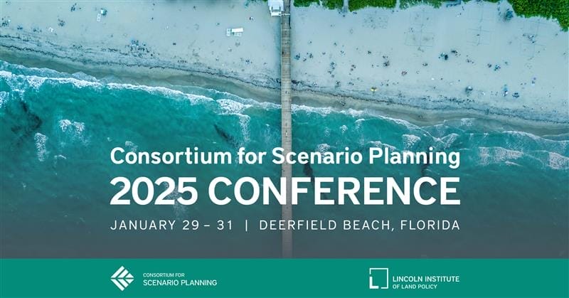
The Consortium for Scenario Planning invites you to its eighth annual conference at the Embassy Suites by Hilton Deerfield Beach Resort & Spa in Deerfield Beach, Florida, January 29–31, 2025.
In an era marked by extreme weather events, economic instability, and the challenges of post-pandemic living, scenario planning is an essential tool for cities and regions preparing for an uncertain future. The in-person conference is an opportunity to explore cutting-edge advances in the use of scenarios to address local and global trends that shape our communities’ future with leading practitioners, consultants, and academics in the field. Attendees will dive into topics ranging from climate adaptation and urban resilience to economic disparities and housing challenges.
Jennifer Jurado, Broward County’s chief resilience officer and deputy department director, will deliver the keynote presentation on how scenario planning is transforming the region’s approach to compound flooding and other climate risks. Lightning talks and participant-driven unconference sessions will allow attendees to share their projects, collaborate, and hear new perspectives.
Registration closes on January 22, 2025, and is free for students. Conference sessions will be eligible for AICP Certification Maintenance credits.
The event will be held at the Embassy Suites by Hilton Deerfield Beach Resort & Spa. The closest airport is Fort Lauderdale–Hollywood International. Book your stay at the conference venue.
Please share this opportunity with your colleagues and contact Madeline Hiller, program assistant, planning practice and scenario planning, at the Lincoln Institute, with questions.
Climate Mitigation, Disaster Recovery, GIS, Housing, Land Use Planning, Mapping, Planning, Scenario Planning, Water
Consortium for Scenario Planning Advisory Board Application
Submission Deadline:
September 30, 2024 at 11:59 PM
SHARE
The Consortium for Scenario Planning Advisory Board is a group of practitioners, academics, and consultants that guides our community of practice to foster growth in scenario planning at all scales. There are currently three open positions, each covering a three-year term.Applications close on September 30, 2024, at 11:59 p.m. ET. We will notify applicants by November 27, 2024.
Details
Submission Deadline
September 30, 2024 at 11:59 PM
Keywords
Planning, Scenario Planning
Events
Big City Planning Directors Institute 2024
October 6, 2024 - October 8, 2024
Cambridge, MA United States
Offered in English
SHARE
For this in-person, invite-only event, the Lincoln Institute of Land Policy brings planning directors from the largest US cities to Cambridge, Massachusetts, for a three-day summit at the Lincoln Institute offices. The Big City Planning Directors Institute is a collaboration of the Lincoln Institute, Harvard University’s Graduate School of Design, and the American Planning Association. Planning directors will examine emerging public policy questions that influence the planning and design of large cities and their metropolitan regions. In 2023, the event was attended by 27 directors, representingcities from New York to Los Angeles.