Topic: Infraestructura

Eventos

Accelerating Community Investment Community of Practice Convening November 2024

Noviembre 12, 2024 - Noviembre 14, 2024

Santa Rosa, CA United States

Offered in inglés

The Accelerating Community Investment (ACI) initiative seeks to improve public finance by creating opportunities for public development, housing, and infrastructure finance agencies to engage with philanthropies, mission-aligned investors, and the broader capital markets. These partnerships help create new, community-led investments in underserved places and people.  

Through field research, technical assistance, and a national community of practice, ACI explores the intersection of public finance, impact capital, and community. The national community of practice (CoP) connects participants in local community investment ecosystems from 100 agencies and institutions in 18 states to each other and their peers. The group meets both virtually and in person to build partnerships, identify new investment opportunities, and share experiences and advice.  

The ACI Community of Practice Convening will be held on November 12–14 in Santa Rosa, California. Participants will have the opportunity to network, learn, and explore the Santa Rosa community. The agenda will include participant-led deal workshops, presentations from national impact investors, and a site tour that tracks the disaster recovery efforts in Sonoma County.  

This is an invitation only event.


Detalles

Fecha(s)
Noviembre 12, 2024 - Noviembre 14, 2024
Location
Santa Rosa, CA United States
Idioma
inglés

Keywords

desarrollo económico, vivienda, infraestructura, finanzas públicas

Nueva publicación

Lincoln Institute of Land Policy Releases New Book, City Tech

By Kristina McGeehan, Agosto 26, 2024

CAMBRIDGE, MA—The Lincoln Institute of Land Policy has released its newest book, City Tech: 20 Apps, Ideas, and Innovators Changing the Urban Landscape, by Rob Walker.

In this thoughtful, inquisitive volume, Walker investigates technologies that have emerged over the past few years and their implications for planners, policymakers, residents, and the virtual and literal landscapes of the cities we call home. Featuring a foreword by tech journalist Kara Swisher and an afterword by urbanist and futurist Greg Lindsay, the book explores the role of technology in our rapidly urbanizing world.

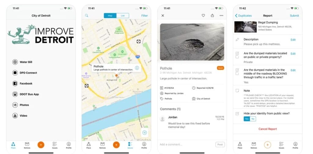
Experts predict that up to 80 percent of the population will live in cities by 2050. To accommodate that growth while ensuring quality of life for all residents, cities are increasingly turning to technology, from apps that make it easier for citizens to pitch in on civic improvement projects to designs for smarter streets and neighborhoods.

“We’re on a complicated journey; our decisions can set us off in surprising directions, and opinions may differ on how to navigate the challenges ahead,” writes Walker, a Fast Company columnist and New York Times contributor, in the book’s introduction. “But based on the examples in this collection, it seems clear that collaboration, creativity, and an openness to new ideas are the keys to getting where we need to go.”

City Tech is a chronicle of the recent rise of urban technologies, featuring firsthand reflections from the founders, innovators, and researchers closest to the work and from the planners and other officials who are putting these tools into practice on the ground. It’s also a source of essential questions: What are the ethical implications of smart cities? How can cities keep up with the rapid evolution of driverless vehicles? Is building skyscrapers out of wood a viable climate solution?

“If the last decade of urban tech has been a dress rehearsal, then the curtain is now rising on the most momentous decade of change most cities have ever had to face,” writes Lindsay in the book’s afterword. “It is our turn to formulate what we demand from our technologies, versus the other way around.”

City Tech, a curated collection of newly updated columns originally published in Land Lines, the magazine of the Lincoln Institute, follows last year’s release of Mayor’s Desk by Anthony Flint, a compilation of interviews with mayors from five continents who shared their strategies for tackling global challenges at a local level. Together, the books provide tangible examples of how cities across the world have mobilized to implement innovative land-based solutions for some of society’s most critical challenges.

City Tech is available for purchase on the Lincoln Institute website. For review copies, contact Kristina McGeehan at kmcgeehan@lincolninst.edu. City Tech is distributed by Columbia University Press.

About the Author

Rob Walker is a journalist and columnist covering technology, design, business, and other subjects. A longtime contributor to the New York Times, Walker writes a column on branding for Fast Company, and has contributed to Bloomberg Businessweek, The Atlantic, Fortune, Marketplace, and many other outlets. He writes the City Tech column for Land Lines, the magazine of the Lincoln Institute of Land Policy. He is the coeditor of Lost Objects: 50 Stories About the Things We Miss and Why They Matter and the author of The Art of Noticing. His Art of Noticing newsletter is at robwalker.substack.com. He also serves on the faculty of the School of Visual Arts in New York City.

About the Lincoln Institute of Land Policy

The Lincoln Institute of Land Policy seeks to improve quality of life through the effective use, taxation, and stewardship of land. A nonprofit private operating foundation whose origins date to 1946, the Lincoln Institute researches and recommends creative approaches to land as a solution to economic, social, and environmental challenges. Through education, training, publications, and events, we integrate theory and practice to inform public policy decisions worldwide. We organize our work around three impact areas: land and water, land and fiscal systems, and land and communities. We work globally, with locations in Cambridge, Massachusetts; Washington, DC; Phoenix, Arizona; and Beijing, China.


Lead image: Quantum network servers managed in a partnership between Chattanooga utility EPB and Qubitekk. Credit: Courtesy of EPB.

Curso

Gestión del Suelo en Grandes Proyectos Urbanos

Octubre 14, 2024 - Octubre 30, 2024

Ofrecido en español


El curso presenta una aproximación general a las intervenciones urbanas de gran envergadura, denominadas usualmente Grandes Proyectos Urbanos (GPU), y busca generar una reflexión sobre los desafíos que representan para la gestión de suelo, especialmente en las ciudades latinoamericanas. En este sentido, el participante tendrá una introducción a los fundamentos de la formación de precios y al funcionamiento de mercados de suelo en América Latina, y se abordarán los impactos y desafíos que traen los GPU en el manejo del suelo. Se hará énfasis en el análisis de casos locales e internacionales de estos proyectos y sus instrumentos de planificación, financiación y gestión del suelo.   

Los postulantes seleccionados aparecerán en la página Listas de Seleccionados a partir del 25 de septiembre de 2024.


Detalles

Fecha(s)
Octubre 14, 2024 - Octubre 30, 2024
Período de postulación
Agosto 8, 2024 - Septiembre 8, 2024
Idioma
español
Tipo de certificado o crédito
Lincoln Institute certificate

Palabras clave

desarrollo económico, economía, infraestructura, regulación del mercado de suelo, uso de suelo, planificación de uso de suelo, salud fiscal municipal, finanzas públicas

El escritorio del alcalde

Rezoning and Revitalization in Minneapolis

By Anthony Flint, Junio 12, 2024

Jacob Frey is an unabashed transplant. While attending law school at Villanova, the Virginia native and professional runner came to Minneapolis to run the Twin Cities Marathon and, as he tells it, fell in love with the city. The day after graduating, he drove the 1,200 miles west to Minneapolis, his chosen home.

He started as an employment and civil rights attorney, became a community organizer, served on the City Council, and was elected mayor in 2017, promptly faced with COVID and the police murder of George Floyd in 2020. He was re-elected in 2021 and continued to address police and race relations, as well as the connections among racial equity, affordability, and zoning.

Senior Fellow Anthony Flint interviewed Frey while visiting Minneapolis for the American Planning Association National Planning Conference. Frey later joined the Lincoln Institute and two other mayors from legacy cities—Aftab Pureval of Cincinnati and Paige Cognetti of Scranton—for a standing-room-only APA panel discussion about what’s working in legacy cities.

The interview, which has been edited for length, can be heard in full on the Land Matters podcast.

Anthony Flint: Minneapolis has been a pioneer in zoning reform and banning single-family-only zoning. How is it going? Can you talk a little bit about whether increasing supply is a good path to affordability?

Jacob Frey: There are two critical paths that you need to take simultaneously to achieve affordability. The first is subsidy. It’s bridging the gap between the market rate and the affordable rate, making sure that people who are experiencing homelessness have that next rung on the ladder to pull themselves out. That side of the equation can’t be achieved simply through supply; it requires some government intervention.

About 10 years ago when I first took office as a city council member, I said very clearly that we were going to go to war on surface parking lots. We were going to dramatically add supply and density, and we did. We coupled that with a comprehensive plan which, as you mentioned, got rid of single-family exclusive zoning, allowing duplexes and triplexes in residential neighborhoods, and then also adding density and height along commercial corridors.

All those things have allowed Minneapolis to keep rents down more than just about any other major city in the country. Other cities were seeing double-digit increases, where we were keeping our rent increases to 1 percent and 2 percent. That’s with a whole lot of new people moving in. We’ve dramatically increased supply and it’s helped a whole lot.

For years, we were operating under these prescriptive zoning ordinances that explicitly said, we’re going to keep the Blacks and the Jews in one portion of the city. When that became illegal to do explicitly, we then started to do the same stuff implicitly through the zoning code, making it so that unless you could own a huge home on a huge parcel, you couldn’t live in huge swaths of the city. The tails of those decisions continued to the present. We wanted to push back on that. We’re going for a diversity of housing options in every neighborhood, and therefore a diversity of people in every neighborhood. In the last three years, we’ve built over 1,000 housing units in multifamily buildings on parcels that previously would only allow a single-family home.

We’ve seen a whole lot of progress . . . and then we got sued. We’re going to ultimately win, whether through legislation or through the litigation itself. Everybody should have that opportunity to live in a great city, and we want to create that opportunity for everyone.

AF: For people outside of Minneapolis, who did you get sued by, and what was the rationale?

JF: We got sued by a group of people who said we were doing something that would harm the environment, and I adamantly disagree. One of the best ways to improve the environment, to reduce your individual carbon output, is by living in a great city. Rather than commuting 45 minutes into work from your own single-family home and picket fence out in the suburbs or exurbs, you can walk to the grocery store and take your bicycle to work. If you do take a car, well, it’s fewer miles traveled anyway. The suit is largely saying that we should have conducted an environmental review on this comprehensive plan and the total potential build-out. Let’s be real here. We can’t assume that every single building downtown is going to be 100 stories tall and every single-family home is going to be a triplex, because that is never going to happen. The way they were asking us to calculate this buildout is not operating in reality.

AF: Turning now to transit and mobility, how are you achieving your vision for sustainable mobility in a historically car-dependent metropolis?

JF: Our city was built out at a time when people were largely dependent on cars. To the extent that it was built out prior to that time period, the streets and the grids were shifted to make them car-centric. Of course, we recognize that cars are a way people get around, but we want to add options so people can safely and comfortably take their bike to work, we want to make it so that pedestrians feel comfortable and in fact are prioritized, we want to add public transportation, not just as an option that’s available occasionally, but as a convenient one for getting from point A to point B.

We are adding bus rapid transit wherever we can. We’ve seen a dramatic uptick in the number of BRT lines, and over the last 15 years, Minneapolis has grown by about 50,000 people, yet the total vehicle miles traveled and gas emissions have gone down.

We recognize that people are going to take cars and we’re going to try to make those cars as sustainable as possible through electric vehicle charging stations. Right now we’re adding bus-specific transit lanes as well so that you can take the bus and whip by traffic that you would otherwise be sitting in.

Old and new approaches to architecture in the Twin Cities. Credit: Anthony Flint.


AF: What is your assessment of land-based financing to fund transit, redevelopment, affordable housing, and parks? The idea is that government action and investments create value in private land and development. Isn’t it possible to harness some portion of that increase in value and plow it back into the community? Are you a value capture fan?

JF: I think it’s not smart to be pro-value capture, pro-TIF, or anti–value capture, anti-TIF. It is a very important tool and needs to be balanced.

There is a way to enhance a city by using tools such as value capture and TIF to achieve wonderful structures and building and transportation options that would not happen but for government intervention. We’ve been using it in a number of different ways, including one of the most popular policy moves I’d say we’ve done in the last few years, which is to knock down this old Kmart. To take you back: 40 or 50 years [ago] there was a policy decision made to block off Nicollet Avenue and put a big Kmart in a huge parking lot in the middle of it.

It would be somewhat unfair of me to question decisions that were made at that time, because I’m sure 40 years from now, there are decisions I will have made that turn out to be not so smart, but this is one of the worst, in my opinion, urban planning decisions that was made in our city. We found ways to get land control over that former Kmart. We are knocking the building down. We’re opening up the street and breathing new life into this important artery and making sure everything is there, from a park to affordable housing to commercial to market rate. It allows the flow of entrepreneurship and new business growth on that corridor to expand south and north. A big part of what we’re using to achieve this large-scale goal is value capture.

It is a tool that should be used, but it’s also a tool that shouldn’t be used every single time there’s a new building that goes up or a new opportunity to be had. It’s got to be a balance.

AF: A task force is looking at changes to the Metropolitan Council, but in what ways is this pioneering arrangement working? Can or should it be replicable, this idea of regional governance?

JF: You can’t think about any city as living in a vacuum. Mayor Carter [of St. Paul] and I joke that it’s not like we just protect the water on our side of the Mississippi River. We share. Likewise, we share an economy that doesn’t end where the street ends and the boundary starts.

I’ve got a responsibility to the city of Minneapolis, and it helps to have a governing body that has a regional focus. We’ve got a Metropolitan Council appointed largely by the governor that helps us put up light rail that goes through a number of different municipalities. It helps us design bus-rapid transit, helps pay for Metropolitan Transit police. To have that regional focus is not just important; it’s crucial to furthering a regional mindset and goal.

AF: What’s your view on skyways? Current urban planning practices suggest a focus on the street and activity at the street level. Is there a conflict there? Tell us a little bit about the urban design part of your job.

JF: If you’ve got 100,000, 200,000 people coming downtown, and you’ve got two levels of activity, you’re splitting whatever number it is between those two levels.Do I like the splitting of activity? Of course I don’t. Nobody does. I’d rather have a concentration of all that bustle and excitement and vibrancy all on one level. But I use the skyways. During the months where it’s cold, I go in and I grab a sandwich and I don’t feel guilty about it. In fact, I’m really pumped to see the small local business owners that are operating in it.

Skyways have been hit particularly hard in the last few years because of a decrease in the number of workers that come downtown on an annual basis. I will not take any more criticism about the lack of vibrancy downtown or somebody’s favorite sandwich shop closing, from the person that’s sitting on their couch at home in the suburbs. If you care, then you should be supporting that sandwich shop.

If you want to see vibrance and want to see more foot traffic, your feet should be adding to that traffic. We are increasing the numbers pretty dramatically right now. People are definitely coming back, but it’s not happening all in one big burst.

AF: It’s become a bit of a cliche, but there really is no substitute for being in the office.

JF: It’s the unplanned interactions that ultimately help. I’m largely in Minneapolis because of a coincidence. You meet somebody, you get a job, you get an interview, you find a great city that you fall in love with. These things only happen because you were there to have it happen to you.


Anthony Flint is a senior fellow at the Lincoln Institute of Land Policy, host of the Land Matters podcast, contributing editor of Land Lines, and author of Mayor’s Desk: 20 Conversations with Local Leaders Solving Global Problems.

Lead image: Minneapolis Mayor Jacob Frey. Credit: Office of Mayor Frey.

Nuevas investigaciones sobre políticas de suelo y desarrollo urbano en América Latina

Por Luis Felipe Quintanilla, Junio 11, 2024

En el marco de la reciente convocatoria de investigación sobre políticas de suelo y desarrollo urbano en América Latina, el Instituto Lincoln de Políticas de Suelo se complace en anunciar los proyectos seleccionados para recibir apoyo financiero. Estas propuestas se destacan por su potencial de generar nuevos conocimientos sobre cómo las políticas de suelo pueden contribuir a la superación de desafíos sistémicos para el desarrollo sostenible en la región, tales como la asequibilidad de la vivienda, la equidad socioespacial, el mejoramiento integral de barrios informales, la autonomía fiscal de los municipios y la adaptación al cambio climático.

Adicionalmente, los proyectos seleccionados resaltan por su alta capacidad de incidir en debates de política pública vigentes en América Latina en temáticas de interés para el Instituto, incluyendo lecciones en la implementación de instrumentos de financiación en base al valor del suelo, políticas para reducir déficits cualitativos y cuantitativos de vivienda, y condiciones propicias para la incorporación de soluciones basadas en la naturaleza para la acción climática.

A continuación, se mencionan los proyectos y equipos de trabajo que reciben una comisión del Instituto Lincoln y que resultarán en informes científicos a presentarse en abril de 2025:

  • María Mercedes Di Virgilio, Felipe Gonzalez, María Vitoria Boix, Nicolás Ferme y María Victoria Marco, todos integrantes del Centro de Implementación de Políticas Públicas para la Equidad y el Crecimiento (CIPPEC), realizarán una medición de niveles de vivienda vacante y recomendaciones de políticas públicas en las ciudades de Buenos Aires, Córdoba y Rosario, en Argentina.
  • Ernesto Lopez-Morales, Luis Inostroza, Lien Rodríguez, Nicolás Herrera y Vicente Mosso investigarán aumentos de valor de suelo generados por proyectos de infraestructura azul-verde y la provisión de servicios ecosistémicos en la región de Patagonia, Chile.
  • Aurora Echavarria y Paavo Monkkonen generarán una base de datos de tasas del impuesto predial aplicadas en más de 200 municipios de México, para evaluarlas contra niveles de progresividad y de cumplimiento en pagos, así como su relación con costos fiscales por exenciones y frecuencia de estimaciones de la base gravable.
  • Ciro Biderman y Luis Antonio Fantozzi Alvarez evaluarán variaciones en cobros de derechos de edificabilidad y sus impactos en valores de suelo y edificios en São Paulo, Brasil.
  • Pedro Abramo, Adriana Hurtado, Juan Cabrera, Denisse Brikman, María Mercedes Di Virgilio y Julia Queiroz realizarán un estudio comparativo de procesos de densificación en áreas de origen informal en cinco países—Bolivia, Perú, Colombia, Argentina y Brasil—con el objetivo de identificar modelos de política pública para gestionar los procesos actuales de crecimiento vertical informal.
  • Daniel Kozak, Demián Rotbart, Hayley Henderson, Mariana Giusti, Rodolfo Aradas y Esteban Otto Thomasz analizarán el costo-beneficio de un sistema urbano de drenaje sostenible, incluyendo su potencial como solución basada en la naturaleza y mecanismo de recuperación de plusvalías, en el municipio de General San Martín, Argentina.
  • Oscar Eduardo Pérez Moreno, Catalina Hinestroza Gallego, Jean Carlo Figueroa Santamaría y Susana Aguilar Cuartas analizarán los marcos jurídicos e institucionales de instrumentos de recuperación de plusvalías para la financiación de acciones de resiliencia climática, con enfoque en el proyecto “Paisajes de Agua” del municipio Rionegro, Colombia.
  • Ivo Gasic, Néstor Garza y Clemente Larraín realizarán una estimación de la tasa de variación general del precio del suelo de Santiago de Chile, con el objetivo de ser utilizada en investigaciones sobre estimaciones de plusvalías que genera la inversión pública en esta ciudad.
  • Fernando Mello Franco, Alexandre Fontenelle-Weber, Giselle Mendonça Abreu, Joyce Reis Ferreira da Silva, Rafael Chasles y Bárbara Frutuoso explorarán la función socioambiental de azoteas en São Paulo, Brasil, generando una tipología en base a morfologías y usos.
  • Beatriz Toribio, Gastón Gertner, y Guadalupe Dorna, compararán los efectos de obras para control de inundaciones en valores de propiedades en zonas de alto riesgo en la ciudad de Buenos Aires, Argentina.

Para conocer más acerca de esta y otras iniciativas de investigación del Instituto Lincoln en la región, visite nuestra página principal de oportunidades para investigaciones (en inglés) y nuestro repositorio de recursos relacionados con políticas de suelo en América Latina.


Luis Felipe Quintanilla es analista de políticas para el Instituto Lincoln de Políticas de Suelo.

Lead image: Casas en Buenos Aires, Argentina. Credit: Gustavo Enrique Cortez via iStock/Getty Images Plus.

A man looks at a flooded area from a helicopter

Recovery and Resilience: New Research on Exploratory Scenario Planning for Disasters

By Jon Gorey, Mayo 9, 2024

When heavy rains unload on Beaumont, Texas—which is to say, pretty often, in this small Gulf Coast city 80 miles east of Houston—flash flooding can turn the underpasses beneath train tracks and bridges into unpassable, sewage-laden lakes, as pump systems get overwhelmed.

It’s a citywide issue, but it’s especially problematic in Beaumont’s historic South End. Ringed on three sides by heavy industrial facilities—including a 2,400-acre ExxonMobil refinery and chemical plant, the 100-acre Port of Beaumont, and a facility that holds thousands of rail cars—such inundation can essentially leave residents and workers stranded in the neighborhood, with no way out.

“We’ve always had an issue where our underpasses flood, and so we’re trapped without access to emergency medical facilities,” says Christopher Jones, founder and director of the South End Charlton-Pollard Greater Historic Community Association. “During events like Harvey or Imelda, we’re trapped within that industrial horseshoe.”

The prospect of getting stranded by an everyday downpour creates anxiety for residents, as well as tangible health hazards. “Our streets fill up with sewer and rainwater, and there’s no cleanup that happens afterward, whether it’s from the city or the state of Texas,” Jones says. “Then that sewage matter dries up and becomes an airborne pathogen that we breathe,” along with other pollutants, such as limestone dust, sulfur, and petrochemical byproducts produced or transported nearby. Indeed, between the dangerous chemicals in nearby rail cars and refineries, its hurricane-prone location, and the increasing frequency of extreme heat waves, flooded roadways are hardly the only disaster-related risk facing the Charlton-Pollard neighborhood.

So when Jones heard about a request for proposals issued by the Lincoln Institute’s Consortium for Scenario Planning (CSP), he proposed a series of exploratory scenario planning workshops that would gather ideas and input from community members, city officials, emergency agencies, and local businesses, to formulate and prioritize resilience strategies.

The review committee found the Beaumont proposal unique and compelling for a couple of different reasons, says Heather Hannon, associate director of planning practice and scenario planning at the Lincoln Institute. “It’s the first community organization awarded through this process,” Hannon says, as opposed to a municipal department, planning agency, or research team. What’s more, the proposal specifically focuses on the “dual-threat landscape” of both natural and man-made disasters.

The neighborhood is well aware of the “escalating risks posed by climate change, industrial accidents, and other man-made hazards,” Jones explained in his proposal. “Our community’s proximity to a dense concentration of industrial operations elevates the risk of chemical spills, industrial explosions, and air quality emergencies, in addition to natural disasters like hurricanes, floods, and severe weather events.”

Jones says the old housing stock in his neighborhood isn’t very suitable for sheltering in place, whether it’s during a storm or a chemical spill. “My neighborhood dates back to the 1800s, and many of the homes here are, if not the same age as ExxonMobil, a little bit older.” Many of those homes lack the kind of weatherization upgrades—insulation, storm windows, air sealing—that would better protect them from storms and air quality issues.

“I definitely want my neighbors to have the opportunity to not only weatherize their homes, but to be able to seek safety and shelter inside of their homes if there’s anything like an explosion from ExxonMobil,” Jones says. When a series of chemical explosions rocked a TPC plant in nearby Port Neches in 2019, “We felt it—we smelled it,” Jones says.

“So if we were to experience something like, God forbid, a big waste of benzene, everybody here is [in serious trouble], because they don’t have the knowledge or adequate facilities to shelter in place,” he adds. “And that includes schools that are in our area, businesses in our neighborhood, elders . . . that, to me, is our starting point for our resilience.”

Smoke from an explosion at a chemical refinery in Texas
Aftermath of a series of explosions at a TPC Group chemical plant in Port Neches, Texas, in 2019. The initial blast was felt up to 30 miles away, and the explosions caused $153 million in offsite property damage. Credit: US Chemical Safety and Hazard Investigation Board.

The South End Charlton-Pollard project is one of five that the Consortium for Scenario Planning has chosen to support in response to the RFP. From Colombia to Canada, each project will design exploratory scenario planning workshops focused on disaster recovery and resilience. The awardees will have the opportunity to present and describe their work in early 2025 at the annual Consortium for Scenario Planning conference.

Awardees are tasked with designing workshops that use exploratory scenario planning (XSP) to help members of their community—which could be a neighborhood, city, or entire region—explore disaster recovery and resilience strategies. Applicants were encouraged to address both one-off disasters as well as those that are part of a larger cycle of “cascading hazards, where the effects of one disaster bleed into or cause another”—such as droughts that contribute to wildfires or landslides, or floods that destroy homes and then trigger sanitation crises.

In addition to the XSP workshops that the South End Charlton-Pollard Greater Historic Community Association will design and conduct in Beaumont, CSP selected four other proposals to support:

  • Building off its recent completion of a participatory climate risk assessment, the Rural Municipality of Piney in Manitoba, Canada, will use a seven-step XSP framework to develop workshops and educational resources to help the region better prepare for a spectrum of disasters, particularly wildfires.
  • Casa del Sur/Encuentro in Santa Fe, Argentina, will focus on building resiliency awareness among vulnerable citizens, who have been affected by both record floods and record lows of the Paraná River, urban heat, and fires in the past two decades.
  • A team from the Virginia Institute of Marine Science (VIMS) at the College of William and Mary in Williamsburg, Virginia, will develop a framework for rural communities to plan for and adapt to sea level rise flooding and increased storm flooding impacts, using rural Virginia as the target audience and a special emphasis on nature-based features.
  • A team from the Urban Mapping Agency, BuroDAP, and Universidad del Rosario in Bogotá, Colombia, will conduct XSP workshops with a special focus on vulnerable communities and informal settlements facing flood risk in the urban peripheries of two major cities—Policarpa in Cartagena, and the Tunjuelo River floodplain in Bogotá.

All five projects, scheduled to be completed by May 2025, were selected as part of an annual RFP process managed by the Consortium for Scenario Planning. Past projects have focused on housing affordability (2023), changing food systems (2022), climate strategies (2021), and equity and low-growth scenarios (2020).

To learn more about all Lincoln Institute RFPs, fellowships, and research opportunities, visit the research and data section of our website.


Jon Gorey is staff writer at the Lincoln Institute of Land Policy.

Lead image: A member of the Coast Guard inspects flooding in Beaumont, Texas, as part of a search and rescue mission after Hurricane Harvey. Credit: Petty Officer 3rd Class Brandon Giles/US Coast Guard/US Department of Defense.

Fellows in Focus

Demystifying Land Value Capture, from Colombia to California

By Jon Gorey, Mayo 9, 2024

The Lincoln Institute provides a variety of early- and mid-career fellowship opportunities for researchers. In this series, we follow up with our fellows to learn more about their work.

Urban economist Néstor Garza first partnered with the Lincoln Institute’s program on Latin America and the Caribbean (LAC) over 20 years ago—to publish a working paper based on his undergraduate thesis, looking at the spatial distribution of land values in Bogotá, Colombia. Garza’s early career coincided with the city’s increased use of land value capture tools—policies that empower communities to recover and reinvest a portion of property value increases that result from public investment or government action—which allowed him to both study and experience their impact on the built environment. In 2005, Garza received a LAC Graduate Student Fellowship while pursuing his master’s degree in Colombia; he later earned a PhD in Land Economy from the University of Cambridge.

Today, Garza teaches economics at California State University, Dominguez Hills. In this conversation, which has been edited for length and clarity, Garza explains what Los Angeles could learn from his former hometown, why the concept of land value capture is sometimes misunderstood, and why he was excited to prove a 19th-century political economist correct.

JON GOREY: What is the main focus of your research, and how did your Lincoln Institute fellowship help you build upon that work?

NÉSTOR GARZA: My research has always been about urban economics, and more precisely, on the spatial analysis of land markets, regulation, and taxation. For example, I wrote a series of four papers on the neutrality of the land value development tax in Bogotá. This is neutrality in the sense described by Henry George, in that you’re able to extract part of that land value without changing anything else; I was able to prove both static and dynamic neutrality in Bogotá.

In 2005, I was doing my master’s in economics at Universidad Nacional, and I participated in the LAC fellowship. It was about the spatial distribution of housing markets and the creation of a value index for newly built housing in Bogotá. That one was super special: they flew us to an event in Quito, Ecuador, with Lincoln Institute faculty and with the other thesis fellows, and it was super interesting, I learned a lot. And more importantly, I started exchanging with all these colleagues in Latin America that are also interested in these types of things. It was really valuable for me. Then in 2008, Lincoln invited us to stay for three months in Bogotá, a group of Latin American students from maybe 10 different countries, to intensively learn about land markets, land policy, land law, geographic information systems, valuation, and so on. Once again, it was extremely rewarding.

JG: What are you working on now, and what are you hoping to work on next?

NG: One thing I’m working on is in-kind development contributions in Seattle. We all know the West Coast is suffering from a lack of housing—at this point it’s a humanitarian crisis, no?—and part of that is definitely related to the operation of land markets. So I have continued studying in-kind development contributions, specifically sidewalks in Seattle, and the effect of that on the supply of housing.

In Latin America, I’m working with a colleague in Santiago, Chile, creating spatially accurate land value indexes, and with another colleague in Merida Yucatan, in Mexico, on the effects of globalization on the local real estate markets. Essentially, huge amounts of international money are flowing to this region, purchasing absentee-owner real estate which geographically encloses the city, limits its development potential, and increases land values.

And I’m working with a colleague in Colombia tracing the unfolding of neoliberalism there back in the 1980s and ’90s. There was a paradigm shift in the way policy is made toward neoliberal logics, so we analyzed, one by one, the key economists and policymakers who were behind those transformations, analyzed their professional, educational, and research careers, to understand the motivations behind the reforms of 1991.

Buildings and a pedestrian in Mexico
Garza’s current work includes studying the effects of globalization on the local real estate market in Merida, Mexico (pop. 892,000). Credit: Laurentiu Morariu via Unsplash.

JG: What’s the most surprising thing you’ve learned in your research?

NG: To really be able to see and prove, empirically, the static and dynamic neutrality of land value capture, that surprised me. Because, sure, I expected to find that, but when you do find it? Okay! So Mr. George was right, it’s not crazy. The entire thing makes sense. So I would say that was surprising, but a nice surprise, that it works the way we thought it works. Static neutrality means that applying a land value capture fee where there’s a reason for it—for example, new zoning rules, or a new park—decreases land values or decelerates land value increases while leaving everything else constant; it doesn’t discourage new development or change built environment prices in that area. Dynamic neutrality means that the enactment of the land value capture fee does not cause preemption, where developers rush to build, increasing land values, nor does it shift development or home value increases to a different part of the city that doesn’t have the land-based fee.

JG: What’s one thing you wish more people understood about Latin American land policy, or about urban economics more broadly?

NG: There are two things. One is what I wish that the Latin American policymakers and public would understand, and another is what I wish the rest of the world would perceive, particularly the place where I live, the metro area of Los Angeles.

In Latin America, thanks to the Lincoln Institute, I have traveled around the continent, making presentations, talking to people. Some people are really engaged and want to participate and activate all these economic tools for land management. But some people are super resistant, and the resistance comes from a kind of preconception, where in Spanish “land value capture” is translated as la captura de plusvalías. And plusvalías, in Spanish, is the same as the Marxist term “value added,” which has a kind of socialist connotation. People think that this is some kind of socialist conspiracy against private property and markets. This preconception is very difficult to change, to tell them, ‘No, it’s not, it’s actually the opposite. These are tools to enhance the construction industry, to enhance a very active real estate market’—because that’s what we want to march towards, an active market able to provide more housing for everybody.

Now on the other hand, I would like other places, particularly Los Angeles, to see how well Latin American cities use the tools they have to make positive changes in the built environment. It’s an environment of precariousness, poverty, lack of funding—but still, things get made, city blocks get transformed. Here in LA, we have Proposition 13 that completely undermines property taxes, and it’s the exact opposite. We have one of the largest financial bonds markets in the world, with large and extremely sophisticated developers, but we are unable to, for example, redevelop one block, we are unable to increase densities to what’s required to make this region sustainable. It’s so, so difficult here to do anything, as if all of those policy tools did not exist. In Latin America, regardless of the poverty and the problems, it’s not that it’s easy, but it’s being done, it’s happening. So I would like the rest of the world, the US and particularly the state of California, to notice that lots of positive transformations to the urban built environment can be made in the context of market institutions. We can change cities and make them a bit more livable, a bit less hostile to pedestrians or to the inhabitants.

JG: When it comes to your work, what keeps you up at night? And what gives you hope?

NG: For the last few years, what has kept me awake at night, but at the same time given me hope, is higher education, here in the United States and around the world.

On the one hand, I notice a kind of obsession with the specialization of higher education, an obsession with practical skills in everything we do. I feel it from students, from administrators, and from higher level education experts, where everything has to be immediately applicable, and abstract or higher reasoning skills are set aside as unimportant, because they’re not immediately marketable skills to be used in the labor market. But those higher-level abstract reasoning skills are the ones all of us use all the time in the labor force.

At the same time, the higher education system is what gives me hope. In Colombia, back in the ’90s, I attended public school—it was one school for millions of possible students, so the rate of rejection was like 99 percent, everybody was rejected using purely standardized exams. Then once you got in, they failed about 50 percent of the students. It was a cruel elimination process that I somehow survived. But that’s not what higher education should be about—it’s not about eliminating people, it should be about widening possibilities for everybody. Of course, you have to have some degree of rigor, some real seriousness with it. But it doesn’t help to just eliminate people, that doesn’t help society. And I have noticed that in my own country, and everywhere in the world, higher education has moved towards a more accepting, less regimented, less boring way of doing things. And that gives me hope.

JG: What’s the best book you’ve read or show you’ve streamed lately?

NG: About three or four years ago, I read a book—the title is actually quite aggressive—called Bullshit Jobs: A Theory, by anthropologist David Graeber. And it caught my attention because, in a very funny way, it touches on the nonsense that the neoliberal organization of society is bringing on us, the kind of obsession with working. Why? The truth is, the modern capitalist system is able to deliver for everybody by doing almost nothing, it’s so immensely wealthy. But we have ingrained in our heads that we need to have a job to justify our very existence, and that’s produced a kind of collective paranoia where we need to do something and justify doing it, because our lives depend on it. And it creates these masses of disenfranchised workers in a middle state, where it isn’t clear if they’re productive or not, and people suffer psychologically because of that. So the book, in a funny way, takes all of that, and actually touches on important elements of ethics and economics and philosophy, with some funny commentary and interesting anecdotes.


Jon Gorey is staff writer at the Lincoln Institute of Land Policy.

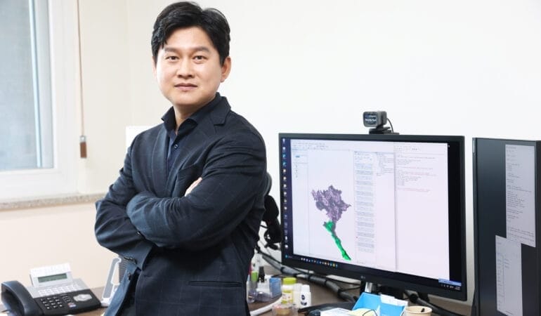
Lead image: Néstor Garza. Credit: Courtesy photo.