
Planning for a Just Transition in the California Delta
Some 50 miles inland from the iconic San Francisco Bay—east of the Golden Gate Bridge, beyond the Berkeley Hills and Mount Diablo—is the lesser-known California Delta, more than 1,100 square miles of lowlands and estuaries near the city of Stockton, at the confluence of the Sacramento and San Joaquin rivers.
Those two waterways alone drain about half of California, and much of that water gets pumped southward and westward to more populous areas of the state. Almost all the land in the delta—98 percent, much of it farmland—has been reclaimed since the 19th century with the help of hundreds of miles of levees and channels that drained what was once an inland sea during the wet winter months.
However, those drained wetlands, deprived of their natural sogginess, have been subsiding for decades as the peaty soil gets exposed to oxygen. “When you dry those out and make them terrestrial, they subside, the land elevation sinks,” says Brett Milligan, professor of landscape architecture and environmental design at the University of California, Davis. Despite its inland setting, “you have many places in the delta that are up to 20 or 25 feet below sea level.”
As sea levels rise, tidal saltwater intrusion from San Francisco Bay is increasingly a problem—especially during droughts and the summer dry season, when there’s less freshwater draining from the rivers to push back against rising tidal flows. Higher sea levels also put added strain on protective levees as the delta behind them sinks, increasing the risk of their potential failure.
An increase in salinity creates a lot of problems—for agriculture, for the ecosystem, and for the drinking water supply of millions of Californians. “We have one of the largest water infrastructure systems in the world,” Milligan says, largely focused on moving water from the wetter northern parts of the state to the more arid southern regions—“and the delta is sort of that switching point from north to south.”

This tangle of interconnected issues is why the delta is often regarded as a “wicked problem,” Milligan says. “There are so many factors involved. It’s very complex; conditions are also changing quite fast.” Climate change is exacerbating nearly every challenge facing the delta: Tides are getting higher. Droughts are getting more frequent and more intense. Winter snowpack in the uplands would once have held back freshwater long into the spring, but it now melts earlier, and more precipitation falls as rain rather than snow to begin with.
That variety of factors makes the problem more complex, but it also means there are multiple ways of looking at—and perhaps addressing—the overarching issue of salinity in the delta. To help the delta community discuss and better understand some of the available solutions, Milligan and colleagues are conducting a series of participatory scenario planning workshops focused on salinity management as part of a four-year, multi-campus University of California project called Just Transitions in the Delta.
Exploring Multiple Futures to ‘Liberate the Present’
Scenario planning is a type of collective visioning process that invites community members to imagine and evaluate a set of specific, possible futures. It’s an inherently participatory process, but Milligan is foregrounding that idea of inclusion and equity, intentionally seeking out voices who don’t typically have a seat at the decision-making table.
By engaging dozens of people from across the delta’s diverse population—from farmers to Indigenous tribal members to residents of communities bearing a disproportionate burden of environmental pollution—Milligan hopes to build a broader understanding of the adaptation strategies available, and what tradeoffs each one presents. “We were really interested in trying to explore, within a context where people are often at odds, could this type of scenario planning around salinity management options be a way to build trust and mutual understanding?” he says.
The project is now in its third year, and Milligan and his colleagues presented their progress at the Lincoln Institute of Land Policy’s Consortium for Scenario Planning conference in 2025. (Registration is now open for the 2026 conference, to be held February 4–6, 2026, in Salt Lake City, Utah.)
So far, Milligan’s team has conducted more than half a dozen workshops with well over 100 total participants—including two main public workshops in 2024 and 2025, as well as smaller sessions requested by Indigenous groups and vulnerable communities—with the goal of first deciding upon the suite of scenarios to be included, then designing and refining them.
“The first thing we did was a lot of outreach and interviews,” Milligan says, to determine and design the six main scenarios to be considered. The questions ranged from what people valued most about the delta, to which salinity management practices they wanted the team to explore, to who else ought to be included in adaptation discussions. Notably, Milligan says, 83 percent of respondents felt that past decision-making in the delta had not been equitable.
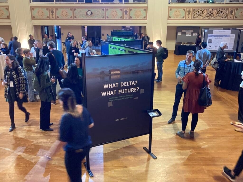
Using feedback from those interviews, the team designed a set of six scenarios for evaluation, which continue to be refined as workshops yield more feedback, and created an immersive, interactive exhibition of scenario narratives and maps ahead of the second full public workshop.
The first scenario is simply “Business as Usual,” which extrapolates current trends into the future as a sort of baseline from which to compare other adaptation measures. The second scenario models the Delta Conveyance Project, a long-discussed, partially permitted 40-mile water supply tunnel that could be built beneath the delta. The controversial tunnel is not particularly popular among many residents, Milligan explains, “but a lot of people wanted us to model that, to compare it to the other options.”
The third and fourth scenarios are nature-based restoration solutions. The “Eco Machine” approach would use strategically placed green infrastructure to reduce salinity intrusion and create recreational and ecological benefits. The “New Green Watershed,” meanwhile, is more ambitious in scope, phasing in green infrastructure across the entire region, along with carbon banking, land repatriation to Indigenous communities, and wet soil agriculture (such as rice farming) to reverse land subsidence and transition the delta to a regenerative green economy.
“That was driven by tribal input asking us to think about the delta more holistically,” Milligan says. “A lot of people are concerned about flooding, and interested in what can be done upstream in terms of land management, better fire stewardship, restoration of meadows, and things like that, that will influence when and how water comes down,” he says. “Could you reinvent the delta in a way that’s more sustainable and make that economically viable?”
The last two scenarios focus on more traditional infrastructure, but implemented and managed in smarter ways. “Bolster and Fortify” models how major engineering investments in the delta’s gray infrastructure—such as barriers, operable gates, and augmented levees—could reduce salinity and protect subsided land from levee breaches. “Calling on Reserves” focuses on operating upstream dams and reservoirs differently—allowing more water out when necessary to push back against tidal intrusion, for example—combined with statewide investments in increased water efficiency and storage.

In the large public workshops, participants have so far ranked the two nature-based solutions most favorably (with the tunnel and business-as-usual scenarios battling it out for last place).
Those workshops also sought input on how each scenario ought to be assessed. The team is now using hydrodynamic and other modeling methods to evaluate and score each scenario according to six criteria participants selected: water quality and flow, ecological restoration, Indigenous sovereignty, environmental justice, recreation, and economy. A final public workshop in 2026 will present the fully modeled and scored scenarios, and ask participants to rank their preferences.
“What I find most useful about scenario planning is exploring multiple futures as a way to kind of liberate the present and how we think about futures. There’s not just one way the world can be,” Milligan says. He notes that people seem to be more open to understanding other people’s perspectives in the context of specific scenarios.
Encouragingly, post-workshop surveys have confirmed that participants feel the process has been useful. “We get very positive feedback from people saying they felt heard,” Milligan says. But voicing opinions is not the only reason people are attending the workshops; many have said they specifically came to hear what others had to say. “I’ve never heard that in my 12 years working in the delta,” he says.
“People are showing up because they’re curious about how other people experience this and think about this, which was a goal for our project—can we foster that kind of learning space? It seems that many people are coming to these because they want to learn; they want to understand other ways of how it can be.”
Jon Gorey is a staff writer at the Lincoln Institute of Land Policy.
Lead image: Middle River Bridge near Discovery Bay in the California Delta. Credit: toddarbini via iStock/Getty Images Plus.