Communities around the world are contending with accelerating climate change and finding ways to adapt. Through networks and communities of practice, courses and workshops, research, and publications, the Lincoln Institute identifies and shares promising practices for land-based greenhouse gas mitigation, and adaptation and resilience. With partners, we bring together elected officials, community members, and key planning and policy staff to facilitate the transfer of knowledge, strategies, and promising practices to scale up effective climate solutions.
We are demonstrating the economic, environmental, and public health benefits of integrating nature more fully into cities, working with ecological systems rather than against them. Design with Nature Now (2019) and Nature and Cities (2016) feature photographs, articles, and essays by leading international architects, landscape architects, city planners, and urban designers.
View the Book
Storymap: Land-based Climate Solutions from Around the World
This StoryMap features a growing library of case studies that illustrate the role of land use and policy in mitigating and adapting to climate change. Featured case studies range from the Life Vimine Project in Venice, Italy, to the Watts Rising Transformative Climate Communities Project in Los Angeles.
In July 2022, we published a special issue of Land Lines magazine that features articles on the growing practice of community-led relocation, the link between climate action and property value increases, and land as an essential component of climate solutions.
Having impact at a nonprofit research organization requires being both determined and nimble, according to three scholars who retired last year from the Lincoln Institute of Land Policy after decades of service.
The three scholars—geographer and urbanist Armando Carbonell, who led programs in urban planning and land conservation; Daphne Kenyon, an economist studying the property tax and municipal finance; and economist Martim Smolka, director of the organization’s Latin America program—share reflections about their work and the Lincoln Institute in a special edition of the Land Matters podcast.
Though they pursued different areas of inquiry during their time at the organization, they found common themes, like the central task of assembling and convening a network of practitioners, and continually inviting feedback to keep up to date on the challenges and emerging issues in their fields.
One such network formed in the 1980s when Boston attorney Kingsbury Browne brought together a handful of people who were establishing conservation easements to safeguard ecosystems across the United States. The value of exchanging information about tax laws and land conservation was deemed to be so great, the group ended up forming the Land Trust Alliance, which now represents nearly 1,000 land trusts with some 60 million acres in conservation.
Another area of critical importance: communicating in plain terms and being attentive to different audiences, whether the topic is climate migration or informal settlements or the way the property tax pays for essential local services including schools. The interviewees cite Lincoln Institute projects like the State-by-State Property Tax At a Glance website, the Making Sense of Place film series, and a role-playing game that leads participants through the steps of functioning land markets as successful examples of this approach.
The three scholars (bios below) also recall how they first discovered and interacted with the Lincoln Institute—all of them starting more than 30 years ago—and share their experiences putting together extensive programming over that time. They also look ahead to the daunting challenges awaiting future generations working in the nonprofit realm.
Martim O. Smolka, former senior fellow and director of the Program on Latin America and the Caribbean, is an economist. His areas of expertise include land markets and land policy, access to land by the urban poor, the structuring of property markets in Latin America and property tax systems, including the use of land value increment charges to finance urban development and infrastructure. A graduate of the University of Pennsylvania (MA/PhD), he is co-founder and former president of the Brazilian National Association for Research and Graduate Studies on Urban and Regional Planning.
Daphne A. Kenyon, PhD, is a former resident fellow in tax policy at the Lincoln Institute of Land Policy. Her specialty is state and local public finance, with an emphasis on the property tax. She serves as the president of the National Tax Association. Kenyon’s prior positions include principal of D.A. Kenyon & Associates, a public finance consulting firm; professor and chair of the economics department at Simmons College; senior economist with the U.S. Department of the Treasury and the Urban Institute; and assistant professor at Dartmouth College. Kenyon earned her BA in economics from Michigan State University and her MA and PhD in economics from the University of Michigan. She has published numerous reports, articles, and three books. Her research has been cited in The New York Times and The Economist, among other publications. Her latest work was writing a major revision of the 2007 report The Property Tax-School Funding Dilemma with co-authors Bethany Paquin and Andrew Reschovsky.
Armando Carbonell served as head of the Lincoln Institute’s urban planning program. After attending Clark University and the Johns Hopkins University, Carbonell spent the early part of his career as an academic geographer. He went on to initiate a new planning system for Cape Cod, Massachusetts, as the founding Executive Director of the Cape Cod Commission. In 1992 he was awarded a Loeb Fellowship at the Graduate School of Design at Harvard University. Carbonell later taught urban planning at Harvard and the University of Pennsylvania and served as an editor of the British journal Town Planning Review. He has consulted on master plans in Houston, Texas, and Fujian Province, China, and is the author or editor of numerous works on city and regional planning and planning for climate change, including Nature and Cities: The Ecological Imperative in Urban Design and Planning. Carbonell is a Fellow of the American Institute of Certified Planners, Fellow of the Academy of Social Sciences (UK), and Lifetime Honorary Member of the Royal Town Planning Institute (UK).
In Cincinnati lately, good fortune extends well beyond the Bengals, the city’s football team, which has consistently been making the playoffs. The population is growing after years of decline, companies are increasingly interested thanks to its strategic location, and there’s even talk of southwestern Ohio becoming a climate haven.
But any resurgence in a postindustrial legacy city comes with downsides, as newly elected Cincinnati Mayor Aftab Pureval has been discovering: the potential displacement of established residents, and affordability that can vanish all too quickly.
One of Pureval’s first moves was to collaborate with the Port of Greater Cincinnati Development Authority to buy nearly 200 rental properties in low- and moderate-income neighborhoods, outbidding more than a dozen institutional investors that have been snapping up homes to rent them out for high profits. That sent an important signal, Pureval said in an interview for the Land Matters podcast: transitioning neighborhoods will be protected from the worst outcomes of market forces in play in Cincinnati.
“These out-of-town institutional investors … have no interest, frankly, in the wellbeing of Cincinnati or their tenants, buying up cheap single-family homes, not doing anything to invest in them, but overnight doubling or tripling the rents,” he said, noting a parallel effort to enforce code violations at many properties. “If you’re going to exercise predatory behavior in our community, well, we’re not going to stand for it, and we’re coming after you.”
Pureval, the half-Indian, half-Tibetan son of first-generation Americans, said affordability and displacement were his biggest concerns as Cincinnati—along with Pittsburgh, Cleveland, and other cities hard hit by steep declines in manufacturing and population—gets a fresh look as a desirable location. Cincinnati scored in the top 10 of cities least impacted by heat, drought, and sea-level rise in a recent Moody’s report.
“Right now, we are living through, in real-time, a paradigm shift,” spurred on by the pandemic and concerns about climate change, he said. “The way we live, work, and play is just completely changing. Remote work is … altering our economy and lifestyle throughout the entire country but particularly here in the Midwest. What I am convinced of due to this paradigm shift is because of climate change, because of the rising cost of living on the coast, there will be an inward migration.”
But, he said, “We have to preserve the families and the legacy communities that have been here, in the first place. No city in the country has figured out a way to grow without displacing. The market factors, the economic factors are so profound and so hard to influence, and the city’s resources are so limited. It’s really, really difficult.”
Joining a chorus of others all around the U.S., Pureval also said he supports reforming zoning and addressing other regulatory barriers that hinder multi-family housing and mixed-use and transit-oriented development.
An edited version of this interview will appear in print and online as part of the Mayor’s Desk series, our interviews with innovative chief executives of cities from around the world.
By many accounts, Costa Rica has been a unique Central American success story—“a beacon of Enlightenment” and “a world leader in democratic, sustainable, and inclusive economic growth,” according to the prominent economist Joseph Stiglitz.
A nation of about 5 million people roughly the size of West Virginia, Costa Rica has been punching above its weight particularly in the realm of sustainability and climate action: a pioneer in eco-tourism; successful in getting nearly all of its power from renewable sources, including an enterprising use of hydro; and a leader in fighting deforestation and conserving land with its carbon-soaking rainforests.
The Land Matters podcast welcomed two special guests recently who know a thing or two about this country: Carlos Alvarado Quesada and Claudia Dobles Camargo, the former President and First Lady of Costa Rica. They are both in the Cambridge, Massachusetts, area this year—she is a Loeb Fellow, part of a mid-career fellowship program based at Harvard’s Graduate School of Design, and he is a visiting professor of practice at the Fletcher School of Law and Diplomacy at Tufts University.
Former Costa Rican President Carlos Alvarado Quesada and former First Lady Claudia Dobles Camargo at the Lincoln Institute offices in Cambridge, Massachusetts, in April 2023. Credit: Will Jason.
Also in the studio was Enrique Silva, vice president of programs at the Lincoln Institute, who oversees the organization’s research and activities globally, and has years of experience in and familiarity with Latin America.
The conversation, recorded at the Podcast Garage in Allston after a visit by the couple to the Lincoln Institute, included reflections on leadership and climate action, and what it’s been like to take a year to decompress after an eventful time in office, from 2018 to 2022.
Costa Rica has much to show the world when it comes to the implementation of targeted sustainability practices, Quesada said. “We’re not saying people have to do exactly the same [as we did], but we can say it’s possible, and it’s been done in a model that actually creates well-being and economic growth,” he said. “Back in the day, people would say it’s impossible—‘if you’re going to create protected areas, you’re going to destroy the economy.’ It turned out to be the other way around, it actually propelled the economy.”
After seeing big successes in the countryside, the interventions have turned to urban areas. “Costa Rica has done such an amazing job in nature-based solutions, not so much on urban sustainability,” said Dobles, noting the ambitious National Decarbonization Plan she launched with Quesada, which aims to reach net-zero emissions by 2050. “In order to decarbonize, we really needed to focus also on our urban agenda.”
A big task was reinvigorating public transit, starting with a new electric train that would have spanned the city of San Jose. Quesada’s successor shelved the $1.5 billion project, demonstrating the common mismatch between long-term projects and limited time in office. A pilot project to electrify buses was implemented, however, to rave reviews. The couple says they are hopeful the train will be revived.
“I know that this is eventually going to happen. Sometimes you have political setbacks,” said Quesada. “Your administration cannot own throughout time what’s going to happen, but you can plant positive seeds.”
Costa Rica has been nothing if not creative in addressing the many dilemmas inherent in climate action. Open-ore mining is banned, for example, but entrepreneurs figured out a way to extract lithium from recycled batteries.
“That’s very linked to the discussion of the just energy transition, where the jobs are going to come from, where the exports are going to come from. While there’s a huge opportunity for many developing countries which are rich and are endowed with minerals and metals . . . we need to address those complexities,” said Quesada.
Dobles added, “When we talk about decarbonization, we cannot exclude from that conversation, the inequality conversation. This is supposed to provide our possibilities of survival as humankind, but also it’s a possibility for a new type of social and economic development and growth.”
Former First Lady Claudia Dobles Camargo makes a point as former President Carlos Alvarado Quesada looks on. The pair visited the Lincoln Institute office to discuss their climate and sustainability initiatives in April 2023 while spending a year at Harvard and Tufts universities, respectively. Credit: Anthony Flint.
Reflecting on being in the land of Harvard, MIT, and Mr. Bartley’s Burger Cottage, Dobles said she has been immersed in “the whole academic ecosystem that is happening here . . . just to be, again, in academia, sometimes just to receive information, not having the pressure of having the answers . . . . It’s been wonderful.”
“Being a head of state for four years of a country, it’s an experience that I’m currently unpacking still,” said Quesada. “I’m doing a little bit of writing on that, but you get to reflect a lot, because it’s a period of time you live very intensely. In our case, we were not only working with decarbonization, with the projects we mentioned, we [were also working] with the fiscal sustainability of the country. We had COVID. We had [the legalization of same-sex marriage].
“We tend to train ourselves for things that are outside of us, like methods, tools, knowledge,” he said. “There’s a part of it that has to do with training ourselves, our feelings, our habits, our framing, our thinking . . . to address those hard challenges.”
Carlos Alvarado Quesada served as the 48th President of the Republic of Costa Rica from 2018 to 2022, when his constitutionally limited term ended. He won the 2022 Planetary Leadership Award from the National Geographic Society for his actions to protect the ocean, and was named to the TIME100 Next list of emerging leaders from around the world. Before entering politics, he worked for Procter and Gamble, Latin America.
Claudia Dobles Camargo is an architect with extensive experience in urban mobility, affordable and social housing, community engagement, climate change, and fair transition. As First Lady, she was co-leader of the Costa Rica National Decarbonization Plan. Her architecture degree is from the University of Costa Rica, and she also studied in Japan, concentrating on a sustainable approach to architecture.
Record-breaking heat, out-of-control wildfires, and eye-stinging smoke have made the impacts of climate change inescapable for millions of people this summer.
Heat, drought, high winds, and conditions on the ground are all making wildfires more intense, longer lasting, and more destructive, according to the National Oceanic and Atmospheric Administration, which notes that big wildfires require a number of factors to align, including temperature, humidity, and the lack of moisture in fuels such as trees, shrubs, grasses, and forest debris.
Containing the blazes is mostly a matter of land use management, says Canadian science journalist Edward Struzik, author of Firestorm: How Wildlife Will Shape Our Future and Dark Days at Noon: The Future of Fire, on this latest episode of the Land Matters podcast. The continual threat of fires also requires resilience-building techniques similar to those deployed to fend off floods and sea-level rise. “We have to learn to live with wildfire and the smoke that comes from wildfire. This isn’t going to go away,” said Struzik, a fellow at the Institute for Energy and Environmental Policy at Queen’s University in Kingston, Canada. “There’s a number of different ways that we can handle it. . . . We can do more prescribed burning where it’s appropriate. We can restore our wetlands, which would create natural buffers on the landscape. We can invest in science that provides firefighters with better tools and predicts where fire is likely to burn.”
Wildfires have become bigger, more intense, longer lasting, and more destructive for several reasons. Fires have long been nature’s way of regenerating forests, but Struzik blames the current situation on land management practices dating back to at least the 19th century: farmers burning and slashing their land, and mining companies doing the same, just to get at the mineral resources underground. The draining of wetlands took away potentially fire-stopping buffers. “If you think about it, a firefighter’s best friend really is a wetland, a swamp, a bog, a fen, a marsh,” Struzik said.
“Once [a fire] hits a wetland, it really doesn’t have anything to burn because things are just too wet and moist. We’ve essentially eliminated all those natural fire barriers over time and it’s bigger than an area the size of California. Fire now basically has its own way once it gets going.”
After the establishment of the Forest Service, the policy of prescribed or controlled burns attempted to mimic nature, but the practice became politically risky because many fires deliberately set veer out of control. Much of today’s wilderness has become a worst-case-scenario mix of dense, older forests, with abundant dry fuel on the forest floor due to high temperatures—all subject to the cascading effects of high winds, blazing heat, and fire-induced storms featuring dry lightning.
“Wildfire can actually create its own thunderstorm because of the amount of heat and vapor that it sucks up . . . and it rises up just like what would happen normally in a thunderstorm, and you get what they call a dirty thunderstorm that almost never produces any rain, but shoots out lightning,” Struzik said. “A great example of this was the Fort McMurray fire in the oil sands of Northern Alberta in 2016, where . . . the fires created their own thunderstorm and shot out lightning 20 miles in advance of the fire front. That’s how much energy there was, and [it] created a cluster of fires 20 miles away from the front of the fire. Firefighters at that time were thinking, ‘How do you manage this?’”
“They have their prediction scenarios or forecasting scenarios, but when you have a thunderstorm created by a wildfire, and it’s shooting out lighting 20 miles away, you’ve got a new rule book coming into play, and everybody’s adjusting to this. Also, I think that the other big thing for them is that you can no longer put people on the ground or in the air in a situation like that because it’s essentially like a small to moderate size volcano that’s blowing up. That’s how much energy there is.”
Wildfires allow forests to thin out, spread seeds, and spur regrowth that provides food and habitat for wildlife. But many of those benefits are obliviated in today’s megafires, which burn so intensely they destroy the nutrients deep in the ground, leaving behind a desert-like landscape where nothing regrows. In addition, the degraded forest loses its ability to soak up moisture and keep the soil stable, resulting in disastrous post-fire floods. Without trees to help absorb heavy rainfall, water rushes straight to rivers.
“Say a fire tears through the mountainsides in Colorado, which has happened a number of times. . . . You have all that ash, all that carbon on the ground,” Struzik said. “The thunderstorm comes in—and we are having more extreme thunderstorms for a variety of reasons and record heavy rainfalls in these spots—and it sweeps through, and then it just collects all that carbon and soot, puts it into the river, and actually threatens our drinking water supplies.
“There’s a great example of this in Waterton Lakes National Park on the Montana border. There’s a waterfall that most tourists come to see called Cameron Falls. A year after the fire following a thunderstorm, that crystal-clear mountain water that descended over the falls turned absolutely black,” he added.
The apocalyptic scenarios and feedback loops are almost certain to continue. And many of the near-term solutions lie in land.
“We’re using 20th-century strategies to deal with the 21st-century paradigm for which we’re not prepared,” Struzik said. “We’ve got to start thinking about other strategies. We’ve got to invest a lot more in science and predicting where these fires are likely to start . . . [with] a better understanding of the landscape. Where are the refugia from fires? Those areas that are unlikely to burn—or those areas that will slow or stop a fire— we should start looking at those areas from a conservation point of view, [to] protect those areas so that we don’t lose these natural barriers.”
Edward Struzik has been writing about scientific and environmental issues for more than 30 years and completed both the Atkinson Fellowship in Public Policy and the Knight Science Journalism Fellowship. His 2015 book, Future Arctic, focuses on climate change in the Canadian Arctic and its impacts on the rest of the world. He is on the board of directors for the Canadian Arctic Resources Committee, a citizens’ organization dedicated to the long-term environmental and social well-being of northern Canada and its peoples.
Water in the West—one of the most enduring and confounding stories of human settlement anywhere around the world.
Jim Holway, who retired as director of the Babbitt Center for Land and Water Policy this summer, has spent more than 40 years helping to solve the puzzle of ensuring sustainable water resources in this increasingly arid region. In the latest Land Matters podcast, he describes the challenges ahead, and the kind of leadership—and serious, good-faith negotiation—it will take to establish a more secure water future.
With some places having their water restricted, and big reservoirs like Lake Mead drawing down to historically low levels, it has become increasingly clear that water from the Colorado River—distributed to nine states in the US and Mexico through a series of agreements and amendments hammered out since the 1920s—is no longer enough to meet the demands of a fast-growing population.
How did the region get to this point? “I’d say it was a combination of optimism, beginning with allocating more water [than would be available], and then it was just ignoring science for political reasons,” said Holway. “If I want to get my water project approved, it’s going to be a lot easier if I can convince people there’s enough water left for their project too. Even once we should have known better, we acted like we didn’t know better.”
The water allocations now have a structural deficit, Holway said, that is clear throughout the year-to-year ups and downs of drought and sufficient snowpack. Climate change is intensifying everything.
“We designed a hydrologic system for a physical reality that is changing on us, and the change in the level of heat is driving the system. More evaporation and more demand for agriculture, more demand in urban use—that heat is actually a more significant factor than precipitation. Whereas there is a lot of uncertainty about what the future precipitation changes will be in the Southwest, it’s very clear that it’s going to be hotter.”
While politicians debate climate science, Holway says, water and land managers know they have no choice but to prepare for the uncertain future that climate change will bring: “Droughts that cause inadequate supplies for historic uses, floods that exceed the infrastructure we’ve built to handle flooding, wildfires of much greater intensity and size, urban areas that are getting increasingly hot and leading to crisis situations in the middle of the summer—this is the reality of our future, and we need to adapt to deal with it.”
Building the capacity of local communities to integrate land use planning and the management of water resources has been the calling card of the Babbitt Center under Holway’s tenure, including using scenario planning techniques to map out future supply and demand conditions. Importantly, agriculture—which uses approximately three-quarters of Colorado River water—has increasingly been at the table, Holway said.
When asked to look to the future, Holway said, “It’s important for anyone doing this kind of work to find some way to sustain themselves. I suspect the thing that makes me most optimistic is when I look at the 20- and 30-year-olds getting involved . . . it seems that they really have an understanding of the challenges they’re inheriting.”
One of those challenges is developing the capacity to work together as a civilization to address water shortages in a more serious and straightforward manner, he said.
“When societies fail, it may look like it’s because of a flood, a drought, disease, or warfare. However, societies have survived those challenges before. Why do they not survive the next one? Typically, what we find is they have lost the ability to govern themselves.
“To me, that is where my main pessimism comes from. It isn’t our water challenge. It’s, will we come together? Will we make the necessary decisions we need to govern ourselves? That is our biggest challenge, and it’s what we’re doing particularly badly at the moment.”
Water, Holway said, “perhaps will help us rediscover our ability to come together and make collaborative decisions. There are very few things that humans see as critical to their survival [more than] a good water supply. That’s pretty clear and pretty compelling. Let’s hope it’s part of our path forward.”
Jim Holway served as director of the Babbitt Center for Land and Water Policy from its founding in 2017 until late 2023. He was elected to the board of the Central Arizona Water Conservation District, directed the Western Lands and Communities program with the Sonoran Institute, and served as a professor of practice in sustainability at Arizona State University and assistant director at the Arizona Department of Water Resources. He has degrees from Cornell University and the University of North Carolina, and was inducted into the College of Fellows of the American Institute of Certified Planners.
Some 150 heads of state, 195 countries, and a total of 85,000 participants engaged in the COP28 global climate summit in Dubai in December, which concluded with an appeal to triple renewable energy capacity and combat methane emissions, a goal to halt deforestation by 2030, an outline for a loss and damage fund, and the launch of a global stocktake to keep track of how nations are doing reducing carbon emissions.
Most of the headlines referred to a call at the close of COP28 for all nations to be focused on “transitioning away from fossil fuels in energy systems, in a just, orderly, and equitable manner.” Many had hoped for stronger language calling for the phasing out of oil and gas on a stricter timetable – and of course there was the fact that the summit itself was hosted by a region whose economy is fundamentally based on extracting and exporting fossil fuels. But it was the first time a COP declaration has specifically identified fossil fuels.
All of that could be fairly characterized as progress in the face of a planetary emergency. Still, 2023 was the hottest year on record, and current emissions are on track for a world that is 2.5 degrees warmer, well above the 1.5 degree Celsius goal set in the Paris Accords – the major international agreement to come out of the COP21 summit in 2015. Missing that target has contributed to more skepticism about COP, and the pledges and non-binding declarations that have followed, including some dashed hopes after COP26 in Glasgow two years ago.
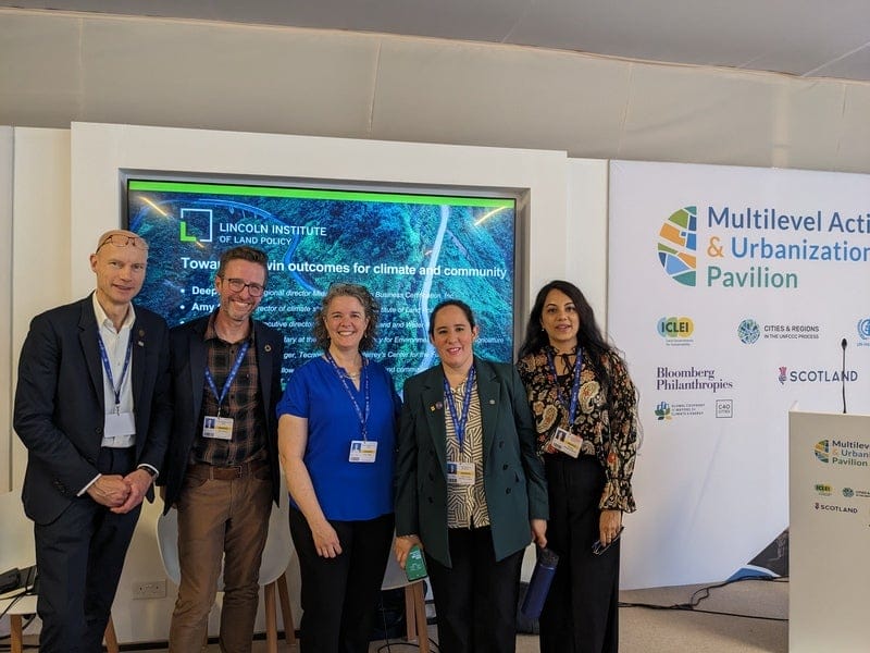
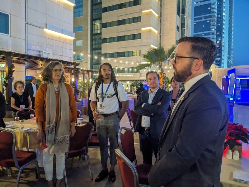
Are these big summits what the world should be looking to? Are they designed to accomplish anything more than to keep the parties talking, taking stock, and keeping score on commitments? To break down the proceedings – and to consider progress that was made on other fronts, including land use and urban issues – this episode of the Land Matters podcast is devoted to a roundtable discussion with four Lincoln Institute staff members who were in Dubai: Amy Cotter and Patrick Welch from the climate strategies team, Anaclaudia Rossbach, who runs the Latin America program, and John Farner, the director of the Babbitt Center for Land and Water Policy.
The Lincoln Institute’s John Farner (second from left) and Amy Cotter (middle) pose with partners at the COP28 Multilevel Action & Urbanization Pavilion. Credit: Amy Cotter.
“I gain a lot of encouragement from the prevailing understanding that these are systems and we can’t seek a single silver-bullet solution—we must embrace a multiplicity of solutions across different levels of government,” says Cotter. “But there’s both no time to waste and no single solution. The recognition of that, I hope, will break through analysis paralysis and finger-pointing.”
The next Conference of the Parties summit, COP29, will be hosted in December of this year in Azerbaijan, another petroleum state.
The Lincoln Institute’s Anaclaudia Rossbach (far left) and Patrick Welch (middle) connect with fellow participants at COP28. Credit: Amy Cotter.
Subscribe to Land Matters on Apple Podcasts, Spotify, Stitcher, or wherever you listen to podcasts
The Hardest Working River in the West
A StoryMap Exploring the Colorado River Through Data
Although not the largest or longest river in the World, the Colorado River is known for its many legacies. The Babbitt Center for Land and Water Policy developed a StoryMap about the Colorado River, its tributaries, and the lands upon which communities, economies, and the environment depend. It is also about the places, people, and policies that have shaped water and land management and planning in the past and will continue to shape decisions about how we use, share, and conserve these finite resources today and in the future. With a widening gap between supply and demand, the water resources upon which land use, planning, and development depend are more vulnerable than ever.
The Babbitt Center has created an Esri ArcHub open data portal that contains the data, maps, and related reports seen or mentioned in The Hardest Working River in the West StoryMap. This allows individuals to download and explore the data for themselves.
This RFP will open for submissions on March 7, 2024, and close on April 11, 2024. See the application guidelines for additional information on evaluation criteria, expected budget ranges, and further context.
The Lincoln Institute of Land Policy invites proposals for original research that examines the challenges and implications of land-based climate change mitigation responses to promote more effective and equitable action. The geographic focus is global, with particular interest in proposals from a developing context. Proposals will be reviewed competitively according to evaluation criteria. The output is expected to result in a document that could become a Lincoln Institute Working Paper appropriate for publication.
Proposals must align with at least one of the four themes outlined below.
Theme 1: Translate Lessons from Closely Related Fields Past large-scale land-based interventions and extractive industries, such as wildlife conservation, large dams, and mining, demonstrate that policies and programs often fail to consider local contexts and can amplify existing international and domestic power disparities. These past interventions and industries have been examined extensively via diverse academic disciplines, including rural sociology, development economics, anthropology, and geography. Such in-depth review has generated lessons, analysis, and policy recommendations that can be applied to the emerging field of land-based climate mitigation.
This research theme aims to apply the knowledge, history, and policy recommendations from existing research of analogous past large-scale land-based interventions to help minimize the pitfalls of land-based mitigation. Through documentation and analysis, the research should identify lessons and propose recommendations for land-based mitigation.
Theme 2: Emerging High-Level Policy Frameworks and Their Implications for Land-Based Mitigation Policy decisions that drive the financing and implementation of land-based mitigation occur at a very high level, largely removed from any local context. Ongoing negotiations and decision-making create frameworks that establish expectations, objectives, and rules for defining and undertaking land-based mitigation activities. Such frameworks, which include voluntary carbon markets, Article 6 of the Paris Agreement, net-zero pledges, and nationally determined contributions (NDCs), affect how, where, at what scale, and by whom land-based mitigation is implemented and its potential consequences.
This research theme aims to analyze these frameworks, including the context in which policies and decisions are made, to understand how they are evolving and to identify the emerging policy implications. Implications could relate to emerging national and subnational legislation and regulations on carbon markets, land tenure reforms, or new processes that include local and Indigenous communities in decision-making, among many others.
Theme 3: Understanding Current Trends While international and national policies are still in development, momentum is building around land-based mitigation strategies and resulting in developments on the ground, from proposals to implementation. Land-based mitigation objectives directly drive these large-scale projects, agreements, and proposals. This research theme seeks to identify and examine such developments, including their challenges, benefits, and implications for local communities, and to extract lessons and insights to guide future work.
Theme 4: Evaluating Alternatives to Carbon as a Commodity Several less-carbon-centric alternatives that recognize the wider benefits and demands on land more wholly have been offered. Among these are agricultural systems (agroecology, regenerative agriculture, etc.), conservation methods (ecosystem restoration, mosaic restoration, pro-forestation), and rights-based approaches (Indigenous and community-based land stewardship), all of which have been, to some extent, applied, so evidence of their potential benefits and challenges exists. The focus of this research theme is reviewing these alternative approaches, assessing them, and comparing them to other emerging methods. Results from this research theme should help identify viable land-use policies to support effective and equitable land-based mitigation strategies within an earth system governance framework.
RFP Schedule
Application deadline: April 11, 2024
Notification of accepted proposals: May 2, 2024
First progress report*: June 30, 2024
Second progress report: October 17, 2024
First draft: December 20, 2024
Final deliverable(s): May 1, 2025
*We recognize the early timing of this deliverable. The first progress report is intended to show initial advancements and share early project updates, such as data collection or engagement plans. We do not expect it to contain significant findings.
Evaluation Criteria
The Lincoln Institute will evaluate proposals based on the following criteria:
Relevance to at least one research theme identified in the RFP guidelines related to the benefits, challenges, and implications of land-based mitigation strategies.
Quality of the proposed methodology and sources of data.
Qualifications of the members of the research team.
Feasibility of project completion within the stated timeline and budget justification.
The Lincoln Institute provides a variety of early- and mid-career fellowship opportunities for researchers. In this series, we follow up with our fellows to learn more about their work.
As the director of The Nature Conservancy’s North America Center for Resilient Conservation Science, ecologist Mark Anderson led a team of scientists in the development and mapping of TNC’s resilient and connected network: a detailed, nationwide map of linked landscapes that are uniquely suited to preserve biodiversity and withstand the impacts of climate change. In 2021, Anderson received the Kingsbury Browne Conservation Leadership Award and Fellowship, named for the Boston lawyer and former Lincoln Institute fellow whose work led to the creation of the Land Trust Alliance. In this interview, which has been condensed and edited for clarity, he explains why connected natural strongholds are critical to combating our biodiversity crisis.
JON GOREY: What is the focus of your research?
MARK ANDERSON: Conservation of land and water is extremely expensive, and it’s long term. What we’ve really been focused on is making sure we’re conserving places that are resilient to climate change—really thinking about biodiversity loss, and where are the places on the ground or in the water that we think will continue to sustain nature, even as the climate changes in ways that we can’t fully predict.
As we dove deeper and deeper into the science, the beauty of it is that the properties of land and water—the topography, the soil types, the way water moves and collects—actually build resilience into the system. When you hear about a climate disaster, for example, a drought or a flood, you kind of picture it as a big swash everywhere. But in fact, there’s all sorts of detail to how that plays out on the land, and we can actually use an understanding of that to find places that are much more resilient and places that are much more vulnerable. So the effects of that are spread in understandable and predictable ways, and that’s what we are focused on: finding those places where we think nature will retain resilience.
Climate change is very different than any other threat we’ve ever faced because it’s a change in the ambient conditions of the planet. It’s a change in the temperature and moisture regimes. And in response to that change, nature literally has to rearrange. So a big question is, how do we help nature thrive and conserve the ability of nature to rearrange? Connectivity between places where species can thrive and move is key to that.
We divided the US into about 10 regions, and in each of those regions, we had a large steering committee of scientists from every state. They reviewed it, they argued about the concepts, we tested stuff out, they tested it on the ground, and that’s what improved the quality of the work, it’s all thanks to them. By the time we finished, it took 287 scientists and 12 years, so it was a lot of work. We involved a lot of people in the work, and so there’s a lot of trust now of the dataset.
Anderson led the development of The Nature Conservancy’s Resilient Land Mapping Tool, which allows users to generate customized maps of the places in the US where species can survive and thrive in a changing climate. Credit: The Nature Conservancy.
JG: What are you working on now, and what are you interested in working on next?
MA: The US has not signed on to the global 30 by 30 agreement [to protect 30 percent of the world’s lands and oceans by 2030], but we have America the Beautiful, which the Biden Administration has launched as a 30 by 30 plan. People get hung up on that 30 percent, which is important, but if we want to sustain biodiversity, what’s really important is, which 30 percent is it? Are we representing all the ecosystems, are we reaching all the species? Are we finding places that are resilient, and are we connecting them in a way that nature can actually move and be sustained?
Our work is all about resilience and connectivity and biodiversity, and it turns out that the network we came up with, that has full representation of all the habitats and ecoregions and connectivity, turned out to be 34 percent [of the US]. So we have internally adopted it within TNC as our framework: We are trying to conserve that network, and that’s been super exciting. Because over the last five years, we conserved 1.1 million acres, of which about three quarters was directly in the network.
In 2023, The Nature Conservancy protected high-priority landscapes including Fern Lake, which spans the Kentucky-Tennessee border in the Cumberland Gap. Credit: PapaBear via iStock/Getty Images Plus.
It’s very unlikely that the federal government is going to actually do the conservation; it’s really going to be done by the private NGOs, state agencies, and land trusts. In fact, in the Northeast, private land conservation over the last 10 years surpassed all the federal and state agency conservation combined. So our strategy has been to create a tool and get the science out and just encourage people to be using the science and thinking about climate resilience—with our fingers crossed that, if this makes sense to people, wherever they are, and we’re all sort of working off that, it will conserve the network in a diffuse way.
What we’re working on now is freshwater resilience, focusing on rivers and streams and the connectivity and resilience of those systems. Our vision of a resilient system is a long, connected network with good water quality that allows fish and mussels to move around and adapt to the changing climate. But a lot of those systems are fragmented by dams, their floodplains are developed, their water quality is poor, and there’s a lot of water use, because they’re in a residential area that’s extracting all the water.
JG: What do you wish more people knew about conservation, biodiversity, and ecology?
MA: Well, two things—one good, one bad. I wish more people understood the urgency of the biodiversity crisis. The fact that we’ve lost 3 billion birds—there are 3 billion fewer birds than there were 40 years ago. Our mammals are constrained now to small fragments of their original habitats. There’s a crisis in our insects, that is really scary. Most of my career, we were focused on rare things; now these are common things that are dropping in abundance. So I wish people really understood that.
And I also wish people understood that we can turn that around, by really focusing our energy and conserving the right places, and there’s still hope and time to do that. It’s a big task, and it can only be done by thousands of organizations working on it, but it can be turned around.
River otters in Indiana’s Patoka River National Wildlife Refuge. The Nature Conservancy recently purchased 1,700 acres adjacent to the refuge, expanding the valley’s connected wildlife habitat to more than 20,000 acres. Credit: Steve Gifford via Flickr CC BY-NC-ND 2.0.
JG. When it comes to your work, what keeps you up at night? And what gives you hope?
MA: Well, I’m a scientist, and there are so many potential errors and problems and data issues, they never end. So our results are not perfect. They’re pretty good, they’ve been ground tested a lot, but they’re not perfect.
The other thing is the future. I really want my kids and grandkids to have a wonderful world full of nature, and to get there, we’re going to have to really change our course.
JG. What’s the most surprising thing you’ve learned in your research?
MA: When we started this work, we didn’t have a concept of what the end was going to look like. And I probably thought of the end as a bunch of big places, you know? But it’s not a bunch of big places, it’s a net, it’s a web—a web of connected places, some big, some small. So that was a surprise to me.
JG: You work a lot with maps—what’s the coolest map you’ve ever seen?
MA: We have a concept called climate flow, which is predicting how nature will move through the landscape following unfragmented areas and climatic gradients. And one of our scientists successfully animated that map, so that you can see the movement of the flows—and that is one of the coolest maps. It’s not perfectly accurate, but it gets the concept across really nicely. And it was this map that helped us figure out that there’s a pattern to all this. It’s not random, there’s a pattern—there are places where flows concentrate, there are places where flow diffuses, and that’s really important to know.
The Nature Conservancy’s animated Migrations in Motion map shows the average direction species need to move to track hospitable climates as they shift across the landscape. Credit: Dan Majka/The Nature Conservancy.
JG: What’s the best book you’ve read lately?
MA: My favorite book recently was Wilding by Isabella Tree. It’s a nonfiction book from the British Isles, where a farming couple in Knepp, they were never able to make the area a productive farm so they decided just to stop farming it and let it go wild, and they document the change from farming to wildness. They introduce some grazing animals that would be the counterpart of the aurochs and warthogs that would have been there, and immediately, the farm becomes a total mess—lots of weeds, dug up areas, the neighbors complain. But over time, all these rare species start to show up, all these owls that have not been seen, nightingales, turtle doves, and pretty soon it is like a total biodiversity hotspot. So it’s a very interesting read, it’s very hopeful.
In the last year I’ve read several books about African American perspectives on the environmental movement, and those are powerful. One was called Black Faces, White Spaces, by Carolyn Finney, and I’m reading one now called A Darker Wilderness, and it’s really eye-opening on the equity issues that are buried in conservation.


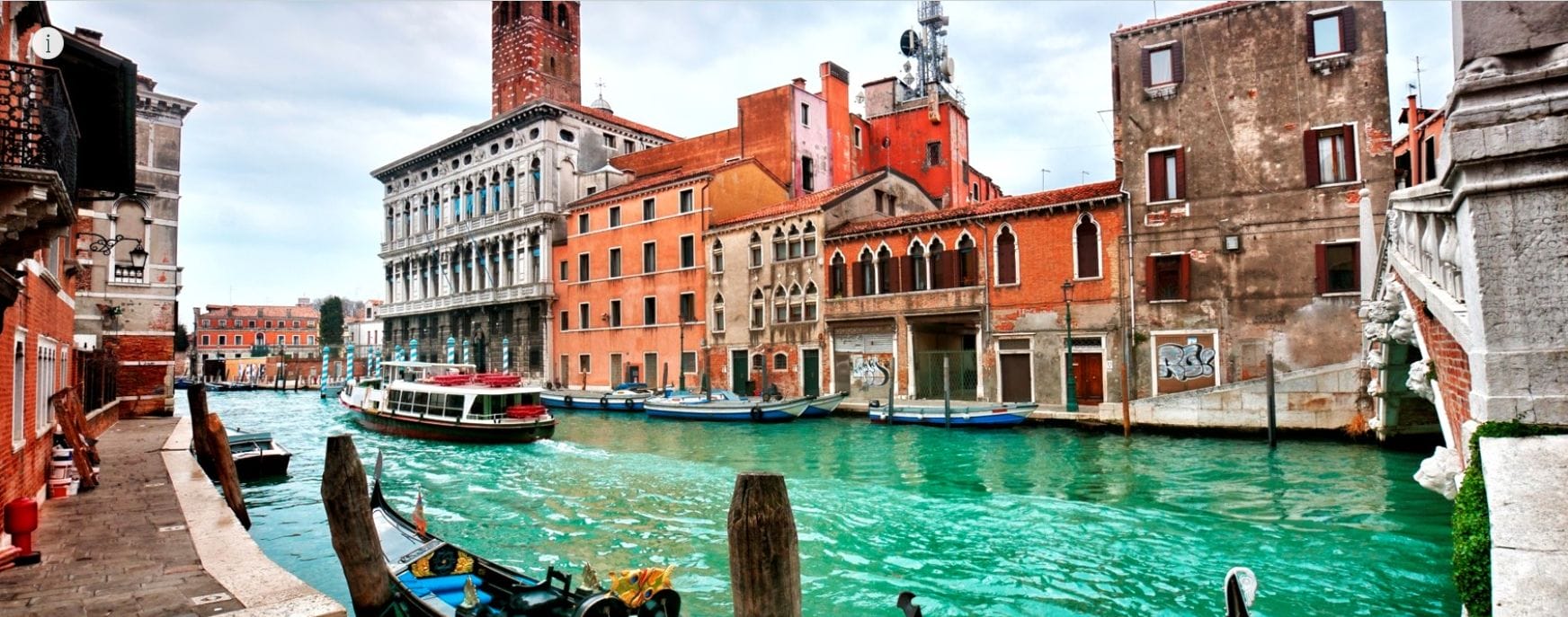 This StoryMap features a growing library of case studies that illustrate the role of land use and policy in mitigating and adapting to climate change. Featured case studies range from the Life Vimine Project in Venice, Italy, to the Watts Rising Transformative Climate Communities Project in Los Angeles.