Visualizing Density

Overview
For a concept so central to the composition of neighborhoods everywhere, density is little understood. Compact residential multifamily and mixed-use development is regularly perceived in negative terms, particularly when new construction is proposed at infill sites in established neighborhoods. A slew of upzoning measures and bans on single-family-only zoning have intensified scrutiny of the concept of greater density. Designed well and located near transit, parks, and other amenities, however, density can be pleasant, elegant, and functional, evocative of traditional neighborhood design from the early twentieth century.
This Visualizing Density subcenter is a guide to density in all its forms. It encourages planners, policymakers, practitioners, journalists, and citizens to explore how different densities fit into the context of cities and towns around the world. The Lincoln Institute’s work on density informed Visualizing Density—one of our most popular titles—by Julie Campoli and Alex MacLean, an aerial photographer. An ensuing volume, Made for Walking, also by Julie Campoli, showcases well-functioning urban agglomerations of density and mixed-use development.
Visualizing Density
Febrero 2007
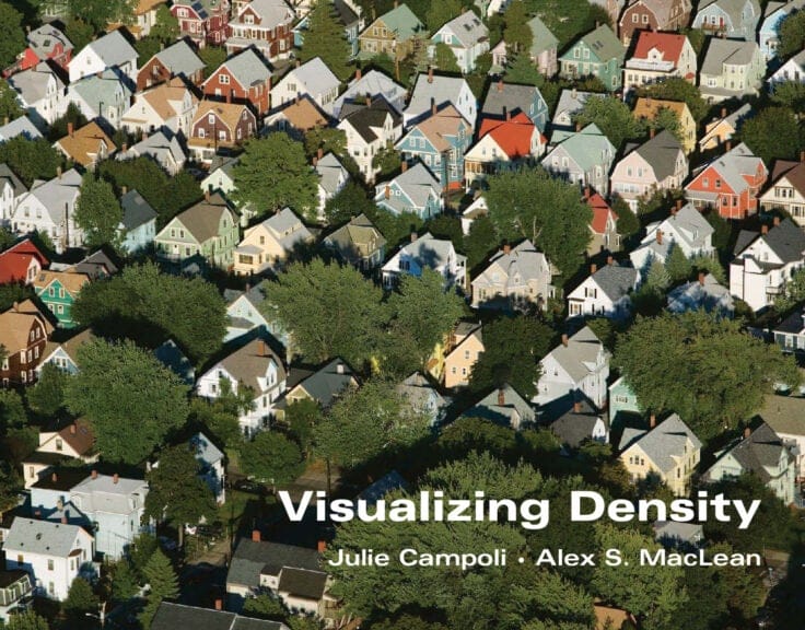
This best-selling and richly illustrated book by landscape architect Julie Campoli and aerial photographer Alex S. MacLean helps planners, designers, public officials, and citizens better understand how residential density can help save energy, dollars, and the environment.

Made for Walking
Density and Neighborhood Form
Diciembre 2012
Through hundreds of photographs and maps, this book showcases 12 vibrant North American neighborhoods where residents can live comfortably without a car, and identifies the replicable policies and amenities that foster walkability.