StoryMaps

Check out these interactive storymaps on the Colorado River, zoning, corporate ownership of housing and more.

What Does 15 Units Per Acre Look Like?
A Massachusetts law intended to encourage density near public transit could serve as a model for other states, but it has sparked pushback in some communities. This StoryMap explores what the new density requirements look like on the ground in and around Boston.

The Hardest Working River in the West
Explore the key water sustainability issues in the Colorado River Basin through data and stories updated regularly. Although not the largest or longest river in the world, the Colorado River connects a rich array of social and ecological communities along its 1,450-mile journey from its headwaters in the Rocky Mountains of Colorado to its mouth in the Gulf of California, Mexico.

The Life of an Idea
The Origins and Impact of the Lincoln Institute of Land Policy.

Who Owns America?
A new data mapping tool from the Lincoln Institute’s Center for Geospatial Solutions can help equip nonprofits, advocates, and local governments with similarly powerful technology to help identify and defend affordable housing stock threatened by real estate speculators and absentee landlords.

Grassroots Conservation (Minus the Grass)
A growing movement is inviting nature back into the cities and towns from which it was once expelled, planting native pollinator gardens and Miyawaki microforests in front yards, schoolyards, parks, and vacant lots. This StoryMap explores how individuals and municipalities are creating and protecting habitat at the local level.

Unlocking Climate Resilience Through Land Value Capture
Drawing from new research by the Lincoln Institute of Land Policy , this StoryMap illustrates how cities can tackle these challenges head-on, using land value capture to fund essential climate action projects that turn risk into resilience.
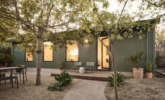
A(lready) D(esigned for) U – StoryMap
Cities across North America are providing residents with pre-approved building plans for accessory dwelling units, or ADUs, to help homeowners add housing to established neighborhoods. This StoryMap is a collection of pre-approved ADU designs and floor plans from Seattle to Roanoke, Va.